Area Overview for SE9 4HN
Photos of SE9 4HN


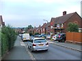
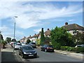

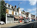

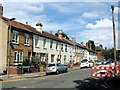
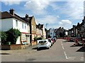
51 photos from this area
Area Information
Key information about the SE9 4HN including its size, population, and administrative classification.
- Area Type
- Postcode
- Area Size
- 7037 m²
- Population
- 1572
- Population Density
- 9134 people/km²
House Prices in SE9 4HN
34
Properties
£244,313
Average Sold Price
£55,000
Lowest Price
£395,000
Highest Price
Showing 34 properties
| Address | Type | Beds | Baths | Last Sale Price | Last Sale Date | |
|---|---|---|---|---|---|---|
| 52 Thursley Road, Mottingham, London, SE9 4HN | Terraced | 3 | - | £375,000 | Apr 2024 | |
| 38 Thursley Road, Mottingham, London, SE9 4HN | Terraced | 2 | - | £395,000 | Jul 2022 | |
| 6 Thursley Road, Mottingham, London, SE9 4HN | Retail | 2 | - | £368,000 | Feb 2022 | |
| 14 Thursley Road, Mottingham, London, SE9 4HN | house | - | - | £395,000 | Dec 2021 | |
| 66 Thursley Road, Mottingham, London, SE9 4HN | Terraced | 3 | 1 | £307,000 | Sep 2020 | |
| 54 Thursley Road, Mottingham, London, SE9 4HN | Terraced | 3 | 1 | £335,000 | Apr 2019 | |
| 4 Thursley Road, Mottingham, London, SE9 4HN | Terraced | 3 | 1 | £350,000 | Oct 2018 | |
| 48 Thursley Road, Mottingham, London, SE9 4HN | house | - | - | £295,000 | Mar 2018 | |
| 62 Thursley Road, Mottingham, London, SE9 4HN | Semi-detached | 3 | 1 | £331,259 | Aug 2016 | |
| 58 Thursley Road, Mottingham, London, SE9 4HN | Terraced | 3 | - | £250,000 | Aug 2013 |
Page 1 of 4
Energy Efficiency in SE9 4HN
Amenities
Schools
| Rank | School | Type | Entry gender | Ages |
|---|
Explore more schools in this area
Go to Schools tabDemographics
Household Size
Family (3-5 people)
most common
Accommodation Type
Houses
most common
Tenure
42
majority
Ethnic Group
White
most common
Religion
N/A
most common
Household Composition
N/A
most common
Age
47
median
Adults (30-64 years)
most common
Household Deprivation
N/A
with no deprivation
NS-SEC
26
in Lower managerial occupations
Explore more demographic insights in this area
Go to Demographics tabPlanning
Planning Constraints
- Flood RiskPremium
- Ramsar Wetland SitesPremium
- Area of Outstanding Natural BeautyPremium
- Protected Nature ReservePremium
- Protected WoodlandPremium