Area Overview for SE9 3UD
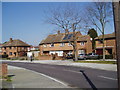
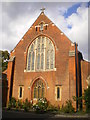
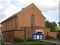
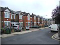
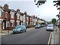
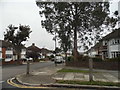
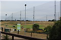
Photos of SE9 3UD
Area Information
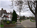
Living in SE9 3UD means residing in a highly specific residential cluster within the London Borough of Bexley. This postcode covers only 3,917 square metres, creating a tightly defined neighbourhood rather than a sprawling district. The area is situated near Sidcup and serves as a well-established part of the Longlands electoral ward, which has represented the borough since 2002. With a stable population of 1,607 residents, the community feels compact and familiar. The density here reaches 410,214 people per square kilometre, a figure that reflects the statistical concentration of this small geographic slice rather than a crowded urban environment. Your daily life in SE9 3UD revolves around established houses and a sense of permanence. The area is defined by its residential focus, with postcodes like DA14 and DA15 anchoring it to the wider Greater London region. Longlands functions as a standard suburban zone where life moves at a predictable pace. You are part of a historic ward that contributes two councillors to the local council, indicating an active connection to local governance. The location at approximately 51.421991, 0.094115 places you in a recognised area with a clear administrative identity. Buying a home here secures your place in a zone that prioritises housing over commercial development. The distinct boundaries ensure you are in a dedicated living space within the Bexley framework.
- Area Type
- Postcode
- Area Size
- 3917 m²
- Population
- 1607
- Population Density
- 5674 people/km²
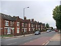
The property market in SE9 3UD is defined almost entirely by owner-occupied homes. Because 92% of residents own their property outright or with a mortgage, the area functions as a primary home for families rather than a lettings market. Accommodation consists predominantly of houses, which aligns with the preferences of the local age group. You are unlikely to find a high concentration of flats or purpose-built rental apartments within this small 3,917 square metre zone. The housing stock supports a long-term resident base who have accumulated wealth and stability in the areas covered by postcodes like DA14 6HD and DA15 7JP. This market dynamic means that selling a property in SE9 3UD may involve holding off-market listings longer, given the low turnover of homes. Buyers looking for investment properties through short-term tenancies will find limited opportunity here. Instead, investors should focus on families moving up or downsizing an existing home. The lack of rental listings suggests that the immediate surroundings share this characteristic of permanent residence. If you are selling, your target market consists mainly of other homeowners exploring similar ageing demographics. The area does not cater to young buyers entering the market for the first time. The housing choices remain consistent with the established pattern of large family houses.
House Prices in SE9 3UD
Showing 5 properties
| Address | Type | Beds | Baths | Last Sale Price | Last Sale Date | |
|---|---|---|---|---|---|---|
| 518 Foots Cray Road, London, SE9 3UD | house | 4 | - | £662,000 | Jun 2021 | |
| 512 Foots Cray Road, London, SE9 3UD | house | 3 | - | £320,000 | Aug 2011 | |
| 520 Foots Cray Road, London, SE9 3UD | Semi-detached | 4 | 2 | £220,000 | Feb 2006 | |
| 514 Foots Cray Road, London, SE9 3UD | Semi-detached | 5 | 2 | £240,000 | Jul 2001 | |
| 516 Foots Cray Road, London, SE9 3UD | Detached | - | - | - | - |
Energy Efficiency in SE9 3UD
Your lifestyle in SE9 3UD is supported by a surprising variety of amenities within practical reach. You can shop at several nearby retail locations, including Co-op New, Morrisons Daily, and Co-op Valliers, ensuring your grocery needs are met. The presence of these shops means you rarely need to travel far for daily essentials. There are also five available ferry points close by, adding a unique leisure element to your routine. You might enjoy trips to Woolwich Arsenal Pier or Barrier Gardens Pier for a change of scenery. Five metro stations are located near the area, offering direct connections to central London and the airport. London City Airport is one of the five airports and tube stations listed as nearby facilities, making business travel convenient. Beyond retail and transport, the area is near five distinct rail stations that serve as community hubs. New Eltham and Sidcup Station are notable for their regular services and local pubs. The mix of five transport links and five retail outlets creates a neighbourly environment where you do not feel isolated. You have the option to visit Co-op Valliers for fresh food or use Morrisons Daily for household supplies. The variety of amenities prevents the small size of the postcode from feeling restrictive. Living in SE9 3UD offers a应有尽有 approach to convenience without sacrificing the benefits of a small community. Your weekend plans might include visits to the piers or commuting via the nearby railway hubs.
Amenities
Schools
| Rank | School | Type | Entry gender | Ages |
|---|
Explore more schools in this area
Go to Schools tabDemographics
The community in SE9 3UD reflects a mature and stable household structure. Almost 92% of residents own their homes, signalling a deep-rooted attachment to the locality. This high ownership rate suggests that very few properties are available on the rental market within this specific cluster. Most of the adult population falls between the ages of 30 and 64, with a median age of 47 years. This age profile indicates a neighbourhood dominated by families and established households rather than young professionals or students seeking temporary accommodation. Houses form the primary type of accommodation in SE9 3UD, catering to those who prioritise space and garden areas over apartment living. The predominant ethnic group is White, and the demographic data confirms a homogenous community without significant recent shifts in diversity. You will find that neighbours have likely lived in their properties for many years, fostering a quiet and predictable environment. The concentration of adults suggests a family-oriented atmosphere where front garden interactions are common. There is no major young demographic driving the local events or shaping the noise levels. The presence of children is moderated by the steady age range of the residents. Your proximity to schools near SE9 3UD is determined by your specific house location, as the demographic data points to a settled community rather than a transient student catchment.
Household Size
Accommodation Type
Tenure
Ethnic Group
Religion
Household Composition
Age
Household Deprivation
NS-SEC
Explore more demographic insights in this area
Go to Demographics tabPlanning
Planning Constraints
- Flood RiskPremium
- Ramsar Wetland SitesPremium
- Area of Outstanding Natural BeautyPremium
- Protected Nature ReservePremium
- Protected WoodlandPremium