Area Overview for SE9 3LS
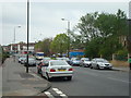
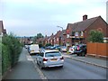
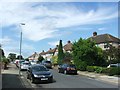
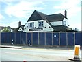
Photos of SE9 3LS
Area Information
Living in SE9 3LS offers a defined residential experience within a tightly clustered 4,620 square metre area. This specific postcode covers a population of 1,609 residents, creating an environment where neighbours know each other through close physical proximity. The area lies in England and functions as a small, self-contained community rather than a sprawling neighbourhood. You will find that daily life here revolves around the immediate surroundings, given the compact footprint of the location. The high population density suggests a vibrant yet concentrated living space where space is at a premium. Residents enjoy a sense of belonging within this specific boundary, distinct from the wider SE9 postcode region. The area serves as a quiet residential hub, ideal for those seeking a contained lifestyle without the need to travel far for essential services. Because the land area is so small relative to the number of people, the community feels intimate. This setting supports a pace of life where local interactions are frequent and the environment is well-managed. You can move through SE9 3LS with the confidence that the infrastructure, though limited in total size, is sufficient for the demographic it houses.
- Area Type
- Postcode
- Area Size
- 4620 m²
- Population
- 1609
- Population Density
- 3459 people/km²
You will find that the property market in SE9 3LS is dominated by owner-occupied homes. The data reveals that 80% of the population owns their accommodation, setting this postcode apart from typical rental-heavy zones. The accommodation type is strictly houses, meaning you are looking at detached, semi-detached, or terraced properties rather than flats. This type of housing appeals strongly to the area's median age of 47, as it suits the needs of families and established professionals. Because the area is small at 4,620 square metres, the variety of property styles may be limited compared to larger suburbs. The high ownership percentage suggests that price fluctuations might reflect broader market trends rather than immediate tenant demand. If you are considering buying homes in SE9 3LS, expect a market driven by investment in property value rather than rentals. The lack of rental figures in the data supports the conclusion that this is a quiet buying market. You may find competition lower than in major hubs because the total population is only 1,609 people. The exclusive nature of the housing stock means buyers should look for well-maintained family homes. This stability offers reliable value for long-term investors or buyers seeking a permanent foothold in the local estate market.
House Prices in SE9 3LS
Showing 10 properties
| Address | Type | Beds | Baths | Last Sale Price | Last Sale Date | |
|---|---|---|---|---|---|---|
| 8 Ministry Way, Eltham, SE9 3LS | Detached | 4 | 1 | £700,000 | Jul 2025 | |
| 5 Ministry Way, Eltham, SE9 3LS | Detached | 3 | 2 | £329,995 | Jun 2010 | |
| 6 Ministry Way, Eltham, SE9 3LS | Semi-detached | - | - | £230,000 | Dec 2002 | |
| 2 Ministry Way, Eltham, SE9 3LS | Detached | 3 | - | £133,250 | Nov 1996 | |
| 10 Ministry Way, Eltham, SE9 3LS | Detached | - | - | - | - | |
| 9 Ministry Way, Eltham, SE9 3LS | Detached | - | - | - | - | |
| 1 Ministry Way, Eltham, SE9 3LS | Detached | 3 | 2 | - | - | |
| 7 Ministry Way, Eltham, SE9 3LS | Semi-detached | - | - | - | - | |
| 4 Ministry Way, Eltham, SE9 3LS | Detached | - | - | - | - | |
| 3 Ministry Way, Eltham, SE9 3LS | Semi-detached | - | - | - | - |
Energy Efficiency in SE9 3LS
Your daily lifestyle in SE9 3LS is supported by a wide range of amenities within practical reach. Five railway stations, including Mottingham Station, New Eltham, and Eltham, provide easy access to London. Retail options are immediately accessible with five local stores, such as Lidl LON, M&S Mottingham BP, and Co-op Mottingham. You can purchase groceries and essentials without needing to travel far. Public transport is seamless, with five metro and DLR stopping nearby, highlighting Cutty Sark for Maritime Greenwich and Cutty Sark DLR Station as key interchange points. For those who enjoy water-based travel, five ferry terminals, including Woolwich Ferry North Pier and Barrier Gardens Pier, are close by. London City Airport is also the single notable airport option for quick domestic flights. The presence of five distinct categories of transport hubs proves that convenient travel is central to life here. You can walk to the local Co-op or catch a train to the city centre in minimal time. The variety of stations and stations around SE9 3LS ensures you are never far from a journey or a shopping trip. Residents benefit from a transport-rich environment that complements the residential nature of the postcode.
Amenities
Schools
| Rank | School | Type | Entry gender | Ages |
|---|
Explore more schools in this area
Go to Schools tabDemographics
The community in SE9 3LS is heavily weighted towards established households, with a median age of 47 years. Most of the residents fall into the adult age range of 30 to 64 years, reflecting a population of mature occupants rather than students or young families. A significant demographic fact is that 80% of the area's residents own their homes, which indicates a highly stable and settled neighbourhood. You are unlikely to encounter a bustling tenant market here; instead, the streets are lined with long-term owners. The predominant ethnic group is White, contributing to a homogenous cultural fabric within this specific cluster. Accommodation types are exclusively houses, meaning you will not find apartments or flats in this postcode. This housing stock appeals to those who value independence and garden space. The age profile suggests that schools nearby SE9 3LS are sought by older children or teenagers, while the high ownership rate points to a family-oriented environment. There is no sign of transient populations in this data set. The demographic consistency creates a predictable environment where local shops cater primarily to family needs and mature professionals. You will find a quiet, established neighbourhood where residents have likely lived for many years.
Household Size
Accommodation Type
Tenure
Ethnic Group
Religion
Household Composition
Age
Household Deprivation
NS-SEC
Explore more demographic insights in this area
Go to Demographics tabPlanning
Planning Constraints
- Flood RiskPremium
- Ramsar Wetland SitesPremium
- Area of Outstanding Natural BeautyPremium
- Protected Nature ReservePremium
- Protected WoodlandPremium