Area Overview for SE9 3LD
Photos of SE9 3LD
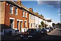

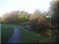
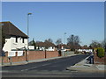
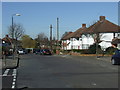
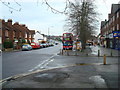
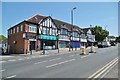
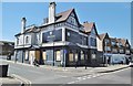
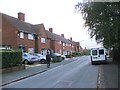
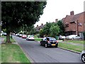
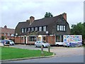
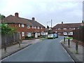
54 photos from this area
Area Information
Key information about the SE9 3LD including its size, population, and administrative classification.
- Area Type
- Postcode
- Area Size
- 1.3 hectares
- Population
- 1737
- Population Density
- 5932 people/km²
House Prices in SE9 3LD
26
Properties
£426,269
Average Sold Price
£107,000
Lowest Price
£650,000
Highest Price
Showing 26 properties
| Address | Type | Beds | Baths | Last Sale Price | Last Sale Date | |
|---|---|---|---|---|---|---|
| 148 Brownspring Drive, Eltham, SE9 3LD | house | - | - | £610,000 | Oct 2025 | |
| 162 Brownspring Drive, Eltham, SE9 3LD | Semi-detached | 4 | 2 | £626,000 | Jul 2024 | |
| 136 Brownspring Drive, Eltham, SE9 3LD | Detached | 3 | 1 | £495,000 | Sep 2023 | |
| 140 Brownspring Drive, Eltham, SE9 3LD | Semi-detached | 3 | 1 | £575,000 | Sep 2021 | |
| 130 Brownspring Drive, Eltham, SE9 3LD | Semi-detached | 4 | 2 | £650,000 | Jun 2020 | |
| 112 Brownspring Drive, Eltham, SE9 3LD | Semi-detached | 3 | 1 | £535,000 | Dec 2018 | |
| 154 Brownspring Drive, Eltham, SE9 3LD | house | 4 | - | £391,000 | Aug 2014 | |
| 124 Brownspring Drive, Eltham, SE9 3LD | Semi-detached | 4 | 2 | £475,000 | Jan 2014 | |
| 116 Brownspring Drive, Eltham, SE9 3LD | house | - | - | £305,000 | Oct 2011 | |
| 144 Brownspring Drive, Eltham, SE9 3LD | house | - | - | £302,500 | Feb 2010 |
Page 1 of 3
Energy Efficiency in SE9 3LD
Amenities
Schools
| Rank | School | Type | Entry gender | Ages |
|---|
Explore more schools in this area
Go to Schools tabDemographics
Household Size
Family (3-5 people)
most common
Accommodation Type
Houses
most common
Tenure
87
majority
Ethnic Group
White
most common
Religion
N/A
most common
Household Composition
N/A
most common
Age
47
median
Adults (30-64 years)
most common
Household Deprivation
N/A
with no deprivation
NS-SEC
40
in Lower managerial occupations
Explore more demographic insights in this area
Go to Demographics tabPlanning
Planning Constraints
- Flood RiskPremium
- Ramsar Wetland SitesPremium
- Area of Outstanding Natural BeautyPremium
- Protected Nature ReservePremium
- Protected WoodlandPremium