Area Overview for SE9 2LL
Photos of SE9 2LL
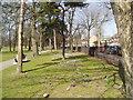
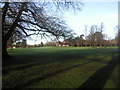
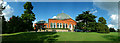
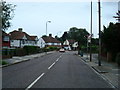
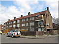
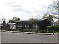
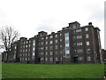
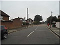
63 photos from this area
Area Information
Key information about the SE9 2LL including its size, population, and administrative classification.
- Area Type
- Postcode
- Area Size
- 1.4 hectares
- Population
- 2478
- Population Density
- 3568 people/km²
House Prices in SE9 2LL
38
Properties
£198,358
Average Sold Price
£94,000
Lowest Price
£301,000
Highest Price
Showing 38 properties
| Address | Type | Beds | Baths | Last Sale Price | Last Sale Date | |
|---|---|---|---|---|---|---|
| 29 Anstridge Road, Avery Hill, SE9 2LL | Flat | 1 | - | £217,300 | Jul 2020 | |
| 1 Anstridge Road, Avery Hill, SE9 2LL | house | 2 | 1 | £301,000 | Jul 2019 | |
| 25 Anstridge Road, Avery Hill, SE9 2LL | Flat | 1 | 1 | £225,000 | Jul 2018 | |
| 59 Anstridge Road, Avery Hill, SE9 2LL | Flat | - | - | £227,000 | Feb 2018 | |
| 69 Anstridge Road, Avery Hill, SE9 2LL | Terraced | 3 | - | £289,995 | Mar 2015 | |
| 45 Anstridge Road, Avery Hill, SE9 2LL | Flat | 1 | 1 | £125,000 | Jun 2013 | |
| 73 Anstridge Road, Avery Hill, SE9 2LL | house | - | - | £94,000 | Mar 2011 | |
| 35 Anstridge Road, Avery Hill, SE9 2LL | Flat | - | - | £120,000 | Jan 2011 | |
| 71 Anstridge Road, Avery Hill, SE9 2LL | house | - | - | £225,000 | Oct 2007 | |
| 13 Anstridge Road, Avery Hill, SE9 2LL | Terraced | - | - | £210,000 | Apr 2007 |
Page 1 of 4
Energy Efficiency in SE9 2LL
Amenities
Schools
| Rank | School | Type | Entry gender | Ages |
|---|
Explore more schools in this area
Go to Schools tabDemographics
Household Size
Family (3-5 people)
most common
Accommodation Type
Flats
most common
Tenure
35
majority
Ethnic Group
White
most common
Religion
N/A
most common
Household Composition
N/A
most common
Age
22
median
Young Adults (15-29 years)
most common
Household Deprivation
N/A
with no deprivation
NS-SEC
19
in Lower managerial occupations
Explore more demographic insights in this area
Go to Demographics tabPlanning
Planning Constraints
- Flood RiskPremium
- Ramsar Wetland SitesPremium
- Area of Outstanding Natural BeautyPremium
- Protected Nature ReservePremium
- Protected WoodlandPremium