Area Overview for SE9 2JW
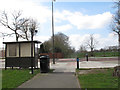
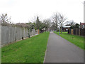
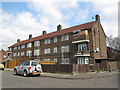
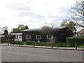
Photos of SE9 2JW


Area Information
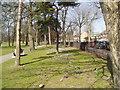
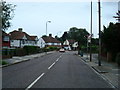
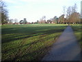
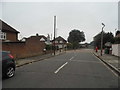
Living in SE9 2JW means residing within a small residential cluster in Eltham and Avery Hill, an electoral ward in the Royal Borough of Greenwich. This postcode covers 2,478 people, creating a tight-knit community where daily life moves at a steady suburban pace. The area sits approximately 8.7 miles east-southeast of Charing Cross, blending urban town centre convenience with access to significant green spaces. Human activity here dates back to the Mesolithic period, evidenced by a flint found in nearby Avery Hill Park, yet the residential character developed distinctly in the 19th century. Avery Hill estate formed from local farms, eventually featuring a mansion built circa 1841 and later housing Avery Hill College of Education from 1906. Today, the neighbourhood retains its historical roots while offering modern conveniences. You will find yourself sitting between the bustling town of Eltham and the more rural feel of Avery Hill. This distinctive balance provides plenty of open green space for weekend walks while remaining close to city jobs. The area is defined by specific landmarks like the restored Winter Garden, which houses Britain's largest Canary date palm, and offers a quieter alternative to denser central London locations. History enthusiasts will appreciate the Tudor Conduit and 'Henley's Field', a wild flower meadow located within the park grounds.
- Area Type
- Postcode
- Area Size
- Not available
- Population
- 2478
- Population Density
- 3568 people/km²
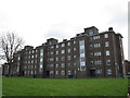
The property market in SE9 2JW is defined by its specific accommodation type and ownership patterns. Flats comprise the predominant accommodation type within this small residential cluster, making them the primary asset class for buyers and tenants alike. Home ownership sits at 35%, which is relatively low compared to other parts of London. This figure indicates that the area functions more as a rental market than an owner-occupied sanctuary. While flats suggest a mix of purpose-built apartments and perhaps converted upper floors, the low ownership rate implies that many residents do not secure mortgages here. For buyers looking at homes in SE9 2JW, this means entering a market where competition could be fierce for the finer selection properties, yet supply remains constrained by the flat-focused stock. The characteristics of the housing stock align perfectly with the young demographic profile, prioritising proximity and affordability over large family homes. If you are searching for a place to put down roots, the high rental turnover implied by the 35% ownership statistic suggests you may face competition from mobile professionals and students. The market here is practical and direct, driven by the needs of a population that does not yet intend to own property permanently.
House Prices in SE9 2JW
No properties found in this postcode.
Energy Efficiency in SE9 2JW
The lifestyle in SE9 2JW is shaped by a dense network of amenities within practical reach. For shopping, you have five retail options nearby, including M&S Crownwood Connect BP, a Co-op University of, and Co-op Valliers. These venues provide essentials and daily groceries without requiring car travel. Transport links are equally diverse, with five railway stations available, such as Falconwood Station, New Eltham, and Sidcup Station. You also benefit from five ferry terminals, including Woolwich Arsenal Pier, Woolwich Ferry North Pier, and Barrier Gardens Pier, offering cross-river river travel. For those preferring air travel, London City Airport sits just a short distance away. Additionally, five metro stations provide sub-surface rail access, with King George V., Gallions Reach Station, and locations near London City Airport being notable points. This density of recreational and commercial options means you do not need to venture far for leisure or work. The combination of multiple rail lines and river ferry services creates a redundant and resilient transport network. Convenience is high, as you can choose between the ferry, the rail, or the metro depending on your destination or schedule. This variety supports a flexible lifestyle where daily errands take minutes rather than hours.
Amenities
Schools
Families considering schools near SE9 2JW will find limited choice but high quality within the immediate vicinity. The area lists Alderwood Primary School, which operates as a primary institution. Notably, this school holds a Good Ofsted rating, confirming its standard of education is robust. You should note that the data provided includes Alderwood Primary School twice, once without a rating and once with a Good Ofsted rating, confirming the status of this single facility. There are no secondary schools listed in the immediate surroundings of this postcode. This indicates that older children in homes in SE9 2JW will likely need to travel to schools outside the immediate locality. For younger families, the presence of a single primary school with a Good rating offers reassurance regarding early education quality. The concentration of primary education suggests a neighbourhood that may lack comprehensive school facilities for teenagers, requiring parents to plan further transport logistics. The quality of Alderwood Primary School serves as a strong anchor for family life, even if further options lie beyond the neighbourhood boundaries.
| Rank | School | Type | Entry gender | Ages |
|---|
Explore more schools in this area
Go to Schools tabDemographics
The community in SE9 2JW is notably young, with a median age of 22 years. This demographic skew is driven by the fact that young adults between 15 and 29 years represent the most common age range in the area. Consequently, the population feels dynamic and energetic rather than established. Home ownership stands at 35%, indicating that a significant majority of residents likely rent rather than own their homes. This lower level of ownership suggests a transient population typical of student areas or young professional enclaves. The predominant ethnic group is White, which shapes the social fabric of the neighbourhood. Accommodation types are heavily dominated by flats, reflecting the density required to house such a young population in a limited urban footprint. For families planning to stay long term, the high proportion of renters and young adults might imply a vibrant but shifting social scene. The demographic profile suggests an area attractive to those seeking a young, lively environment rather than a traditional family suburb with deep-rooted generational ties. You are entering an area where life stages are generally early, and the social rhythm reflects this youthful demographic structure.
Household Size
Accommodation Type
Tenure
Ethnic Group
Religion
Household Composition
Age
Household Deprivation
NS-SEC
Explore more demographic insights in this area
Go to Demographics tabPlanning
Planning Constraints
- Flood RiskPremium
- Ramsar Wetland SitesPremium
- Area of Outstanding Natural BeautyPremium
- Protected Nature ReservePremium
- Protected WoodlandPremium