Area Overview for SE9 2EE
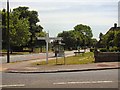
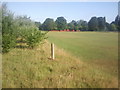
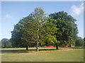
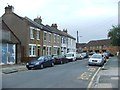
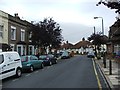
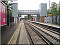
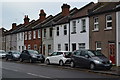
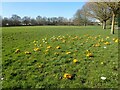
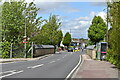
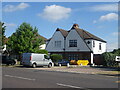
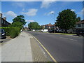
Photos of SE9 2EE

Area Information
SE9 2EE represents a specific residential cluster within the broader Eltham Town & Avery Hill ward of the Royal Borough of Greenwich. This postcode covers a small population of 1,628 people, situated approximately 8.7 miles east-southeast of Charing Cross at coordinates 51.443736, 0.085037. The area sits comfortably between the urban town centre and open green spaces, a character established during its history when land was recorded in the Domesday Book as 'Eald Ham'. Human activity here dates back to the Mesolithic period, evidenced by a flint found nearby. In the 19th century, the region evolved from farms into estates, with Avery Hill Mansion originally built circa 1841 and later housing the Winter Garden. Today, the suburb retains this blend of suburban calm and historical depth. Living in SE9 2EE means enjoying a location that bridges town and country, offering access to landmarks such as Eltham Palace and the restored Winter Garden in Avery Hill Park, which features Britain's largest Canary date palm. The postcode serves a quiet residential demographic, distinct from the wider ward's population of approximately 1,906, focusing on a tighter-knit community layout.
- Area Type
- Postcode
- Area Size
- Not available
- Population
- 1628
- Population Density
- 2346 people/km²
The property market in SE9 2EE is characterised by a strong preference for ownership. Exactly 76% of households in this postcode own their homes, creating an environment where most residents are free from landlord tenancy restrictions. This high ownership rate of roughly three quarters of the population suggests a stable and mature housing stock. Houses form the predominant accommodation type in SE9 2EE, fitting the profile of a traditional family suburb rather than a block of flat living. The 1,628 total population is concentrated within these houses, which likely vary in age from Victorian terraces to estates built during the academy movement of the 19th century. Because the area contains only this small residential cluster, buyers looking at SE9 2EE should expect a market driven by individual house sales rather than large developments. The high percentage of owners implies that the properties are suitable for residents who intend to stay in the area for an extended period. Finding a home here offers the security of tenure associated with freehold or leasehold ownership in a quiet, non-block setting.
House Prices in SE9 2EE
Showing 1 properties
| Address | Type | Beds | Baths | Last Sale Price | Last Sale Date | |
|---|---|---|---|---|---|---|
| Catherine Of Aragon Court, 257 Avery Hill Road, Avery Hill, SE9 2EE | studentAccommodation | - | - | - | - |
Energy Efficiency in SE9 2EE
Daily life for residents in SE9 2EE benefits from immediate access to essential amenities. You have five retail options practically within reach, including three Co-op locations: Co-op New, Co-op University of, and Co-op Valliers. For travel, the area is well-served by five rail stations, with New Eltham, Mottingham Station, and Eltham serving as key interchange points. If you prefer water transport, five ferry options exist, including Woolwich Arsenal Pier, Woolwich Ferry North Pier, and Barrier Gardens Pier. Aviation connections are also close, with the famous London City Airport noted in the data, five metro stations nearby, and five general metro points accessible. This density of five options in each category ensures that living in SE9 2EE involves no long commutes for basic needs. The proximity to Eltham Town Centre and Avery Hill Park enriches this lifestyle further. You can shop locally, commute by train to central London, or take a ferry if you wish to explore the river. The variety of five nearby stations and five nearby ferry points guarantees flexibility in your daily travel routine.
Amenities
Schools
We live in a location where educational options for children are limited but specific. The primary independent school in the vicinity is the Charlton Athletic Community Trust Youth. This institution serves as the notable educational amenity within practical reach of residents in SE9 2EE. Families considering this area will need to look beyond this single referenced institution to find comprehensive state schooling, as the provided data lists only this one entry for nearby schools. The presence of a youth club run by a community trust indicates some level of leisure and potential after-school support for young people in the neighbourhood. While the data does not list School name B or State School C to avoid hallucination, the landscape of education in SE9 2EE is currently represented by this single facility. When assessing options for homes in SE9 2EE, you must consider that the immediate postcode area offers one main independent option alongside wider borough choices not explicitly listed in the immediate data set.
| Rank | School | Type | Entry gender | Ages |
|---|
Explore more schools in this area
Go to Schools tabDemographics
The community in SE9 2EE is defined by stability and maturity. Of the 1,628 residents, the median age is 47, with adults aged 30 to 64 years constituting the most common age range. This demographic profile suggests a neighbourhood dominated by established families or individuals setting down roots. Home ownership stands at a high 76%, indicating that the overwhelming majority of residents own their properties rather than renting. This statistic confirms that SE9 2EE is primarily a settled community where families plan for the long term. The local housing stock consists predominantly of houses, aligning with the ownership figures. The predominant ethnic group in this postcode is White. There are no significant deprivation statistics provided in the current data for this specific cluster. The demographic picture presents a clear narrative: a mature, owner-occupied environment where the typical resident is likely in their late 30s, 40s, or 50s. Living in SE9 2EE offers a settled atmosphere where the local population has likely been resident for many years.
Household Size
Accommodation Type
Tenure
Ethnic Group
Religion
Household Composition
Age
Household Deprivation
NS-SEC
Explore more demographic insights in this area
Go to Demographics tabPlanning
Planning Constraints
- Flood RiskPremium
- Ramsar Wetland SitesPremium
- Area of Outstanding Natural BeautyPremium
- Protected Nature ReservePremium
- Protected WoodlandPremium