Area Overview for SE9 1XP
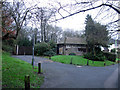
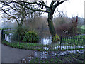
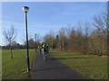
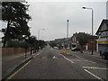
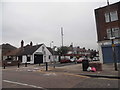
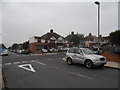
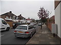
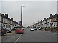
Photos of SE9 1XP
Area Information
Living in SE9 1XP means occupying a small, defined residential cluster characterised by significant local ownership and a settled atmosphere. This specific postcode covers an area of only 7.9 hectares, creating a compact environment for its 1,627 residents. You will find that daily life revolves around this concentrated community where neighbours are likely known for decades rather than weeks. The sheer density suggests a close-knit neighbourhood where the same families maintain properties for generations, fostering a sense of permanent stability rather than transient living. Because the area size is so limited compared to the population, infrastructure and local facilities are all within immediate practical reach. There are no large industrial zones or sprawling commercial parks within this specific square kilometre; instead, the character is purely residential. This focus ensures that every journey to local amenities feels short and convenient. You are living in a place where the community infrastructure supports a steady, quiet lifestyle without the noise or bustle of larger urban extensions. The area functions as a stable residential island within the broader SE9 district.
- Area Type
- Postcode
- Area Size
- 7897 m²
- Population
- 1627
- Population Density
- 7718 people/km²
The property market in SE9 1XP is dominated by the private residential sector with houses forming the sole accommodation type available in this postcode. With home ownership standing at 87 per cent, you are walking into a market where potential buyers compete against existing owners rather than renting from a landlord. This high rate of ownership often results in a slower turnover of properties, as residents are less motivated to move compared to those living in the rental sector. When you look at homes in SE9 1XP, you are examining stock that has remained in families for significant periods, often meaning the interiors still retain original features and layouts. The area size of 7,897 square metres limits the variety of street types, suggesting a consistent architectural style across the neighbourhood. There is a distinct lack of social housing stock within this specific cluster, which supports the high owners-occupier figure. If you are looking to buy, you will likely need a higher budget than you might expect for similar housing elsewhere in South East London due to this stable, owner-led market dynamic. The absence of rental properties simplifies the transaction process for buyers who know they intend to stay for life.
House Prices in SE9 1XP
No properties found in this postcode.
Energy Efficiency in SE9 1XP
Your lifestyle in SE9 1XP benefits from amenities located within practical reach, eliminating the need for long commutes to town centres. You have immediate access to five retail options, including specific venues such as Tesco Eltham, Co-op Well, and Lidl Eltham. These shops provide everything from fresh groceries to household essentials without requiring a journey outside the local district. Beyond retail, transport links are diverse and robust, with five rail options available including stations at Eltham, Falconwood, and Kidbrooke. You also have access to five ferry crossings at Woolwich Arsenal Pier, Woolwich Ferry North Pier, and Barrier Gardens Pier, offering a unique waterway commute to Kent. Additionally, five metro and airport connections serve the area, highlighting a special proximity to London City Airport and King George V Station. This variety of travel options means you can choose between rail, bus, boat, or private car depending on your destination. The presence of these specific transport hubs creates a versatile lifestyle where you can walk to work or drive to the coast. This network of facilities supports a convenient life where daily errands and leisure activities are all close by.
Amenities
Schools
Families living in SE9 1XP have Deansfield Primary School as their nearest educational institution. This school serves as the primary option for children within the immediate neighbourhood. The data lists Deansfield Primary School twice in the database, which suggests it is the dominant educational facility serving this specific cluster of homes. There are no secondary schools mentioned in the immediate vicinity, meaning older children will likely commute to neighbouring developments for their high school education. For parents evaluating schools near SE9 1XP, the presence of a primary school dedicated to the local catchment area is a key feature. The school类型为primary, confirming it caters to children from age four or five up to their 11-year-old year. While the data does not provide an Ofsted rating or specific curriculum details, the naming convention "Deansfield" aligns with the well-established educational provision found in the south London suburbs. You will find that the proximity of this single primary option means local families are tightly integrated into its catchment zone. The consistency of this provision supports the demographic profile of an area with relatively young children compared to the median age of the adult population.
| Rank | School | Type | Entry gender | Ages |
|---|
Explore more schools in this area
Go to Schools tabDemographics
The community in SE9 1XP is defined by a mature population with a median age of 47 years. Most residents fall within the 30 to 64 year age range, indicating a neighbourhood populated by established adults rather than young professionals or students. You will find that 87 per cent of households own their homes, which signals a highly stable environment where families have planted their roots. This high ownership rate contrasts sharply with areas dominated by social housing or private rentals, creating a market where people tend to stay for the long term. The predominant ethnic group is White, reflecting a traditional demographic profile for this part of South East London. Accommodation types are exclusively houses, meaning you will not see rows of flats or converted offices in this specific postcode. There are no data points provided regarding deprivation levels, but the combination of high home ownership and an older median age typically suggests an area free from the acute economic pressures seen in inner-city regeneration zones. The demographic picture is one of consistency, with most households likely managing mortgages comfortably as the owners they are.
Household Size
Accommodation Type
Tenure
Ethnic Group
Religion
Household Composition
Age
Household Deprivation
NS-SEC
Explore more demographic insights in this area
Go to Demographics tabPlanning
Planning Constraints
- Flood RiskPremium
- Ramsar Wetland SitesPremium
- Area of Outstanding Natural BeautyPremium
- Protected Nature ReservePremium
- Protected WoodlandPremium