Area Overview for SE9 1PH
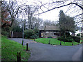
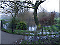
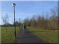
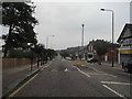
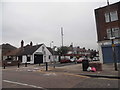
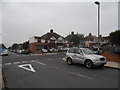
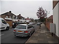
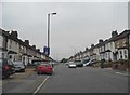
Photos of SE9 1PH
Area Information
Living in SE9 1PH means settling into a specific residential cluster defined by a population of 1,444 residents. This postcode covers a small area where daily life revolves around established communities rather than sprawling developments. The location offers a quiet residential environment without the chaos of high-density city living. You will find yourself part of a neighbourhood where houses dominate the streetscape, reflecting a settled and family-oriented character. The area is situated in England and serves as a practical base for those seeking a home with clear boundaries and local focus. Daily routines involve accessing nearby amenities that sit just beyond the immediate cluster, balancing convenience with peaceful surroundings. The setting avoids the constraints of protected nature reserves or designated wetland sites, allowing for straightforward land use and development history. Residents here enjoy a straightforward living situation without the complications of major planning restrictions or environmental designations that might affect future building projects. The community feels contained and manageable, ideal for those who want to know exactly what surrounds their home.
- Area Type
- Postcode
- Area Size
- Not available
- Population
- 1444
- Population Density
- 3061 people/km²
The property market in SE9 1PH is characterised by a strong leaning towards owner-occupation, with 75 per cent of residents owning their homes. This high ownership rate indicates a stable market where long-term investment and permanence are the norm rather than speculative rental turnover. The accommodation type data confirms that houses form the primary stock of residential properties in this postcode. For buyers looking at this small area, the landscape is dominated by standalone private dwellings rather than high-rise apartments or converted flats. This composition makes SE9 1PH particularly suitable for individuals and families seeking traditional house layouts with associated private gardens. The market is not driven by new rental builds but by existing stock held predominantly by residents. Purchasing a home here means joining a community where tenure stability is the rule. This environment typically signals lower turnover and more predictable local values driven by demand from owner-occupiers rather than the volatility of the rental sector.
House Prices in SE9 1PH
No properties found in this postcode.
Energy Efficiency in SE9 1PH
Residents of SE9 1PH enjoy immediate access to a diverse range of amenities within practical reach. For rail travel, five stations are available within commuting distance, including Eltham, Falconwood Station, and Mottingham Station. Retail choices include five nearby supermarkets and shops, with notable locations like the Co-op Well, Lidl Eltham, and Tesco Eltham ensuring daily necessities are easily obtained. Commuters have three ferry options nearby, such as Woolwich Arsenal Pier and Woolwich Ferry North Pier, providing alternative transport routes across the Thames. Metro connectivity is strong with five stations listed, ranging from King George V to Pontoon Dock Station DLR Station. Aviation travel is convenient, as London City Airport is located just one major airport away. This breadth of transport and commercial options means you can run errands in the morning and travel across London in the afternoon without spending hours travelling. The area balances local convenience with extensive regional links, ensuring that living in SE9 1PH does not mean being isolated from the wider city network.
Amenities
Schools
Families living in SE9 1PH have access to a specific selection of educational institutions within reach. St Mary's Catholic Primary School stands out with an outstanding Ofsted rating, offering high-quality primary education for younger children. Another option is Social Arts for Education, a special school holding a good Ofsted rating, providing tailored support for students with additional needs. The presence of St Mary's Catholic Primary School alongside a special education provider indicates a mix of general and specialist learning pathways available near the area. This combination means parents do not rely solely on one type of educational institution for their children's needs. The schools listed serve the immediate neighbourhood, ensuring that education is integrated into daily life for residents of SE9 1PH. While secondary education is not listed in the available data, the primary and special school infrastructure suggests a supportive educational environment for the core school-age population. Parents can confidently navigate their child's education with the assurance of an outstanding primary option and a well-regarded special school.
| Rank | School | Type | Entry gender | Ages |
|---|
Explore more schools in this area
Go to Schools tabDemographics
The community within SE9 1PH reflects a mature demographic profile with a median age of 47 years. The most common age group consists of adults between 30 and 64 years old, indicating a neighbourhood populated by those firmly established in their careers and families. High home ownership stands at 75 per cent, suggesting a stable population with deep roots in the area rather than transient renters. Accommodation types are predominantly houses, which aligns with the preference for single-family living over flats or apartments. The population is primarily White, contributing to a culturally homogenous local atmosphere. These figures paint a picture of a settled residential zone where long-term residents value stability and community continuity. The high rate of ownership combined with the age profile suggests that many families and individuals have remained in SE9 1PH for significant periods. This demographic structure often correlates with lower statistical levels of deprivation, supporting a consistent quality of life for the majority of households.
Household Size
Accommodation Type
Tenure
Ethnic Group
Religion
Household Composition
Age
Household Deprivation
NS-SEC
Explore more demographic insights in this area
Go to Demographics tabPlanning
Planning Constraints
- Flood RiskPremium
- Ramsar Wetland SitesPremium
- Area of Outstanding Natural BeautyPremium
- Protected Nature ReservePremium
- Protected WoodlandPremium