Area Overview for SE9 1JF
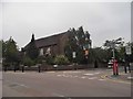
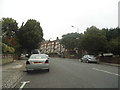
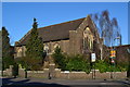
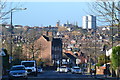
Photos of SE9 1JF
Area Information
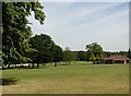
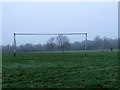
Living in SE9 1JF means owning a part of a compact residential cluster that sits just 1.6 hectares in size. This specific postcode area forms part of the wider Eltham Town and Avery Hill ward within the Royal Borough of Greenwich. The location lies approximately eight miles and seventy minutes east-southeast of Charing Cross, placing it securely within southeast London. You will find the community situated between the urban town centre and open country, retaining a suburban character despite the local development. The area encompasses a population of 1,444 residents who inhabit a neighbourhood defined by its small scale and historical depth. History permeates the local landscape, with human activity dating back to the Mesolithic period as evidenced by flint found nearby. The land around Eltham was recorded in the Domesday Book simply as 'Eald Ham', owned by Odo, Bishop of Bayeux. In the nineteenth century, the Avery Hill estate evolved from farms into a grand mansion built around 1841. This estate later became home to Avery Hill College of Education in 1906. Today, you can explore restored features like the Winter Garden, which houses Britain's largest Canary date palm, or walk across the wildflower meadow known as Henley's Field. Eltham Palace remains a key landmark close to your door. You benefit from being in a district where green space and historic heritage coexist with modern convenience.
- Area Type
- Postcode
- Area Size
- 1.6 hectares
- Population
- 1444
- Population Density
- 3061 people/km²
The property market in SE9 1JF is dominated by the interests of buyers seeking to purchase rather than tenants seeking to rent. Seventy-five per cent of households in this area own their homes, creating a market where stability and established ownership are the norm. This high ownership rate suggests the stock consists primarily of family-sized properties rather than investor-held units. The accommodation type is strictly houses, so you are looking at detached, semi-detached, or terraced homes rather than flats. This distinction is vital if you require garden space or specific house configurations for your household size. Because the postcode covers only 1.6 hectares, it functions as a small residential cluster within the larger Eltham Town and Avery Hill ward. The housing stock reflects the history of the area, including former estate lands that transitioned from farms to grand mansions and eventually to established residential zones. When you consider buying a home here, you are joining a community where three-quarters of neighbours have already made that commitment. The concentration of houses means limited opportunity for rapid neighbourhood change, offering a predictable environment for long-term living. This market structure favours those willing to navigate the current buy-to-move landscape rather than the fluid rental sector. The presence of Lidl, Sainsburys, and M&S Eltham nearby supports the needs of homeowners managing their own finances and maintenance directly.
House Prices in SE9 1JF
Showing 37 properties
| Address | Type | Beds | Baths | Last Sale Price | Last Sale Date | |
|---|---|---|---|---|---|---|
| 43 Westmount Road, Eltham, SE9 1JF | Detached | 7 | 4 | £1,700,000 | May 2025 | |
| 33 Westmount Road, Eltham, SE9 1JF | Detached | 5 | 3 | £1,050,000 | Feb 2025 | |
| 77 Westmount Road, Eltham, SE9 1JF | Detached | 4 | 2 | £950,000 | Jul 2024 | |
| 55 Westmount Road, Eltham, SE9 1JF | Bungalow | 4 | 1 | £645,850 | Aug 2020 | |
| 59 Westmount Road, Eltham, SE9 1JF | Detached | 4 | 1 | £750,000 | Mar 2018 | |
| 79 Westmount Road, Eltham, SE9 1JF | Semi-detached | 3 | - | £401,000 | Mar 2015 | |
| 75 Westmount Road, Eltham, SE9 1JF | Bungalow | 3 | 1 | £440,000 | Dec 2013 | |
| 63 Westmount Road, Eltham, SE9 1JF | Detached | 3 | - | £378,000 | Jun 2010 | |
| 49 Westmount Road, Eltham, SE9 1JF | Bungalow | - | - | £349,000 | Feb 2010 | |
| 39 Westmount Road, Eltham, SE9 1JF | Detached | 5 | 2 | £499,995 | Mar 2003 |
Energy Efficiency in SE9 1JF
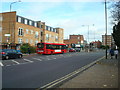
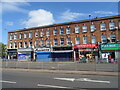
Living in SE9 1JF offers practical access to a network of amenities that support daily life without requiring long commutes. You have direct access to five retail locations, featuring notable venues such as Lidl Eltham, Sainsburys Eltham, and M&S Eltham. These supermarkets provide essential goods, meal ingredients, and household necessities within a short journey. For those who travel by rail, five station options are available, including Eltham, Falconwood, and Mottingham Station, allowing flexible commuting schedules. Residents with river access can utilise five ferry points, such as Woolwich Arsenal Pier and Woolwich Ferry North Pier, to cross the Thames. Your lifestyle choices also include access to a network of five metro lines, with stops like King George V. providing rapid transit. Those needing air travel benefit from the proximity of the single London City Airport, which offers quick connections to the European continent. The area sits between the town of Eltham and the open spaces of Avery Hill. You can enjoy the restored Winter Garden in Avery Hill Park, which features a Tudor Conduit and the wildflower meadow known as Henley's Field. The site also commemorates the former Avery Hill College of Education grounds. Nearby Eltham Palace serves as another key landmark, offering cultural depth to your leisure time. This blend of urban retail, transport hubs, and historic green spaces defines the character of your daily routine.
Amenities
Schools
Families living in SE9 1JF have access to a specific mix of educational institutions, led by highly rated primary and special needs provisions. St Mary's Catholic Primary School stands out as a key option, holding an Ofsted rating of outstanding for its primary education provision. This school serves the spiritual and academic needs of children within this specific residential cluster. School arts for Education operates nearby as a special school with a good Ofsted rating, ensuring that families with children requiring specialised support have a registered educational option within the neighbourhood. The availability of these specific schools means you do not need to look far for education; both facilities are located conveniently near the postcode area. The outstanding rating of St Mary's provides a strong academic foundation, while the good rating of School arts for Education ensures inclusive provision. This combination of school types indicates a community that caters to general primary education as well as specialised learning requirements. If you are considering schools near SE9 1JF, you will find that the local offering is defined by these two named entities. The presence of an outstanding-rated primary school often correlates with high demand from local parents, reinforcing the area's status as a family-oriented location.
| Rank | School | Type | Entry gender | Ages |
|---|
Explore more schools in this area
Go to Schools tabDemographics
The community in SE9 1JF reflects a mature settlement with a median age of 47 years. The most common age range among residents comprises adults between 30 and 64 years old. This demographic profile suggests a neighbourhood established by families and professionals rather than young professionals or retirees. You will find that 75 per cent of households own their homes across this area. This high rate of ownership indicates a stable community where long-term residents have invested in their properties. The predominant ethnicity in the area is White, mirroring the broader demographic trends of south-east London suburbs. The accommodation type is exclusively houses, meaning you will not find apartments or flats in this specific postcode. This single-household-type environment often fosters a quieter and more enclosed atmosphere compared to mixed-density areas. The population density reaches 88,922 people per square kilometre, a figure that accounts for the small residential cluster encompassed by these coordinates. While the density figure appears high due to the limited 1.6-hectare footprint, the actual experience involves a low-rise suburban setting. You live among a population of 1,444 individuals who share a common character defined by home ownership and established estates. The area does not attract significant transitional housing or large student populations, ensuring the local social fabric remains consistent year-round.
Household Size
Accommodation Type
Tenure
Ethnic Group
Religion
Household Composition
Age
Household Deprivation
NS-SEC
Explore more demographic insights in this area
Go to Demographics tabPlanning
Planning Constraints
- Flood RiskPremium
- Ramsar Wetland SitesPremium
- Area of Outstanding Natural BeautyPremium
- Protected Nature ReservePremium
- Protected WoodlandPremium