Area Overview for SE9 1HS
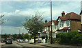
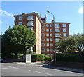
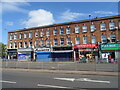
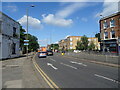
Photos of SE9 1HS
Area Information
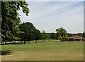
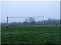
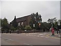
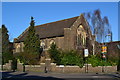
SE9 1HS represents a specific residential cluster within the postcodes of Eltham Borough, part of the Royal Borough of Greenwich. This postcode falls within the Eltham Town and Avery Hill ward, an electoral area that covers approximately 1,688 people at the time of the latest census data. You will find this small area situated about 8.7 miles east-southeast of Charing Cross. Historically, the land was recorded in the Domesday Book as 'Eald Ham', owned by Odo, Bishop of Bayeux. Human activity in the immediate vicinity dates back to the Mesolithic period, evidenced by archaeological finds nearby. Living in SE9 1HS means residing in a suburb that has evolved from agricultural farms into an urban town while retaining significant open green spaces. The area sits between town and country, offering residents access to historic landmarks. Avery Hill Park features the restored Winter Garden, which houses Britain's largest Canary date palm, and the site of the former Avery Hill Mansion. Eltham Palace also stands nearby as a key local landmark. This zone blends suburban housing with accessible heritage sites, providing a setting that balances residential life with historic significance without compromising on modern accessibility.
- Area Type
- Postcode
- Area Size
- Not available
- Population
- 1688
- Population Density
- 5021 people/km²
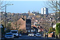
The property market in SE9 1HS is characterised by a significant presence of home owners, with 56% of residents owning their properties. This statistic suggests that over half of the homes in this cluster are not available for rent, which often signals a stable, long-term residential environment. The stock is almost entirely composed of houses, as the data lists 'Houses' as the predominant accommodation type. This type of housing generally offers more garden space and individual living quarters compared to the flats common in central districts. When looking at homes in SE9 1HS, you are essentially entering a private residential zone where the architecture supports independent living. The area is not marketed as a high-density rental hub but rather as a place for settlement. The high ownership percentage means that supply for sale may be lower than in areas where landlords dominate the market. Buyers looking at this postcode area will find that the housing stock aligns with the demographic profile of a mature population seeking permanent residence within a suburban setting near Eltham. The nature of the properties supports a quiet, neighbourhood-focused lifestyle rather than a transient one.
House Prices in SE9 1HS
No properties found in this postcode.
Energy Efficiency in SE9 1HS
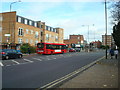
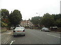
Living in SE9 1HS offers convenient access to a range of retail, leisure, and transport amenities that define your daily routine. You are within reach of five retail outlets, including Sainsburys Eltham, Lidl Eltham, and M&S Eltham, ensuring your weekly shopping needs are met without long journeys. For those who prefer rail travel, stations such as Eltham, Mottingham, and Falconwood are nearby, providing flexible travel options for commuters. Water-based transport is equally accessible, with ferry connections at Woolwich Arsenal Pier, Woolwich Ferry North Pier, and Barrier Gardens Pier. Furthermore, five metro locations are close by, including King George V, Elverson Road, and London City Airport. Beyond transport, you have access to significant green spaces. Avery Hill Park offers the restored Winter Garden, a Tudor Conduit, and a wild flower meadow known as Helley's Field. The area also sits close to Eltham Palace, which attracts visitors and locals to the south-east London district. This blend of retail practicality and notable landmarks creates a lifestyle where daily errands and weekend escapes are both easily reachable from home.
Amenities
Schools
Families considering living in SE9 1HS will find at least one primary school option within practical reach. Eltham Church of England Primary School is recorded as nearby, holding an Ofsted rating of 'good'. This designation indicates that the school meets required quality standards in education and behaviour. The list of schools near SE9 1HS is limited, which means parents may need to rely on this single primary option or look to a wider search radius for secondary education. The presence of a primary school with a good rating provides reassurance for younger children attending schools near this postcode. The data does not list any secondary schools or further education colleges in the immediate vicinity of SE9 1HS. Consequently, families with older children will likely need to travel to other parts of the Royal Borough of Greenwich or wider south-east London for secondary education. The school mix currently offers solid primary provision but requires outward travel for secondary needs. This configuration is typical for many suburban wards where larger secondary institutions serve multiple nearby constituencies rather than sitting within every single postcode boundary.
| Rank | School | Type | Entry gender | Ages |
|---|
Explore more schools in this area
Go to Schools tabDemographics
The community in SE9 1HS is defined by a stable, mature population with a median age of 47 years. Most residents fall into the 30-64 year age range, suggesting a neighbourhood dominated by adults rather than young families or retirees. Home ownership stands at 56% for the postcode, meaning slightly more than half of the residents own their homes outright or with a mortgage. This proportion indicates a settled community where many people have chosen to stay long term rather than viewing property as a short-term investment. Accommodation types in SE9 1HS consist primarily of houses. This predominance of detached or semi-detached properties contrasts with the flats found in more central London zones. The area is predominantly White, reflecting the historical character of eastern London suburbs. You will not find data on specific deprivation levels or income brackets in the public records for this specific postcode point; however, the high home ownership rate and adult age profile suggest a financially stable environment. The demographic data paints a picture of established households who value privacy and space provided by the house-based stock over the density of apartment living.
Household Size
Accommodation Type
Tenure
Ethnic Group
Religion
Household Composition
Age
Household Deprivation
NS-SEC
Explore more demographic insights in this area
Go to Demographics tabPlanning
Planning Constraints
- Flood RiskPremium
- Ramsar Wetland SitesPremium
- Area of Outstanding Natural BeautyPremium
- Protected Nature ReservePremium
- Protected WoodlandPremium