Area Overview for SE9 1HL
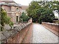
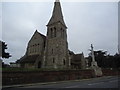
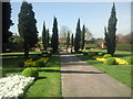
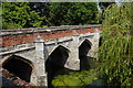
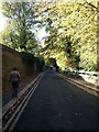
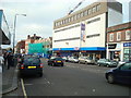
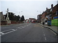
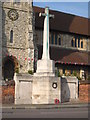
Photos of SE9 1HL
Area Information
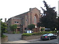
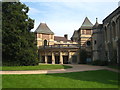
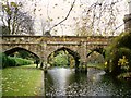
Eltham Town and Avery Hill forms a specific residential cluster in the Royal Borough of Greenwich, currently identified by the postcode SE9 1HL. This area occupies a distinct position eight miles east-southeast of Charing Cross, blending suburban living with significant historical depth. Human activity in this locale dates back to the Mesolithic period, with archaeological evidence including a flint found within local parks. The site of Avery Hill Mansion was established in the 19th century, evolving into the Avery Hill College of Education by 1906 after being owned by Colonel John Thomas North. Today, approximately 1,906 people reside within the Eltham Town and Avery Hill ward, living in an environment that balances urban town centre access with extensive open green spaces. The character of SE9 1HL remains defined by its transition from rural origins to a modern urban setting. Land around Eltham was recorded in the Domesday Book as 'Eald Ham', owned by Odo, Bishop of Bayeux, before becoming part of the County of London in 1889. For those considering living in SE9 1HL, the location offers proximity to key landmarks such as Eltham Palace, which sits near the former college grounds. The area retains a quiet residential quality while maintaining practical connectivity to the wider London network. Residents benefit from access to the restored Winter Garden, which features Britain's largest Canary date palm, alongside a Tudor Conduit and the wild flower meadow known as Henley's Field. This mix of heritage sites and green infrastructure defines the daily experience for anyone seeking homes in this specific postcode area.
- Area Type
- Postcode
- Area Size
- Not available
- Population
- 1688
- Population Density
- 5021 people/km²
The property market for SE9 1HL is distinctly shaped by the type of accommodation available and the ownership patterns of existing residents. Houses make up the primary accommodation type in this cluster, reflecting the historical development of the Avery Hill estate. This preference for standalone homes contrasts with the prevalent flat living found in other parts of southeast London. With a home ownership rate of 56%, the area retains a strong bias toward owner-occupied housing. This high percentage suggests that investors looking for short-term rental yields may find fewer opportunities compared to more transient areas. Instead, the market is driven by individuals and families seeking to buy into a stable, established estate. Buyers looking at homes in SE9 1HL should expect properties that reflect the area's history, such as those built on land that once formed the lair of Colonel John Thomas North's mansion. The specific postcode area covers a small residential cluster, meaning inventory will be limited compared to larger districts. This scarcity can create a competitive environment for desirable properties, particularly those situated near the Avery Hill Park site. The presence of a large proportion of owner-occupiers often means sellers are motivated by improving their own living standards rather than extracting quick rental profits. This dynamic can sometimes result in quicker transactions for serious buyers who can meet vendor expectations. Understanding that the market is skewed toward houses and ownership helps prospective buyers focus their search strategies appropriately for this specific sector of Greenwich.
House Prices in SE9 1HL
No properties found in this postcode.
Energy Efficiency in SE9 1HL
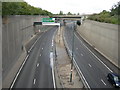
Daily life in SE9 1HL is enriched by a variety of amenities accessible within a short practical distance. Residents can choose from five retail outlets, including Lidl Eltham, M&S Eltham, and Iceland Eltham, ensuring that routine shopping needs are met without extensive driving. The local retail category provides essential goods alongside broader supermarket choices suitable for families. Leisure and recreation are supported by the nearby Avery Hill Park, which features historical attractions like the Winter Garden and offers space for walking or picnics. Three major ferries operate nearby, including Barrier Gardens Pier and Woolwich Arsenal Pier, creating opportunities for leisure boat trips or commuting access to the Peninsula. Transport and leisure converge with five rail and metro stations facilitating easy access to diverse activities. Falconwood Station and Eltham Station serve as key hubs for reaching further attractions. The presence of Cutty Sark for Maritime Greenwich as a nearby metro stop highlights the proximity to cultural maritime heritage sites. This blend of green spaces, historical landmarks, and modern shopping conveniences creates a balanced lifestyle environment. For those planning their move, the combination of local essentials like Iceland Eltham and larger retailers like M&S Eltham reduces the need to travel far for daily necessities. The area's character is defined by this proximity to both nature and commerce, allowing residents to switch easily between quiet park walks in Avery Hill and busy retail trips in Eltham town centre.
Amenities
Schools
Families considering schools near SE9 1HL have access to a verified option within immediate reach. Eltham Church of England Primary School stands as the named primary institution in the vicinity of this postcode. The school holds a 'good' Ofsted rating, which is the classification assigned by the educational authorities in England. This rating indicates that the institution meets the required standards for education quality and child welfare. While there is only one primary school listed in the provided data for this specific cluster, it offers a locally grounded educational choice for families settling in the area. The reliance on Eltham Church of England Primary School suggests a strong continuation of local educational services within the historic Eltham region. Parents looking for schools near SE9 1HL can expect a single, well-regarded option for their younger children before they transition to secondary education further afield. The proximity of this primary school to the residential cluster supports the idea of a self-contained community environment where children can access education without long daily commutes. For those prioritising educational facilities as a key factor in their decision to buy, the presence of a school rated 'good' provides a solid foundation. The specific association with the Church of England denomination may also appeal to families seeking a faith-based upbringing for their children alongside a recognised curriculum.
| Rank | School | Type | Entry gender | Ages |
|---|
Explore more schools in this area
Go to Schools tabDemographics
The community residing in SE9 1HL reflects an established neighbourhood rather than a rapidly developing one. The median age for residents stands at 47 years, indicating that Adults aged 30-64 years form the most common age range in the area. This demographic profile suggests the neighbourhood caters primarily to families and older professionals who have settled permanently rather than recent urban commuters. Home ownership is a dominant feature of the local housing situation, with 56% of households owning their properties outright. This figure signifies a stable community where long-term residency is more common than the high turnover often found in student districts or prime central London locations. The predominant ethnic group in SE9 1HL is White, contributing to the area's established character. Most residents live in houses, which aligns with the older estate structures found on the site of the former mansion. The accommodation type data confirms a focus on detached or semi-detached living rather than high-rise flats or terraced streets common in inner boroughs. While specific deprivation metrics are not immediately obvious from the provided statistics, the high rate of home ownership suggests residents have the financial stability to maintain their homes. The population size of 1,688 within this specific cluster indicates a tightly knit environment where neighbours are likely to know one another. Living in SE9 1HL means moving into an area where the social fabric is woven from generations of local families. The lack of young children dominating the population statistics may affect the pace of community events, but it ensures a peaceful atmosphere for residents seeking quiet suburbs.
Household Size
Accommodation Type
Tenure
Ethnic Group
Religion
Household Composition
Age
Household Deprivation
NS-SEC
Explore more demographic insights in this area
Go to Demographics tabPlanning
Planning Constraints
- Flood RiskPremium
- Ramsar Wetland SitesPremium
- Area of Outstanding Natural BeautyPremium
- Protected Nature ReservePremium
- Protected WoodlandPremium