Area Overview for SE9 1HB
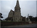
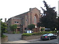
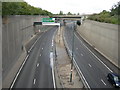
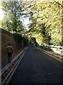
Photos of SE9 1HB


Area Information
SE9 1HB occupies a specific residential cluster within the electoral ward of Eltham Town and Avery Hill in the Royal Borough of Greenwich. Located approximately 8.7 miles east-southeast of Charing Cross, this postcode covers a small residential population of 1,991 people. The area sits between developed town environments and open countryside, characterising a suburban lifestyle with significant green spaces. Human activity in the vicinity dates to the Mesolithic period, evidenced by flint finds in Avery Hill Park, while the land was recorded as 'Eald Ham' in the Domesday Book. In the 19th century, the estate developed into a mansion built circa 1841 by James Boyd, which later became Avery Hill College of Education. Living in SE9 1HB offers proximity to key landmarks such as Eltham Palace and the restored Winter Garden at Avery Hill Park. The site features Britain's largest Canary date palm and a Tudor Conduit, contributing to the local landscape. This area retains the feel of a suburban retreat while providing access to urban amenities. Residents benefit from the dual nature of the location, which extends from Eltham town centre eastwards to Avery Hill. The coordinates 51.443736, 0.085037 place the postcode near DA15 8ED, anchoring it firmly in southeast London. Whether you are seeking a grounded community life or easy access to green areas, this postcode delivers a distinct blend of history and modern convenience without unnecessary urban density.
- Area Type
- Postcode
- Area Size
- Not available
- Population
- 1991
- Population Density
- 2085 people/km²
Homes in SE9 1HB are dominated by flats, which forms the central characteristic of the local housing stock. This concentration of apartment living distinguishes the area from those built on traditional terraced or detached house models. The property market reflects this structural reality, with 45% of households achieving home ownership. This statistic indicates that just under half of the residents possess their dwellings outright or through a mortgage, while the remaining proportion comprises private or social renters. Buying in this postcode often involves navigating the sales of existing flats rather than new builds. The accommodation type data confirms a strong skew towards flat living within this specific residential cluster. For buyers seeking a detached family home, SE9 1HB may not provide the typical stock found in more sprawling suburban postcodes. The market dynamics will centre on available apartment spaces within the existing buildings. Given the small population size of 1,991, the total number of listed properties remains modest, leading to a tightly defined property pool. This scarcity can create a focused buying environment where specific listings command attention. Understanding that flats are the primary housing option here is essential for setting realistic expectations regarding property types and construction standards. The market operates within the context of a mature residential area rather than a new development hub.
House Prices in SE9 1HB
No properties found in this postcode.
Energy Efficiency in SE9 1HB
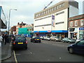
Residents of SE9 1HB enjoy immediate access to a wide range of retail and transport amenities within practical reach. Five retail outlets operate nearby, including prominent supermarkets such as Sainsburys Eltham, Lidl Eltham, and M&S Eltham. These stores provide comprehensive food and household shopping options for local families. Transport links are well developed with five rail stations including Eltham, Mottingham Station, and New Eltham offering frequent train services. Five ferry services connect the area to Woolwich Arsenal Pier, Barrier Gardens Pier, and Woolwich Ferry North Pier, facilitating crossings across the Thames. The local area also benefits from five metro stops, including Elverson Road, King George V, and Cutty Sark for Maritime Greenwich, providing direct access to the DLR network. London City Airport stands as a single nearby airport option, convenient for short-haul travel. This dense network of transport and retail facilities means daily errands are quick and straightforward. You can shop at Sainsburys or M&S without needing to travel far from your home in SE9 1HB. The integration of rail and ferry services ensures flexibility in how you commute. Whether you prefer walking to a train station or taking the bus to a metro line, the local amenities support a convenient and varied lifestyle without significant travel times.
Amenities
Schools
Families living in SE9 1HB have access to three notable educational institutions nearby. The Serenity School Eltham holds an outstanding Ofsted rating and operates as a special school, providing high-standard care for specific educational needs. Independent education remains a strong option locally. Belcanto London Academy Theatre School offers specialist independent training, focusing on performance arts and creative disciplines for students seeking commercial experience in performing industries. Another independent choice is StreetVibes Media Academy, which also carries a good Ofsted rating and provides dedicated media and digital media skills training. The presence of two accredited independent schools alongside one specialist state provision offers a diverse range of educational paths. Families can choose between mainstream special needs education, theatre-focused arts training, or media and communications qualifications without travelling far from SE9 1HB. This variety ensures that residents have multiple high-quality options catering to different ambitions and learning requirements. The independent sector presence suggests a willingness among parents to invest in specialised education beyond the standard state curriculum. Children in this area benefit from proximity to schools that emphasise practical skills in drama and media production. The mix of outstanding, good, and specialist ratings reflects a robust local education landscape capable of supporting varied educational goals.
| Rank | School | Type | Entry gender | Ages |
|---|
Explore more schools in this area
Go to Schools tabDemographics
The community within postcodes SE9 1HB is defined by a demographic profile skewed towards established residents. The median age stands at 47 years, with adults aged between 30 and 64 representing the most common age range. This age distribution suggests a neighbourhood stable enough for family life yet avoiding the transient nature of student enclaves. Home ownership accounts for 45% of households, indicating a balanced market where a significant portion of residents maintain long-term stability. While interest in rental accommodation remains relevant, nearly half of the homes in this sector are owner-occupied, though SE9 1HB specifically features a predominance of flats within its stock. The most predominant ethnic group in this postcode is White, reflecting the broader patterns found across the Royal Borough of Greenwich settlement. The accommodation type is primarily flats, which usually caters to smaller households or individuals seeking low-maintenance living. These demographic factors create a community structure where long-term residents shape the local culture. There are no indications of rapid population turnover or extreme age homogeneity. The area supports a steady demographic with a high proportion of working-age adults. This mix creates an environment where neighbourhood institutions and local services cater to a settled population rather than a constantly shifting transient group. The established nature of the residents contributes to a predictable and steady community atmosphere within the wider Eltham ward.
Household Size
Accommodation Type
Tenure
Ethnic Group
Religion
Household Composition
Age
Household Deprivation
NS-SEC
Explore more demographic insights in this area
Go to Demographics tabPlanning
Planning Constraints
- Flood RiskPremium
- Ramsar Wetland SitesPremium
- Area of Outstanding Natural BeautyPremium
- Protected Nature ReservePremium
- Protected WoodlandPremium