Area Overview for SE8 9BY
Photos of SE8 9BY
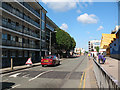
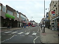
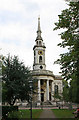
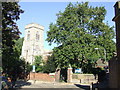
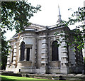
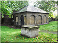
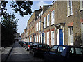
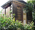
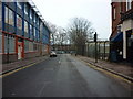
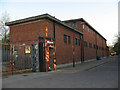
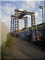
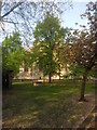
Area Information
Living in SE8 9BY means residing in a specific postcode cluster that defines itself through density and accessibility. This small residential area forms an integral part of the broader Greenwich and Lewisham landscape in south east London. The character of the neighbourhood is shaped by its compact population of 1,422 people, which creates a tightly knit environment rather than a sprawling suburb. Residents here navigate a setting that balances urban convenience with the quiet of a defined cluster. Daily life revolves around immediate proximity to major transport hubs without the isolation of distant outposts. You will find that every street offers a direct link to the city's wider networks. The area lacks the extensive green corridors of wider boroughs, focusing instead on efficient living within its boundaries. This postcode covers a targeted zone where lifestyle choices centre on utilisation of nearby commercial and transport assets. You are living in an environment where distance to amenities is measured in minutes rather than miles. The specific nature of SE8 9BY ensures that your commute and leisure time are optimised by location. Homes here serve as a strategic base for those requiring rapid access to London City Airport or the DLR network. The area does not boast wide-open spaces, prioritising density and strategic positioning instead. This concentration allows for a community that moves quickly between home and work. You will experience an urban rhythm defined by the presence of multiple rail and ferry connections within reach. The flat, heart of this residential cluster offers a unique positioning for professionals and families alike.
- Area Type
- Postcode
- Area Size
- Not available
- Population
- 1422
- Population Density
- 9589 people/km²
The property market in SE8 9BY is distinctly shaped by a housing stock where flats dominate the landscape. Only 24% of residents own their homes, indicating a large rental sector compared to owner-occupied suburban norms. This low ownership rate means that most transactions involve leasehold agreements or direct rentals rather than buying freehold properties. You are looking at an area where the majority of homes in this specific postcode are featured in the rental market. The dominance of flats suggests a design tailored for urban dwellers who value location over traditional garden space. Buying here typically requires navigating leasehold complexities common in South London high-density zones. The small population of 1,422 people means the available inventory of flats is limited by the sheer size of the postcode. This scarcity can drive up competition for available properties during peak seasons. Investors and landlords likely play a significant role in the local market dynamics given the high rental share. Mortgage lenders may view this area similarly to other densely populated postcodes with lower retention rates. You should expect higher service charges for flats as maintenance is managed collectively for shared building structures. The market reflects a pragmatic approach to housing where utility and transport access outweigh architectural grandeur. Few homeownership opportunities exist within the strict boundaries of SE8 9BY compared to surrounding districts. This dynamic makes the area attractive to those prioritising mobility and amenities over equity building through home ownership.
House Prices in SE8 9BY
No properties found in this postcode.
Energy Efficiency in SE8 9BY
Your daily life in SE8 9BY is enhanced by a dense network of transport and retail options within practical reach. You have access to five railway stations including Deptford, New Cross ELL Railway Station, and Greenwich Station for rapid city access. The area also features five ferry piers such as Masthouse Terrace Pier, Greenwich Pier, and Greenland Surrey Quays Pier, offering scenic river crossings. Shopping needs are met by five major retailers including Sainsburys Greenwich, Iceland Deptford, and Tesco Deptford. These supermarkets provide everything from fresh produce to household essentials without long drives. Bus services include three key routes from the Green Line Coach Station, Victoria Coach Station, and London Victoria Coach Station Arrivals. London City Airport is also just one notable airport facility nearby, supporting short-haul international travel. You do not need a car to navigate your lifestyle, as five metro connections like Deptford Bridge and Cutty Sark DLR Station are available. These transport links create a central hub for both commuters and leisure travellers. The proximity of Sainsburys and Iceland means you can run errands locally before or after work. Ferry access allows you to explore the Thames embankment or visit Greenwich Park easily. This variety of options ensures that travel time for both routine and holiday purposes remains minimal. The cluster of amenities creates a self-sufficient living environment with high convenience levels.
Amenities
Schools
St Joseph's Catholic Primary School stands as the only primary school listed in the immediate vicinity of SE8 9BY. The school holds a good Ofsted rating, which signals a standard of education that meets regulatory expectations. As a primary institution, it caters to children from early years through to the end of Key Stage 2. There are no secondary schools explicitly named in the provided data for this specific postcode cluster. Families living here will likely need to look beyond local boundaries for older children's education needs. The presence of one good-rated primary school suggests a functional network for younger students within walking or short bus distance. You will find that the school offers a faith-based curriculum under the Catholic characteristic. This single entity provides a clear choice for early years education without the confusion of multiple neighbouring options. The good rating ensures that academic and pastoral standards are maintained consistently. Parents should note that this school serves the immediate residential cluster of SE8 9BY but may have a catchment area extending further. The lack of data on secondary options means you must verify further education paths separately. St Joseph's Catholic Primary School provides a solid foundation for local children's learning journey.
| Rank | School | Type | Entry gender | Ages |
|---|
Explore more schools in this area
Go to Schools tabDemographics
The community in SE8 9BY reflects a mature, predominantly adult demographic with a median age of 47 years. The most common age range is adults between 30 and 64 years, suggesting a stable population moving beyond early childhood stages. You will find that the area comprises mostly rental accommodations, with only 24% of residents owning their homes. This statistic indicates that renting is the primary mode of tenure for the majority of households living in this postcode. The predominant ethnic group is White, which forms the core of the local diversity profile. Accommodation types are strictly defined as flats, meaning you will not find detached or semi-detached houses in this specific cluster. The housing stock is vertically oriented to accommodate the population density of 1,422 individuals within a small footprint. This demographic profile points to a neighbourhood where older students, young professionals, and families sharing larger units coexist. The high proportion of renters often correlates with transient populations or professionals on fixed-term contracts in nearby business districts. You are looking at a community where household permanence is lower than in owner-dominated suburbs. The age skew towards adults means fewer children are raised within the immediate boundaries of SE8 9BY, though families may reside nearby. The lack of single-owner households suggests that land ownership is largely held by larger corporate landlords or housing associations. You will encounter a neighbourly network built on shared rental agreements and communal living arrangements typical of flat developments. This demographic reality shapes local interactions and community governance significantly.
Household Size
Accommodation Type
Tenure
Ethnic Group
Religion
Household Composition
Age
Household Deprivation
NS-SEC
Explore more demographic insights in this area
Go to Demographics tabPlanning
Planning Constraints
- Flood RiskPremium
- Ramsar Wetland SitesPremium
- Area of Outstanding Natural BeautyPremium
- Protected Nature ReservePremium
- Protected WoodlandPremium