Area Overview for SE8 3BU
Photos of SE8 3BU
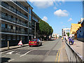


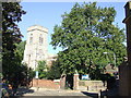
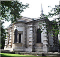
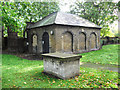
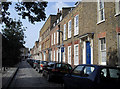
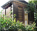
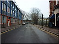
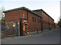
100 photos from this area
Area Information
Key information about the SE8 3BU including its size, population, and administrative classification.
- Area Type
- Postcode
- Area Size
- 1.3 hectares
- Population
- 2711
- Population Density
- 17257 people/km²
House Prices in SE8 3BU
100
Properties
£507,500
Average Sold Price
£280,000
Lowest Price
£905,000
Highest Price
Showing 100 properties (first 250)
| Address | Type | Beds | Baths | Last Sale Price | Last Sale Date | |
|---|---|---|---|---|---|---|
| 51 Creek Road, Deptford, SE8 3BU | Flat | 1 | 1 | £280,000 | Mar 2022 | |
| The Vicarage, 41 Creek Road, Deptford, SE8 3BU | Flat | 1 | 2 | £905,000 | Jun 2021 | |
| 43 Creek Road, Deptford, SE8 3BU | Flat | 1 | 1 | £320,000 | Mar 2016 | |
| 45 Creek Road, Deptford, SE8 3BU | Maisonette | 3 | 2 | £525,000 | Feb 2016 | |
| Block A Mcmillan Student Village, Creek Road, Deptford, SE8 3BU | Retail | - | - | - | - | |
| Room 17, Block G Mcmillan Student Village, Creek Road, Deptford, SE8 3BU | Retail | - | - | - | - | |
| 191A Creek Road, Deptford, SE8 3BU | Flat | 1 | 1 | - | - | |
| Flat 3, 125 Creek Road, Deptford, SE8 3BU | Flat | 1 | - | - | - | |
| Flat 1, 125 Creek Road, Deptford, SE8 3BU | Flat | 2 | - | - | - | |
| 191B Creek Road, Deptford, SE8 3BU | Flat | 1 | 2 | - | - |
Page 1 of 10
Energy Efficiency in SE8 3BU
Amenities
Schools
| Rank | School | Type | Entry gender | Ages |
|---|
Explore more schools in this area
Go to Schools tabDemographics
Household Size
Two person
most common
Accommodation Type
Flats
most common
Tenure
30
majority
Ethnic Group
White
most common
Religion
N/A
most common
Household Composition
N/A
most common
Age
22
median
Adults (30-64 years)
most common
Household Deprivation
N/A
with no deprivation
NS-SEC
37
in Lower managerial occupations
Explore more demographic insights in this area
Go to Demographics tabPlanning
Planning Constraints
- Flood RiskPremium
- Ramsar Wetland SitesPremium
- Area of Outstanding Natural BeautyPremium
- Protected Nature ReservePremium
- Protected WoodlandPremium