Area Overview for SE7 8DN
Photos of SE7 8DN
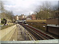
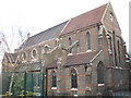
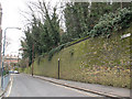
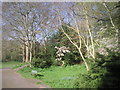

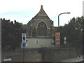
100 photos from this area
Area Information
Key information about the SE7 8DN including its size, population, and administrative classification.
- Area Type
- Postcode
- Area Size
- 2.0 hectares
- Population
- 2324
- Population Density
- 2486 people/km²
House Prices in SE7 8DN
100
Properties
£264,214
Average Sold Price
£190,000
Lowest Price
£332,500
Highest Price
Showing 100 properties
| Address | Type | Beds | Baths | Last Sale Price | Last Sale Date | |
|---|---|---|---|---|---|---|
| 2 Lancey Close, Charlton, SE7 8DN | Maisonette | 3 | 2 | £299,999 | May 2023 | |
| 11 Lancey Close, Charlton, SE7 8DN | Terraced | 2 | 1 | £332,500 | May 2021 | |
| 5 Lancey Close, Charlton, SE7 8DN | Flat | 2 | 1 | £299,000 | Mar 2020 | |
| 10 Lancey Close, Charlton, SE7 8DN | Maisonette | 2 | 1 | £307,000 | Apr 2018 | |
| 12 Lancey Close, Charlton, SE7 8DN | Maisonette | 2 | - | £190,000 | Jun 2013 | |
| 23 Lancey Close, Charlton, SE7 8DN | house | 3 | - | £202,000 | Sep 2011 | |
| 18 Lancey Close, Charlton, SE7 8DN | house | - | - | £219,000 | Jan 2008 | |
| Warspite Woolwich, 1 Lancey Close, Charlton, SE7 8DN | retail_financial | - | - | - | - | |
| Flat 104, Hadwen Apartments, 1 Pett Street, Woolwich, SE7 8DN | Flat | - | - | - | - | |
| Flat 201, Hadwen Apartments, 1 Pett Street, Woolwich, SE7 8DN | Flat | - | - | - | - |
Page 1 of 10
Energy Efficiency in SE7 8DN
Amenities
Schools
| Rank | School | Type | Entry gender | Ages |
|---|
Explore more schools in this area
Go to Schools tabDemographics
Household Size
One person
most common
Accommodation Type
Flats
most common
Tenure
27
majority
Ethnic Group
White
most common
Religion
N/A
most common
Household Composition
N/A
most common
Age
47
median
Adults (30-64 years)
most common
Household Deprivation
N/A
with no deprivation
NS-SEC
30
in Lower managerial occupations
Explore more demographic insights in this area
Go to Demographics tabPlanning
Planning Constraints
- Flood RiskPremium
- Ramsar Wetland SitesPremium
- Area of Outstanding Natural BeautyPremium
- Protected Nature ReservePremium
- Protected WoodlandPremium