Area Overview for SE6 3NF
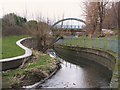
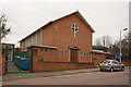
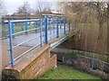
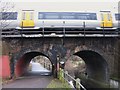
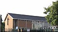
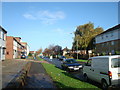
Photos of SE6 3NF

Area Information
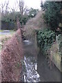
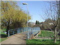
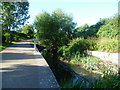
Living in SE6 3NF means residing in a very compact residential cluster within Beckenham, where 2,318 people occupy just 3,805 square metres. You will find yourself in a postcode area that functions as a dense urban block rather than a sprawling village. The close proximity of residents creates an immediate sense of community, though physical space is at a premium. Expect a neighbourhood defined by its high density and accessibility to major South London routes. This environment suits those who prioritise convenience and urban connectivity over private garden space. Daily life here revolves around the efficient use of space and the rhythm of a well-connected suburb. You might notice that streets are narrower and more closely packed compared to wider suburban districts. The area offers a specific quality of life for those working in central London or commuting via the local tram and rail network. Understanding this small footprint is essential before viewing homes in SE6 3NF, as the living experience mirrors that of a larger multi-building estate.
- Area Type
- Postcode
- Area Size
- 3805 m²
- Population
- 2318
- Population Density
- 7108 people/km²
The housing stock in SE6 3NF is defined almost entirely by flats, given the specific accommodation type data for postcode SE6 3NF. With only 28% home ownership, seventy-two percent of the area remains within the private rental market. This statistic suggests you will encounter a high volume of rental properties rather than家庭 homes for purchase. The density of 609,166 people per square kilometre reinforces that individual houses with large gardens are unlikely here. Instead, expect purpose-built blocks or converted Victorian buildings adapted for modern flat living. Buyers focusing on SE6 3NF should prepare to navigate a competitive rental market or consider leasehold flats in shared blocks. This is not an area characterised by detached family homes or sprawling estates. The market dynamics favour tenants and investors who seek high-yield urban properties over owner-occupiers looking for single-family houses.
House Prices in SE6 3NF
Showing 11 properties
| Address | Type | Beds | Baths | Last Sale Price | Last Sale Date | |
|---|---|---|---|---|---|---|
| Flat 1, Riverside, 317 Southend Lane, London, SE6 3NF | Maisonette | 3 | 1 | - | - | |
| Flat 2, Riverside, 317 Southend Lane, London, SE6 3NF | Flat | 4 | - | - | - | |
| Flat 3, Riverside, 317 Southend Lane, London, SE6 3NF | Flat | - | - | - | - | |
| Flat 6, Riverside, 317 Southend Lane, London, SE6 3NF | Flat | - | - | - | - | |
| Flat 7, Riverside, 317 Southend Lane, London, SE6 3NF | Flat | - | - | - | - | |
| Flat 8, Riverside, 317 Southend Lane, London, SE6 3NF | Maisonette | - | - | - | - | |
| Flat 9, Riverside, 317 Southend Lane, London, SE6 3NF | Maisonette | - | - | - | - | |
| Flat 5, Riverside, 317 Southend Lane, London, SE6 3NF | Flat | - | - | - | - | |
| Flat 10, Riverside, 317 Southend Lane, London, SE6 3NF | Flat | - | - | - | - | |
| Riverside, Southend Lane, London, SE6 3NF | Flat | 1 | 1 | - | - |
Energy Efficiency in SE6 3NF
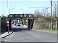
Your daily routine in SE6 3NF benefits from a dense network of transport and retail options within practical reach. For shopping, you have direct access to Lidl London, Sainsburys Sydenham, and Aldi Bell Green RP, providing a solid selection of daily groceries and household essentials. Travelers can choose from five rail stations including Lower Sydenham, Bellingham Station, and Beckenham Hill Station. If you prefer light rail travel, options like the Beckenham Road Tram Stop and Avenue Road Tram Stop are minutes away. Five ferry services are also accessible, with Greenwich Pier and Masthouse Terrace Pier offering routes across the river. This mix of five retail chains, five rail termini, and five tram stops and ferries creates a highly interconnected lifestyle where you rarely need a car for basics.
Amenities
Schools
Families considering schools near SE6 3NF will find one primary option listed within immediate proximity. Haseltine Primary School stands as the sole primary institution referenced for this postcode area. It holds a 'good' Ofsted rating, indicating a standard of education recognised by regulatory bodies. This single entry suggests that while primary education is accessible, secondary options or a wider variety of independent preschools are not explicitly detailed in the current data for this specific zone. Residents must rely heavily on this primary school or look to adjacent postcodes for secondary school choices. The local educational landscape is singular in its documentation, meaning you should verify catchment areas and admission criteria directly with Haseltine Primary School before committing to a home in this district.
| Rank | School | Type | Entry gender | Ages |
|---|
Explore more schools in this area
Go to Schools tabDemographics
The community in SE6 3NF presents a mature profile with a median age of 47 years. Most commonly, the residents fall into the adult age range between 30 and 64 years. You are looking at a population dominated by established households rather than young singles or families with school-age children waiting for local primary placements. Home ownership stands at 28%, which indicates a predominantly private rented sector or leasehold market within this postcode. The dominant accommodation type consists of flats, reflecting a building stock designed for vertical living rather than detached bungalows. This ethnic landscape reflects significant black total representation, contributing to a culturally diverse residential environment. The lack of young families is a defining characteristic that shapes local amenities and social interactions.
Household Size
Accommodation Type
Tenure
Ethnic Group
Religion
Household Composition
Age
Household Deprivation
NS-SEC
Explore more demographic insights in this area
Go to Demographics tabPlanning
Planning Constraints
- Flood RiskPremium
- Ramsar Wetland SitesPremium
- Area of Outstanding Natural BeautyPremium
- Protected Nature ReservePremium
- Protected WoodlandPremium