Area Overview for SE6 2PS
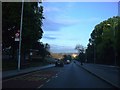
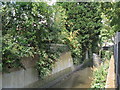
Photos of SE6 2PS


Area Information
Catford South, situated within the SE6 2PS postcode district, defines a specific residential cluster spanning 3.8 hectares in the London Borough of Lewisham. You are looking at a number 1788 homes community with significant density, standing at 46489 people per square kilometre. This area forms part of the administrative centre of Catford, located southwest of Lewisham itself near the River Ravensbourne. The ward has been an electoral unit since the 2002 elections, electing three councillors to the local council. Local history reveals deep roots dating back to 1254 when the name first recorded, deriving from a cattle crossing. Suburban development accelerated from the 1890s following railway arrival, eventually leading to 1960s brutalist redevelopment. Today, you will find a suburban urban district characterised by street markets, cultural events, and shopping centred around Broadway Theatre. The area dedicates space to notable landmarks such as the Catford Cat sculpture at Catford Centre and Grade II listed Milford Towers. If you choose living in SE6 2PS, you enter a ward with a distinct identity, blending historical significance with modern suburban convenience.
- Area Type
- Postcode
- Area Size
- 3.8 hectares
- Population
- 1788
- Population Density
- 5531 people/km²
The housing landscape in SE6 2PS reflects a mature market where ownership is the prevailing norm. You will find that 57% of residents own their properties outright or with a mortgage. This majority ownership rate signals a stable neighbourhood where long-term residents have invested in their homes. The accommodation type data confirms that Houses remain the primary dwelling structure in this cluster, distinguishing it from high-rising blocks found elsewhere in inner London boroughs. This specific postcode covers a small residential cluster, meaning the immediate stock is limited within the 3.8 hectares. Buyers considering homes in SE6 2PS should expect a blend of established properties typical of the area's suburban development phase. The high density of 46489 people per square kilometre suggests potential pressure on housing supply within these boundaries. For those looking beyond the immediate postcode, the wider Catford district offers further variety. However, within this defined area, the market is characterised by significant residential occupancy rather than transient renting arrangements.
House Prices in SE6 2PS
No properties found in this postcode.
Energy Efficiency in SE6 2PS
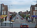
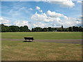
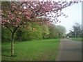
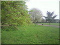
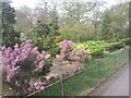
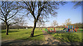
Daily life in SE6 2PS revolves around practical access to essential services and leisure venues. Your nearest retail options include Tesco Bellingham, M&S Downham Bromley BP, and Co-op Bellingham, covering major supermarket and convenience needs within walking distance. For rail and metro access, Bellingham Station stands as a key landmark alongside Beckenham Hill Station. The area's connectivity extends to ferry services at Greenwhich Pier and Greenland Surrey Quays Pier, offering weekend excursions to the east bank. Cultural life is accessible just outside the immediate 3.8-hectare cluster. The Broadway Theatre offers Grade II listed art deco entertainment, while Mountsfield Park provides space for local recreation and events like Lewisham Peoples Day. If you prefer dining, the Black Horse and Harrow pub offers historic character having opened in 1700. Short train journeys link you to London City Airport for business. You will find a balance of shops, dining, and leisure facilities that supports a self-sufficient lifestyle without requiring daily commutes to Central London.
Amenities
Schools
Families looking for schools near SE6 2PS have access to specific educational institutions within the immediate vicinity. The primary option is Conisborough College, which serves younger children in the catchment. For secondary education, Conisborough College operates as an academy, providing a continuous educational pathway for local residents. This placement means you do not need to travel far for academic support. While the area resides within the Lewisham London Borough, the data points directly to these two named entities as the key local providers. The presence of an academy alongside a primary college suggests a mix of governance structures, though both operate to support the local community. If you are evaluating schools near SE6 2PS, these are the first names you will encounter on official maps. The proximity ensures that daily travel times for students remain minimal, allowing for better work-life balance for parents employed in nearby sectors.
| Rank | School | Type | Entry gender | Ages |
|---|
Explore more schools in this area
Go to Schools tabDemographics
The community within SE6 2PS presents a defined demographic profile suitable for adult life stages. The median age sits at 47 years, with the most common age range falling between 30 and 64 years. This suggests a neighbourhood populated by established residents rather than younger families or retirees. You find a strong tradition of stability here, as 57% of households report owner-occupation levels. One accommodation type dominates the landscape: Houses. This indicates the presence of substantial fixed properties rather than high-density flats or shared housing. Diversity is a defining feature of this postcode, with the black_total ethnic group forming the predominant demographic cluster. These figures paint a picture of a settled, middle-aged community living in private homes. While specific deprivation data is not included in this dataset, the high home ownership rate often correlates with long-term investment in the local property market. The population density remains notably high for a residential zone, ensuring local facilities remain close to your doorstep.
Household Size
Accommodation Type
Tenure
Ethnic Group
Religion
Household Composition
Age
Household Deprivation
NS-SEC
Explore more demographic insights in this area
Go to Demographics tabPlanning
Planning Constraints
- Flood RiskPremium
- Ramsar Wetland SitesPremium
- Area of Outstanding Natural BeautyPremium
- Protected Nature ReservePremium
- Protected WoodlandPremium