Area Overview for SE6 2NJ
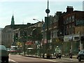
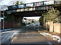
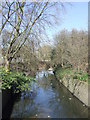
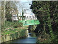
Photos of SE6 2NJ

Area Information
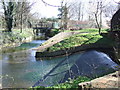
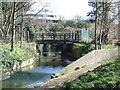
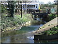
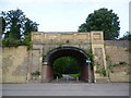
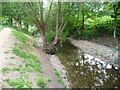
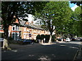
SE6 2NJ represents a specific residential cluster within the broader Catford district in the London Borough of Lewisham. This postcode covers a small geographical footprint of 2,890 square metres, hosting a population of 2,161 residents. The area functions as a tight-knit unit where daily life revolves around the immediate neighbourhood and its immediate connections to wider London. Catford South, the administrative ward containing this postcode, has existed as an electoral unit since 2002, serving as part of the district's administrative centre. The location sits near the River Ravensbourne, southwest of Lewisham town. You will find yourself living in an area defined by its suburban urban character, blending history with modern convenience. The name derives from 'Catford', which was recorded in 1254 as a ford across the river frequented by wild cats. Despite its small size, the postcode offers access to a rich history dating back to the 16th century, including the 1897 arrival of the railway at Catford Bridge. Residents here experience a blend of brutalist architecture and traditional street life, centred around shared amenities. Whether you are commuting to London City Airport or walking to a nearby market, the density and layout of SE6 2NJ provide a specific sense of place within the Lewisham borough.
- Area Type
- Postcode
- Area Size
- 2890 m²
- Population
- 2161
- Population Density
- 6473 people/km²
The housing market in SE6 2NJ is defined by a high density of flats, reflecting the urban character of the Catford South ward. With accommodation type listed specifically as flats, the stock targets those seeking urban living in a compact space. The 53% home ownership rate suggests that a significant portion of residents have purchased their homes, likely including the conversion of older structures or purpose-built blocks typical of post-war developments in the area. This postcode falls within Catford, a district known for brutalist redevelopment in the 1960s. You will find a mixture of property types, yet flats remain the predominant form. The small area size of 2,890 square metres limits the scope of large terraced houses or detached homes within this specific postcode boundary. Instead, buyers focus on the efficiency and modernisation of the existing block structures. The presence of Priory House Private School and Broadoak Rru nearby often correlates with demand for family-oriented flats that allow for easier management of households with children. For those looking at homes in SE6 2NJ, the market is practical rather than extravagant. The high density means less green space within the immediate boundary, pushing residents to rely on Leaf Areas or parks a short walk away. The purchase trend here mirrors the broader Catford market, where established buildings support a stable investment profile. Buying here means acquiring a unit in a cluster that serves a specific, urban function within the Lewisham borough.
House Prices in SE6 2NJ
Showing 4 properties
| Address | Type | Beds | Baths | Last Sale Price | Last Sale Date | |
|---|---|---|---|---|---|---|
| 1 Sambruck Mews, London, SE6 2NJ | Detached | 3 | 1 | - | - | |
| 4 Sambruck Mews, London, SE6 2NJ | Bungalow | 2 | - | - | - | |
| 2 Sambruck Mews, London, SE6 2NJ | Detached | 4 | - | - | - | |
| 3 Sambruck Mews, London, SE6 2NJ | Detached | - | - | - | - |
Energy Efficiency in SE6 2NJ
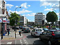
Living in SE6 2NJ offers immediate access to a wide range of amenities within practical reach, removing the need for long journeys into central London. For retail needs, you have five key options, including Lidl Catford, Co-op Catford, and Sainsburys Catford. These supermarkets are located nearby, ensuring groceries and daily essentials are easily accessible within the Catford district. Transport connectivity is a major lifestyle driver, with five nearby rail stations and five metro stops. You can reach Elverson Road, Beckenham Road Tram Stop, and Deptford Bridge quickly. For those who prefer water travel, five ferry stops are available nearby, including Greenwich Pier, Masthouse Terrace Pier, and Greenland Surrey Quays Pier. If flying is an occasional necessity, London City Airport sits just one connection away. Culturally, the area is centred around the Broadway Theatre, a Grade II listed art deco building opened in 1932. The Catford Broadway street market and Mountsfield Park, which hosts the Lewisham Peoples Day, provide regular cultural and social outlets. Historical features like the Black Horse and Harrow pub and the Catford Cat sculpture add unique character to your walk. You are close enough to experience the vibrant non-chain eateries and pubs of the ward while living in the smaller residential cluster of SE6 2NJ.
Amenities
Schools
Families living in SE6 2NJ have access to two specific educational institutions within the immediate vicinity. The most prominent option is Priory House Private School, which operates as an independent institution. This provides a choice for households seeking a private education aligned with independent school standards. The second listed school is Broadoak Rru, categorised as an 'other' type facility. While the exact academy or foundation status is not specified in the current data, it serves the local community as a recognised educational provider. Having both private and 'other' type schools near the postcode indicates a mixed educational landscape. You do not have the benefit of two large state academies listed in the immediate data set, suggesting that families may need to look slightly farther afield for comprehensive state options or choose between these two specific provisions. The presence of these schools near SE6 2NJ supports families residing in the area, particularly given the median age of 47. However, the specific absence of a second independent school or a secondary academy in the immediate list means your options are slightly narrower compared to other prolific educational hubs in South London.
| Rank | School | Type | Entry gender | Ages |
|---|
Explore more schools in this area
Go to Schools tabDemographics
The community within SE6 2NJ consists of 2,161 people living in a compact 2,890 square metre area, resulting in a very high density of 747,687 people per square kilometre. The demographic profile shows a median age of 47 years, placing the area firmly within the range of adults aged 30 to 64. This age distribution suggests a neighbourhood anchored by established families and long-term residents rather than students or empty-nesters. Home ownership stands at 53%, indicating a balanced mix of owners and renters within the cluster. The prevailing accommodation type is flats, which aligns with the density figures and the urban nature of Catford South. While the data highlights a predominantly White ethnic group, the high density implies a diverse community living in close proximity. Children of school age are present, as evidenced by the nearby education facilities. Understanding these demographics helps you gauge the character of the street, the noise levels, and the likely demand for local services such as parks, schools, and retail amenities. The statistic that adults make up the majority confirms a stable, settled population that values the specific amenities of this postcode.
Household Size
Accommodation Type
Tenure
Ethnic Group
Religion
Household Composition
Age
Household Deprivation
NS-SEC
Explore more demographic insights in this area
Go to Demographics tabPlanning
Planning Constraints
- Flood RiskPremium
- Ramsar Wetland SitesPremium
- Area of Outstanding Natural BeautyPremium
- Protected Nature ReservePremium
- Protected WoodlandPremium