Area Overview for SE6 2BW
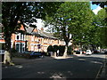
Photos of SE6 2BW


Area Information
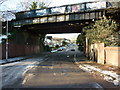
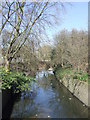
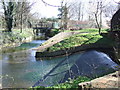
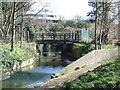
The postcode SE6 2BW identifies a specific residential cluster within the broader Catford region of South East London. You will find a population of exactly 2,075 residents occupying this small footprint. Living here means participating in a neighbourhood defined by its immediate proximity to key transport arteries rather than expansive green space. The area serves as a functional node within the network of South London suburbs. Your daily routine will depend heavily on the nearby rail stations at Catford, Ladywell, and Hither Green, which offer direct access to central London. The Danebury Road station at Catford forms the primary hub for this postcode. Your commute options are further supported by the nearby Elverson Road and Cutty Sark for Maritime Greenwich stations on the North London line. For those living or working on the river, ferry services depart from Greenwich Pier, Masthouse Terrace Pier, and Greenland Surrey Quays Pier. London City Airport sits within practical reach for frequent business travel. This area functions as a transit-oriented community where residents navigate their days using established public transport routes.
- Area Type
- Postcode
- Area Size
- Not available
- Population
- 2075
- Population Density
- 5877 people/km²
The housing stock in SE6 2BW is defined by a heavy reliance on rental markets rather than owner-occupation. Only 27 per cent of households own their homes outright. You will encounter a landscape dominated by flats rather than detached houses or large semi-detached bungalows. This architecture reflects the historical development of the postcode as a specific residential cluster close to transport links. Buying here often involves navigating the complexities of leasehold agreements common in flat conversions and purpose-built blocks. The low ownership rate suggests that property prices may act as a barrier preventing many locals from securing freehold titles. For second home buyers, the focus remains on accessible flats rather than standalone homes. The immediate surroundings of Catford and Hither Green share similar characteristics, with a preponderance of leasehold towers and periods of Victorian or post-war construction. Investors dominate this specific slice of the market.
House Prices in SE6 2BW
No properties found in this postcode.
Energy Efficiency in SE6 2BW
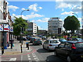
Your daily lifestyle in SE6 2BW revolves around a dense concentration of retail and transport hubs. You have immediate access to five major supermarkets including Iceland Catford, Aldi Catford, and Lidl Catford. These stores are located within practical walking distance of the postcode and supply essential household goods. Transport options remain the defining feature of living here with five rail stations serving the immediate hinterland. You can walk to Catford, Ladywell, and Hither Green for train services. The North London line stations at Elverson Road, Deptford Bridge, and Cutty Sark for Maritime Greenwich are also nearby. For river commuters, five ferry piers provide access to the Docklands Light Railway. You can board services at Greenwich Pier, Masthouse Terrace Pier, and Greenland Surrey Quays Pier. London City Airport lies within a short drive away for early morning flights. This network of amenities means you rarely need to venture far beyond SE6 2BW for your weekly shop or commute.
Amenities
Schools
| Rank | School | Type | Entry gender | Ages |
|---|
Explore more schools in this area
Go to Schools tabDemographics
You will find the local community in SE6 2BW is predominantly composed of adults aged between 30 and 64 years. The median age for residents stands at exactly 47 years. This demographic profile indicates a neighbourhood populated by families with children and professionals in their middle earning years. The majority of the population falls within this broad adult bracket. Home ownership rates stand at 27 per cent, meaning roughly three quarters of residents live in rented accommodation or leasehold properties. Flats represent the predominant accommodation type within this residential cluster. While White residents form the predominant ethnic group, the community reflects the diverse nature of modern South London. The concentration of adult residents suggests a stable environment for younger families seeking to settle down. However, the relatively low rate of owner-occupancy implies that many residents are landlords or tenants within a high-cost market. This balance of ages and tenancy types shapes the social rhythm of the area.
Household Size
Accommodation Type
Tenure
Ethnic Group
Religion
Household Composition
Age
Household Deprivation
NS-SEC
Explore more demographic insights in this area
Go to Demographics tabPlanning
Planning Constraints
- Flood RiskPremium
- Ramsar Wetland SitesPremium
- Area of Outstanding Natural BeautyPremium
- Protected Nature ReservePremium
- Protected WoodlandPremium