Area Overview for SE6 1RU
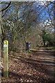
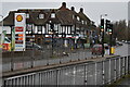
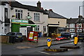
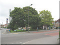
Photos of SE6 1RU
Area Information
You live in SE6 1RU, a small residential cluster measuring 8932 square metres with a population of 1321. This postcode covers a dense pocket of South-east London where daily life moves at a brisk pace due to the high population density of over 147900 people per square kilometre. Hither Green, the wider district containing this postcode, sits where the Prime Meridian crosses the pedestrian tunnel at Hither Green Station. You are positioned in London Borough of Lewisham, in a location that transformed from a medieval hamlet called Romborough into a suburban district by the late 19th century. The architecture here reflects that Victorian and Edwardian heritage, particularly on the Corbett Estate which dominates the landscape. The area remains rooted in its history, with landscapes shaped by Scots developer Archibald Cameron Corbett who purchased North Park Farm in 1896. His temperance convictions meant the area lacks public houses, creating a character distinct from many neighbouring suburbs. You find yourself in a setting where the railway divides the community into an east side focused on Staplehurst Road and a west side centred on Hither Green Lane and Springbank Road. While specific journey times are not detailed in available records, the transport infrastructure is extensive. You benefit from immediate access to a station where the Prime Meridian runs, marking a unique geographical point for residents. The neighbourhood retains a sense of history through landmarks like Mountsfield Park and St Andrew's Church, offering a quiet glimpse into Lewisham's past while serving modern family needs.
- Area Type
- Postcode
- Area Size
- 8932 m²
- Population
- 1321
- Population Density
- 5456 people/km²
The property market in SE6 1RU is defined by its predominantly house-based stock, as indicated by the accommodation type data. With 45% of households in the postcode owning their homes, the area leans towards an owner-occupied model, though nearly half of residents rent. This balance means you have options ranging from independent ownership to tenanted living, all situated within the historic footprint of the Corbett Estate. The houses here are largely late Victorian and Edwardian in style, dating back to when developer Archibald Cameron Corbett purchased North Park Farm in 1896. This small residential cluster of 8932 square metres hosts 1321 residents, creating a high-density environment where property values are supported by proximity to major transport links rather than large gardens or sprawling grounds. The lack of public houses, a legacy of Corbett's temperance convictions, has kept the streetscape distinctively residential without the noise and congestion often found near traditional pubs. You are buying or renting into a location where the architecture tells a story of the late 19th century, specifically on plots developed between 1896 and the early 1900s. The market here is not driven by new-build speculation but by the enduring appeal of established suburban housing in London Borough of Lewisham.
House Prices in SE6 1RU
Showing 29 properties
| Address | Type | Beds | Baths | Last Sale Price | Last Sale Date | |
|---|---|---|---|---|---|---|
| 26 Ector Road, London, SE6 1RU | Semi-detached | - | - | £170,000 | Aug 2016 | |
| 3 Ector Road, London, SE6 1RU | undefined | - | - | £27,000 | Dec 2002 | |
| 5 Ector Road, London, SE6 1RU | undefined | - | - | £78,000 | Jun 2002 | |
| 8 Ector Road, London, SE6 1RU | Detached | - | - | - | - | |
| 10 Ector Road, London, SE6 1RU | Detached | - | - | - | - | |
| 2 Ector Road, London, SE6 1RU | Bungalow | 1 | 1 | - | - | |
| 12 Ector Road, London, SE6 1RU | Detached | - | - | - | - | |
| 1 Ector Road, London, SE6 1RU | Bungalow | 1 | 1 | - | - | |
| 6 Ector Road, London, SE6 1RU | Detached | - | - | - | - | |
| 19 Ector Road, London, SE6 1RU | Detached | - | - | - | - |
Energy Efficiency in SE6 1RU
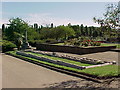
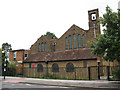
Life in SE6 1RU offers immediate access to five retail venues, including Budgens Catford, Co-op Catford, and M&S Downham Bromley BP. You can shop for groceries, clothing, and other essentials without travelling far beyond your doorstep. Beyond retail, you are surrounded by five rail stations and five metro stops, including Elverson Road, Beckenham Road Tram Stop, and Avenue Road Tram Stop. These five transport hubs provide diverse options for commuters and leisure travellers. Five ferry terminals, such as Greenwich Pier and Greenland Surrey Quays Pier, are also within practical reach if you wish to explore the Thames. For green spaces, you rely on the wider amenities of the district, as Mountsfield Park is a central feature of the area's character. This 28-acre park, which opened in 1905 on the grounds of the former Mountsfield house, serves the community's need for outdoor recreation. St Andrew's Church stands nearby, built on land donated by Corbett and dedicated to Scotland's patron saint. The absence of public houses in the immediate vicinity creates a quieter, more family-oriented atmosphere compared to neighbouring areas. You benefit from a layout where road names, often of Scottish origin, reflect the heritage of the area's developer. Your daily routine involves walking to shops, taking the tram or train, and enjoying parks that blend history with modern leisure needs.
Amenities
Schools
| Rank | School | Type | Entry gender | Ages |
|---|
Explore more schools in this area
Go to Schools tabDemographics
The community in SE6 1RU reflects the broader demographics of Hither Green, where the resident population has a median age of 47. Most people living here fall within the adult age range of 30 to 64 years, creating a stable demographic profile dominated by families and established individuals. This age distribution suggests a neighbourhood where long-term residents coexist with growing families rather than a transient student or young professional hub. You will likely encounter neighbours who have watched the area evolve from the rural woodland felled in the 18th century to the structured suburban homes seen today. Housing ownership sits at 45%, meaning nearly half of the households own their properties outright or have a mortgage, while the remainder rents. This split indicates a balanced market where both security of tenure and flexibility are present. The accommodation type in SE6 1RU consists primarily of houses, aligning with the historical development of the Corbett Estate. The predominant ethnic group identifies as black_total, contributing to a culturally diverse environment typical of South-east London. The high population density of 147901 people per square kilometre means your proximity to others is close, fostering a lived-in community feel despite the limited land area of 8932 square metres. This density is characteristic of the post-1895 expansion when Corbett began building houses on the former North Park Farm grounds.
Household Size
Accommodation Type
Tenure
Ethnic Group
Religion
Household Composition
Age
Household Deprivation
NS-SEC
Explore more demographic insights in this area
Go to Demographics tabPlanning
Planning Constraints
- Flood RiskPremium
- Ramsar Wetland SitesPremium
- Area of Outstanding Natural BeautyPremium
- Protected Nature ReservePremium
- Protected WoodlandPremium