Area Overview for SE6 1PT
Photos of SE6 1PT
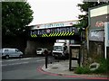
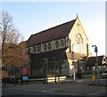
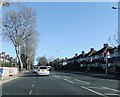
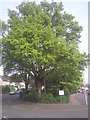
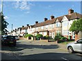
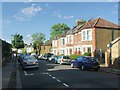
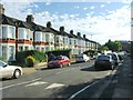
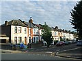
Area Information
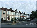
Living in Hither Green, accessible via the SE6 1PT postcode, offers a grounded experience of south-east London. This specific cluster of homes sits within the London Borough of Lewisham, an area historically transformed from a rural hamlet called Romborough into a suburban district. The district is defined by its architecture, featuring late Victorian and Edwardian homes developed by Archibald Cameron Corbett on what was once North Park Farm. You will find that the area lies where the Prime Meridian crosses the pedestrian tunnel at Hither Green Station, marking a geographical boundary where most of the district rests in the western hemisphere. The community consists of 1551 residents, creating a tight-knit neighbourhood rather than a sprawling metropolis. Daily life here revolves around a mix of quiet residential streets and accessible transport hubs. The area retains much of its historic character, including Mountsfield Park, which expanded to 28 acres by incorporating former football grounds. You are not looking for a bustling city centre here but a residential environment with deep historical roots dating back to the 19th century. The transformation from a wooded area to a substantial residential zone happened largely between the 18th and 19th centuries. Understanding this history helps you appreciate the layout of the Corbett Estate and the specific lanes that divide the east and west sides of the district.
- Area Type
- Postcode
- Area Size
- Not available
- Population
- 1551
- Population Density
- 10907 people/km²
SE6 1PT represents a distinct slice of the London housing market dominated by houses and private ownership. With 74% of the area in private hands, you are entering a market where residents have likely stayed for significant periods. The accommodation type is primarily houses, a feature resulting from Archibald Cameron Corbett's development work on North Park Farm starting in 1896. The Corbett Estate remains the most notable architectural feature, comprising the Victorian and Edwardian houses built from 1896 onwards. This historic stock defines the visual character of the postcode. You are looking at an area where large mortgages established in the late 20th century still likely underpin many transactions. The 1551 population spread across these homes means a relatively low density of living units compared to social housing towers or high-rise blocks. This scarcity of affordable rental stock reinforces the status of this zone as an established residential enclave. When you view a home in SE6 1PT, you are viewing property situated on either the east side or the west side of the railway line that bisects the district. The housing stock lacks modern skyscrapers, offering instead a streetscape of late 19th and early 20th century construction. This consistency in property type means you do not need to search far to find a home that matches the traditional aesthetic of the lane.
House Prices in SE6 1PT
No properties found in this postcode.
Energy Efficiency in SE6 1PT
Your lifestyle in SE6 1PT revolves around a network of five retail outlets and five transport terminals within easy reach. For shopping, you have access to Co-op Catford, Morrisons Daily, and Budgens Catford. These stores provide essential groceries and daily necessities without requiring a trip to central London. Transport links are equally convenient, including Hither Green Station, Bellingham Station, and fifty-four ferry options near Greenwich Pier. You can choose between rail or water depending on your destination. The area features Mountsfield Park, which opened in 1905 and covers 28 acres, offering a green space for relaxation. St Andrew's Church, built on land donated by Corbett, stands as a local landmark. The lack of public houses in the area reflects the historical Quaker heritage and temperance convictions of its developer. This absence creates a quieter, less rowdy atmosphere compared to other London districts. Road names with Scottish origins hint at the founder's heritage. You will find the environment peaceful, supported by wide parks and limited late-night nightlife venues. The combination of five retail stores and five railway stations creates a self-sufficient pocket of London.
Amenities
Schools
| Rank | School | Type | Entry gender | Ages |
|---|
Explore more schools in this area
Go to Schools tabDemographics
The community in SE6 1PT reflects a mature population with a median age of 47. Adults between 30 and 64 years old form the most common age range, suggesting a sector of the population settled for the long term. Home ownership stands at 74%, indicating that the majority of residents have purchased their properties rather than renting. This high level of ownership typically contributes to local stability. The accommodation type is predominantly houses, which aligns with the development history of the Corbett Estate. A large proportion of the population identifies as White. This demographic profile paints a picture of established families and long-term professionals. The age profile suggests you will encounter fewer young children and many older residents compared to other parts of London. With three-quarters of the homes owned, the area is characterised by resident investment rather than transient tenancy. The high ownership rate often correlates with quieter streets and a stronger sense of community ownership. While specific data on deprivation is not included in the provided breakdown, the high ownership and age profile suggest a stable, established environment. The presence of Mountsfield Park and Hither Green Hospital in the local history speaks to the area's long-standing role in community welfare.
Household Size
Accommodation Type
Tenure
Ethnic Group
Religion
Household Composition
Age
Household Deprivation
NS-SEC
Explore more demographic insights in this area
Go to Demographics tabPlanning
Planning Constraints
- Flood RiskPremium
- Ramsar Wetland SitesPremium
- Area of Outstanding Natural BeautyPremium
- Protected Nature ReservePremium
- Protected WoodlandPremium