Area Overview for SE5 9SB
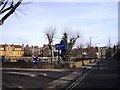
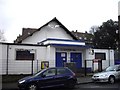
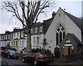
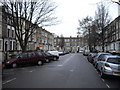
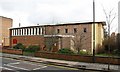
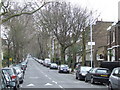
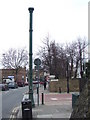
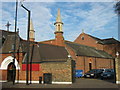
Photos of SE5 9SB


Area Information
Living in SE5 9SB means settling into a defined residential cluster within South London. This specific postcode serves 2,701 people, creating a tight-knit environment where neighbours interact frequently. The area is characterised by close proximity to major transport hubs, making it a practical choice for commuters seeking speed over suburban quiet. You will find yourself surrounded by students, young professionals, and long-term residents who have built their lives near the rapid transit links. Daily life revolves around the constant movement of trains and buses that serve Denmark Hill, Loughborough Junction, Oval, Stockwell, and Kennington stations alongside Southern and Metro lines. The surrounding landscape includes prominent retail locations such as M&S Kings and two major supermarkets, Lidl Denmark and Co-op Coldharbour. Transport availability is extensive, with five rail stations, five metro options, and five ferry piers further down in Vauxhall and Lambeth accessible within practical reach. You also benefit from three dedicated bus services connecting you to Victoria Coach Station and the Green Line Coach Station. This postcode is an entry point to a highly connected part of London, where utility and location outweigh spacious gardens or large detached estates.
- Area Type
- Postcode
- Area Size
- Not available
- Population
- 2701
- Population Density
- 7182 people/km²
The property market in SE5 9SB is defined by a strong presence of rental arrangements. With a home ownership rate of only 29%, the area is fundamentally a landlord and tenant market rather than one dominated by owner-occupiers. Prospective buyers must prepare for a landscape where flats predominate over other property types. This postcode covers a small residential cluster where the architecture focuses on vertical living solutions suitable for a high-density urban environment. If you are considering purchasing homes in SE5 9SB, expect to find a mix of investment properties and owner-occupied flats within this specific cluster. The low percentage of owner-occupied dwellings suggests that capital growth and rental yield here cater primarily to investors seeking liquidity and quick turnover. You will find fewer traditional family homes compared to suburbs with higher ownership rates. The accommodation type data confirms that flats are the standard offering, which appeals to commuters and professionals who prioritise location over space. Buyers should approach this market with an understanding that personal residence rates remain well below the national average for established suburbs.
House Prices in SE5 9SB
No properties found in this postcode.
Energy Efficiency in SE5 9SB
Daily life in SE5 9SB is driven by exceptional convenience and immediate access to major retail and transport nodes. You have five retail options close by, including M&S Kings, Lidl Denmark, and the Co-op Coldharbour, which cover supermarkets and essential goods without requiring a long walk. Transport links are equally extensive, with five rail stations nearby at Denmark Hill, Loughborough Junction, and Brixton, plus five metro stations including Oval, Stockwell, and Kennington. Five ferry terminals are also within practical reach at Vauxhall St George Wharf Pier, Millbank Pier, and Lambeth Pier, offering river access to the city centre. Additionally, three bus services connect you to Victoria Coach Station and the Green Line Coach Station for longer journeys. This density of amenities means you can shop, travel, and dine within minutes of your home. The presence of these specific venues ensures that daily errands and leisure activities remain local rather than requiring extensive travel. You will find that the immediate environment provides all the necessities for a self-sufficient urban lifestyle without needing to venture too far from SE5 9SB.
Amenities
Schools
Educational options for families living in SE5 9SB are straightforward, anchored by two specific institutions listed in the local vicinity. Caldecot Primary School operates as a primary school serving younger residents in the immediate neighbourhood. The Hospital and Home Tuition Sick Children's Service functions as an other type of educational provider, potentially catering to specialist learning needs or additional support for local students. This mix indicates a focus on foundational education and supplementary services rather than a full range of secondary choices within immediate walking distance. Parents should plan for a commute to high schools located further afield, as only primary and other-type facilities are explicitly noted for this postcode. The presence of Caldecot Primary School suggests that early years education is a priority for families choosing this location. The organisation of the Hospital and Home Tuition Sick Children's Service adds a layer of specialised support available to children who may require additional assistance beyond standard classroom settings. You must evaluate whether these specific schools align with your children's current educational stage and learning requirements before finalising your decision to live in SE5 9SB.
| Rank | School | Type | Entry gender | Ages |
|---|
Explore more schools in this area
Go to Schools tabDemographics
The community in SE5 9SB reflects a mature demographic profile, with a median age of 47 years. Adults between the ages of 30 and 64 years form the most common age range, indicating a settled population that values stability and local infrastructure. Home ownership stands at 29%, which means the vast majority of households operate as landlords or tenants within the rental sector. There is no data in the provided information about the specific number of owners versus renters, but the dominance of private renting shapes the housing market dynamics significantly. The predominant ethnic group is White, though the area remains a diverse backdrop to modern London life. The most common form of accommodation consists of flats rather than detached houses, aligning with the urban density expected of such a central postcode. This housing stock supports a younger demographic and families who prioritise access to amenities over traditional suburban property types. Residents in SE5 9SB should expect a neighbourhood where shifting tenant populations are common, reflecting the high mobility inherent in伦敦ian living.
Household Size
Accommodation Type
Tenure
Ethnic Group
Religion
Household Composition
Age
Household Deprivation
NS-SEC
Explore more demographic insights in this area
Go to Demographics tabPlanning
Planning Constraints
- Flood RiskPremium
- Ramsar Wetland SitesPremium
- Area of Outstanding Natural BeautyPremium
- Protected Nature ReservePremium
- Protected WoodlandPremium