Area Overview for SE5 9RN
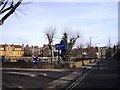
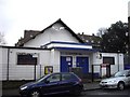
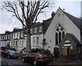
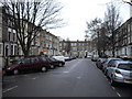
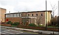
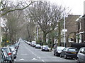
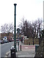
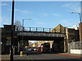
Photos of SE5 9RN


Area Information
Living in SE5 9RN means residing within a compact residential cluster in South London. This specific postcode covers a small population of 2,701 people, creating a tightly knit environment where neighbours are often neighbours keenly. The area is defined by its density and the concentration of flats, which shapes the visual and acoustic character of daily life. You will find yourself surrounded by other homeowners and renters who have chosen this central location for its proximity to major transport hubs. The lifestyle here is practical and urban, focusing on quick access to the rest of the city rather than sprawling suburbs. While the area lacks the green space found in outer boroughs, the convenience of having so many amenities within moments of your doorstep defines the experience. Residents value the immediacy of services like supermarkets and tube stations over expansive gardens. This postcode represents a slice of life where time is saved on travel but perhaps spent differently in the apartment blocks that dominate the streetscape. Understanding this density is key to appreciating why so many choose SE5 9RN as their base.
- Area Type
- Postcode
- Area Size
- Not available
- Population
- 2701
- Population Density
- 7182 people/km²
The property market for homes in SE5 9RN is characterised by a high reliance on private and social rental sectors. With only 29% of residents owning their homes, this is not an owner-occupied zone but a significant rental market. The predominant accommodation type is flats, which aligns perfectly with the 2,701 people living in this small cluster. This housing stock implies that you are unlikely to find terraced houses or large family homes in this specific postcode. Instead, expect multi-unit buildings where boundaries are shared and community interaction occurs in hallways and corridors. For buyers looking at this area, the supply of freehold properties to purchase is naturally low compared to the volume of rental units. The concentration of flats suggests that redevelopment or conversion may be frequent, keeping property values and rents competitive. Those seeking to buy a house with a garden must look beyond this immediate postcode boundary. Within SE5 9RN, the focus is on interior space and location prestige rather than exterior land.
House Prices in SE5 9RN
No properties found in this postcode.
Energy Efficiency in SE5 9RN
Your lifestyle in SE5 9RN is driven by exceptional convenience and proximity to major retail and transport hubs. Within practical reach, you have five retail outlets including M&S Kings, Tesco Denmark, and Lidl Denmark. These specific stores mean you can buy groceries and clothes without relying on independent neighbourhood shops. Transport choices are vast, with five rail options including Denmark Hill Station, Loughborough Junction Station, and Brixton Railway Station. You also have access to five metro stations such as Oval, Stockwell Station, and Kennington Station, plus five ferry piers like Vauxhall St George Wharf Pier. Additionally, three major bus and coach stations including Green Line Coach Station, Victoria Coach Station, and London Victoria Coach Station Arrivals are nearby. This density of amenities ensures you are never more than a short walk from a train or shop. The character of the area is one of high accessibility, where your daily errands are handled quickly.
Amenities
Schools
Families in SE5 9RN have specific schooling options within their immediate reach, though the selection is limited by the small postcode size. Caldecot Primary School is located nearby, offering primary education for younger children in the community. If you are looking for schools near SE5 9RN, this is the named primary institution available in the data. The Hospital and Home Tuition Sick Children's Service is also present, noted as an educational entity of the 'other' type, indicating specialized or supplementary educational provision. You cannot find comprehensive secondary schools listed directly attached to this specific postcode cluster in the provided information. This means that once a child leaves primary education, they must travel further afield for secondary schooling, likely into neighbouring SE5 or SE1 postcodes. The presence of a primary school suggests some family activity, but the lack of secondary options means the local catchment for older children is external to this small residential area.
| Rank | School | Type | Entry gender | Ages |
|---|
Explore more schools in this area
Go to Schools tabDemographics
The community profile in SE5 9RN reveals a predominantly adult population. The median age stands at 47 years, with the most common age range falling between 30 and 64 years. This suggests an area populated by established households, families, and professionals rather than young singles or elderly retirees. Accommodation types here are almost exclusively flats, reflecting the urban fabric of the constituency. Home ownership sits at 29%, meaning roughly 70% of the 2,701 residents rent their homes. This high rental proportion indicates a market where many people move frequently or work on fixed-term tenancies. The predominant ethnic group is White, though you will find a mix of cultures woven into the local fabric. With a median age over 40, families with young children may find the immediate vicinity mature and settled, potentially lacking the playground energy of areas with younger median ages. The demographic makeup points to a stable environment where long-term residents coexist with a steady stream of incoming tenants.
Household Size
Accommodation Type
Tenure
Ethnic Group
Religion
Household Composition
Age
Household Deprivation
NS-SEC
Explore more demographic insights in this area
Go to Demographics tabPlanning
Planning Constraints
- Flood RiskPremium
- Ramsar Wetland SitesPremium
- Area of Outstanding Natural BeautyPremium
- Protected Nature ReservePremium
- Protected WoodlandPremium