Area Overview for SE5 9JP
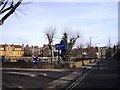
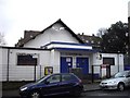
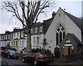
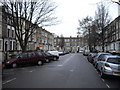
Photos of SE5 9JP


Area Information
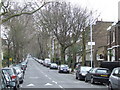
Living in SE5 9JP means residing within a very specific residential cluster on the south side of London. This postcode covers a small area of only 3174 square metres, containing a population of 2234 people. The high density here means streets are closely packed and neighbours are close by. You are situated deep within South London, far from the open spaces found in more suburban districts. Instead, your immediate surroundings are defined by urban residential blocks rather than green belts. This compact nature means daily access to facilities is immediate, yet life feels more anonymous than in a typical village setting. The area functions as a tight-knit urban enclave where planning constraints do not offer significant restrictions on development. There are no protected nature reserves, Areas of Outstanding Natural Beauty, or Ramsar wetland sites to limit building within these boundaries. This lack of planning constraints contributes to the sharp urban character of the neighbourhood. When you consider homes in SE5 9JP, you are looking at a location defined by its efficient space usage and its position as a dense pocket of London living. Daily life involves navigating a neighbourhood where the built environment dominates, offering convenience at the cost of spaciousness.
- Area Type
- Postcode
- Area Size
- 3174 m²
- Population
- 2234
- Population Density
- 16118 people/km²
The property market in SE5 9JP is dominated by rental stock rather than owner-occupied homes. With home ownership standing at just 26 per cent, sellers or landlords holding properties are rare compared to the number of tenants. The predominant accommodation type is flats, which fits the small physical size of the postcode area. A homebuyer looking to purchase must enter a seller-only market where the owner-occupier rate is low, suggesting many properties are sold through lettings agencies or online platforms rather than traditional property chains of homeowners moving. Because this cluster covers only 3174 square metres, inventory levels are naturally slim. You cannot walk far to find a different house; everything is concentrated in a few blocks. The high population density forces a reliance on flat living, making single-family homes virtually non-existent in this specific zone. If you are considering buying new build properties, remember that there are no planning constraints such as protected woodlands or nature reserves to slow development. This allows developers to continue building flats whenever opportunities arise. Whether you are looking for a flat near Southwark or within SE5 itself, the market rules of density apply strictly here.
House Prices in SE5 9JP
Showing 16 properties
| Address | Type | Beds | Baths | Last Sale Price | Last Sale Date | |
|---|---|---|---|---|---|---|
| 90 Denmark Road, London, SE5 9JP | Terraced | 4 | 3 | £858,000 | May 2025 | |
| 84A Denmark Road, London, SE5 9JP | Flat | - | - | £267,500 | Mar 2016 | |
| 88 Denmark Road, London, SE5 9JP | Terraced | - | - | £225,000 | Jun 2008 | |
| 84 Denmark Road, London, SE5 9JP | Terraced | 3 | 1 | £281,200 | Nov 2007 | |
| 92 Denmark Road, London, SE5 9JP | Terraced | 4 | 1 | £230,000 | Feb 2004 | |
| Flat 7, 115 Denmark Road, London, SE5 9JP | Maisonette | - | - | - | - | |
| Flat 8, 115 Denmark Road, London, SE5 9JP | Maisonette | - | - | - | - | |
| Flat 1, 115 Denmark Road, London, SE5 9JP | Flat | - | - | - | - | |
| Flat 9, 115 Denmark Road, London, SE5 9JP | Flat | - | - | - | - | |
| Flat 6, 115 Denmark Road, London, SE5 9JP | Flat | - | - | - | - |
Energy Efficiency in SE5 9JP
Your lifestyle in SE5 9JP revolves around the immediate convenience of Southwark's transport hubs and commercial centres. Supermarket access is immediate, with Tesco Camberwell, Lidl Denmark, and the Co-op Camberwell all within practical reach. You will have five retail options to choose from for your daily food and household needs without ever leaving the immediate zone. Transport options are extensive, acting as a major part of your daily routine. Five rail stations, including Loughborough Junction and Denmark Hill, are close by. You also have access to five metro stations such as Oval and Kennington. For travel across the river, five ferry piers including Vauxhall St George Wharf Pier offer departure points. While the data lists only three bus amenities, major interchanges like the Green Line Coach Station and London Victoria Coach Station Arrivals are noted as nearby. Dining, leisure, and shopping are all clustered around these transport nodes. The character of the area is commercial and transit-focused, prioritising access to wider London over local village green feel. You trade quiet streets for the energy of a major transport interchange.
Amenities
Schools
Families living in SE5 9JP have access to educational facilities nearby, though options are limited within the immediate vicinity. Crawford Primary School is the only school explicitly listed in data for this postcode. It is a primary school rated as good by Ofsted. For parents looking for schooling options, this is the confirmed choice close to home. Beyond primary education, there are no secondary or further education institutions listed in the provided data for SE5 9JP. This means older children will need to commute to schools located in wider Southwark or Lambeth wards. Because the area is dense with flats and residents aged 30 to 64, young families often have to plan carefully regarding school catchment areas outside the postcode boundary. When researching schools near SE5 9JP, you must look beyond this single entry to find secondary options. The local provision is solely focused on early years and primary education under the stewardship of this one good-rated institution.
| Rank | School | Type | Entry gender | Ages |
|---|
Explore more schools in this area
Go to Schools tabDemographics
The community in SE5 9JP reflects an older demographic than the national average, with a median age of 47 years. The most common age range consists of adults aged between 30 and 64 years, suggesting the area attracts established professionals and families who have settled down. Only 26 per cent of residents own their homes outright, meaning the vast majority likely rent or have significant mortgages. You are likely to encounter long-term tenants as well as owner-occupiers in any building you inspect. Accommodation types in this postcode consist primarily of flats. This aligns with the high population density figure of 703 789 people per square kilometre, indicating a demand for vertical living rather than large family houses. The area is also notably diverse, with Black residents forming the predominant ethnic group within the demographic data. This mix suggests a multicultural environment where you might interact with residents from varied backgrounds in your local shops and street. When evaluating homes in SE5 9JP, you must consider that the housing stock is designed for shared spaces and communal living rather than private gardens. The demographic profile paints a picture of a mature, diverse population adaptable to urban apartment living.
Household Size
Accommodation Type
Tenure
Ethnic Group
Religion
Household Composition
Age
Household Deprivation
NS-SEC
Explore more demographic insights in this area
Go to Demographics tabPlanning
Planning Constraints
- Flood RiskPremium
- Ramsar Wetland SitesPremium
- Area of Outstanding Natural BeautyPremium
- Protected Nature ReservePremium
- Protected WoodlandPremium