Area Overview for SE5 9JG
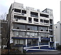
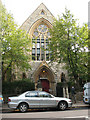
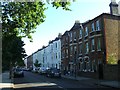
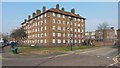
Photos of SE5 9JG


Area Information
Living in SE5 9JG means occupying a specific residential cluster defined by postcode boundaries rather than a vast district. This small population of 1,787 people creates a tight-knit environment where neighbours often know one another. The area falls squarely within the SE5 postcode, placing it at the junction of several London zones where transport links converge. Daily life here centres on practical convenience rather than expansive green space, as the neighbourhood lacks protected woodland, nature reserves, or areas of outstanding natural beauty. Instead, residents benefit from dense urban infrastructure supporting home offices, commuters, and families alike. You will find SE5 9JG to be a functional neighbourhood where proximity to major transport hubs dictates the pace of life. The site covers a limited footprint, concentrating housing and amenities into a walkable radius. While the area does not boast Ramsar wetland sites or significant flood risks, its primary character stems from being a residential pocket surrounded by broader commercial and leisure districts. This central location allows you to access major railway and metro stations within minutes of your doorstep. The very definition of the area relies on its postcode identity, distinguishing it as a distinct, small-scale residential cluster within the wider London landscape.
- Area Type
- Postcode
- Area Size
- Not available
- Population
- 1787
- Population Density
- 9900 people/km²
The property market in SE5 9JG is shaped fundamentally by the fact that only 31% of households own their homes. This low ownership rate indicates that a buyer searching for a home here enters a market dominated by rentals. Most homes in SE5 9JG are flats, which reinforces the character of a high-density, urban residential zone. When you consider these figures together, the housing stock is heavily biased towards accommodation fitted for renting rather than long-term owner-occupation. For a prospective buyer, this means competition for a truly freehold property within this specific postcode will be intense or perhaps rare. You are more likely to find sellers looking for a quick renter income than owners seeking to downsize. The prevalence of flats suggests that land usage is efficient, maximising the yield available from this small residential cluster. While the exact number of properties for sale is not listed, the demographic profile of 31% ownership strongly implies that the market is skewed. If you are looking to move in, you must navigate a system where the majority of occupants are tenants. This dynamic often affects property maintenance standards and the speed of sales. Flats in this area may come with service charges, which are typical for buildings with shared structures and communal areas. Buyers should be prepared for a market where rental yields for landlords often attract investors, potentially driving up competition for the limited number of private sale listings available.
House Prices in SE5 9JG
No properties found in this postcode.
Energy Efficiency in SE5 9JG
Your lifestyle in SE5 9JG is defined by immediate access to extensive transport and retail options. You have five railways nearby, including Loughborough Junction Station, Denmark Hill Station, and Brixton Railway Station. These connections allow you to travel efficiently across London, placing you within practical reach of jobs and leisure destinations. For a resident relying on public transport, this concentration of stations offers unmatched convenience. Retail options are equally dense, with five notable shops including Tesco Camberwell, Spar, and Co-op Camberwell. You can visit Tesco Camberwell for weekly groceries or grab lunch at Spar without leaving the immediate neighbourhood. The presence of Co-op Camberwell adds to the variety of food and household goods available locally. Shopping trips become convenient errands rather than long journeys, enhancing your quality of life. Connectivity extends to the Underground and river services as well. You have access to five metro stations such as Oval, Stockwell Station, and Kennington Station, plus five ferry piers including Vauxhall St George Wharf Pier and Millbank Pier. Five bus routes, including services via Green Line Coach Station and Victoria Coach Station, further deepen your connectivity. This dense web of transport means you are rarely stuck in isolation, even during off-peak hours.
Amenities
Schools
| Rank | School | Type | Entry gender | Ages |
|---|
Explore more schools in this area
Go to Schools tabDemographics
The community in SE5 9JG is dominated by adults aged between 30 and 64 years, reflecting a middle-aged demographic. The median age stands at 47, indicating that the population skews significantly towards older residents rather than young families or students. This age profile suggests a stable community where long-term residents likely hold decision-making power within the local social sphere. Most people living here fall into the working and retirement age brackets, creating a demand for properties suited to established households. Home ownership accounts for only 31% of this total residential cluster, meaning the majority of residents are renting. This high rental proportion distinguishes the local housing market from typical owner-occupied suburbs. The predominant accommodation type consists of flats, a structure that aligns perfectly with the high renter ratio. You will find that most homes in SE5 9JG are first-floor or ground-floor units designed for urban living rather than detached family houses. While the predominant ethnic group is White, the specific breakdown of diversity is not recorded in the dataset for this postcode. Despite the lack of detailed diversity statistics, the age and ownership data paints a clear picture of a mature, largely tenant-led community. The high concentration of adults in their prime working years suggests a population that values location and transport connectivity over single-family living. The 47-year median age implies that staple services, such as general supermarkets and community clinics, are more relevant to the daily needs of the residents than niche youth-focused entertainment venues.
Household Size
Accommodation Type
Tenure
Ethnic Group
Religion
Household Composition
Age
Household Deprivation
NS-SEC
Explore more demographic insights in this area
Go to Demographics tabPlanning
Planning Constraints
- Flood RiskPremium
- Ramsar Wetland SitesPremium
- Area of Outstanding Natural BeautyPremium
- Protected Nature ReservePremium
- Protected WoodlandPremium