Area Overview for SE5 9EF
Photos of SE5 9EF
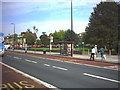
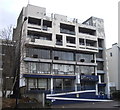
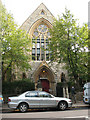
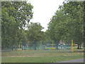
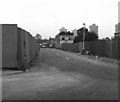
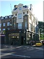
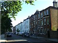


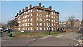

100 photos from this area
Area Information
Key information about the SE5 9EF including its size, population, and administrative classification.
- Area Type
- Postcode
- Area Size
- 9447 m²
- Population
- 1680
- Population Density
- 17722 people/km²
House Prices in SE5 9EF
54
Properties
£298,375
Average Sold Price
£127,000
Lowest Price
£521,500
Highest Price
Showing 54 properties
| Address | Type | Beds | Baths | Last Sale Price | Last Sale Date | |
|---|---|---|---|---|---|---|
| 22 Horle Walk, London, SE5 9EF | Flat | - | - | £426,000 | Dec 2023 | |
| 30 Horle Walk, London, SE5 9EF | Flat | 2 | 1 | £382,500 | Aug 2022 | |
| 11 Horle Walk, London, SE5 9EF | Maisonette | 3 | 1 | £430,000 | Jun 2021 | |
| 32 Horle Walk, London, SE5 9EF | Flat | 2 | - | £468,555 | Jun 2021 | |
| 48 Horle Walk, London, SE5 9EF | Maisonette | 2 | 1 | £521,500 | Nov 2018 | |
| 16 Horle Walk, London, SE5 9EF | Maisonette | 3 | 1 | £320,000 | Jun 2015 | |
| 14 Horle Walk, London, SE5 9EF | Flat | - | - | £268,000 | Mar 2015 | |
| 8 Horle Walk, London, SE5 9EF | Maisonette | 3 | 1 | £170,000 | Dec 2010 | |
| 53 Horle Walk, London, SE5 9EF | Flat | 1 | 1 | £156,950 | Nov 2009 | |
| 40 Horle Walk, London, SE5 9EF | Flat | 2 | - | £150,000 | Jan 2005 |
Page 1 of 6
Energy Efficiency in SE5 9EF
Amenities
Schools
| Rank | School | Type | Entry gender | Ages |
|---|
Explore more schools in this area
Go to Schools tabDemographics
Household Size
One person
most common
Accommodation Type
Flats
most common
Tenure
14
majority
Ethnic Group
black_total
most common
Religion
N/A
most common
Household Composition
N/A
most common
Age
47
median
Adults (30-64 years)
most common
Household Deprivation
N/A
with no deprivation
NS-SEC
26
in Lower managerial occupations
Explore more demographic insights in this area
Go to Demographics tabPlanning
Planning Constraints
- Flood RiskPremium
- Ramsar Wetland SitesPremium
- Area of Outstanding Natural BeautyPremium
- Protected Nature ReservePremium
- Protected WoodlandPremium