Area Overview for SE5 9DH
Photos of SE5 9DH
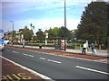
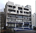
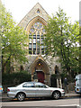
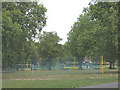

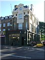
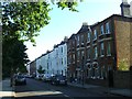


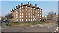

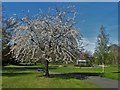
100 photos from this area
Area Information
Key information about the SE5 9DH including its size, population, and administrative classification.
- Area Type
- Postcode
- Area Size
- 6062 m²
- Population
- 1863
- Population Density
- 18017 people/km²
House Prices in SE5 9DH
64
Properties
£435,033
Average Sold Price
£54,000
Lowest Price
£1,184,000
Highest Price
Showing 64 properties
| Address | Type | Beds | Baths | Last Sale Price | Last Sale Date | |
|---|---|---|---|---|---|---|
| 18 Flaxman Road, London, SE5 9DH | Terraced | 3 | 2 | £890,000 | Jun 2025 | |
| 8 Flaxman Road, London, SE5 9DH | Terraced | 4 | 2 | £755,000 | Oct 2024 | |
| 24A Flaxman Road, London, SE5 9DH | Flat | - | - | £205,000 | Apr 2024 | |
| 38 Flaxman Road, London, SE5 9DH | Flat | 3 | 1 | £500,000 | Jun 2022 | |
| 30 Flaxman Road, London, SE5 9DH | Terraced | 3 | - | £1,184,000 | Jun 2021 | |
| 4 Flaxman Road, London, SE5 9DH | house | - | - | £830,000 | Sep 2020 | |
| 24D Flaxman Road, London, SE5 9DH | Flat | - | - | £315,000 | Jan 2014 | |
| 24C Flaxman Road, London, SE5 9DH | Flat | - | - | £240,000 | Oct 2013 | |
| 24B Flaxman Road, London, SE5 9DH | Flat | - | - | £235,000 | Jan 2009 | |
| 16 Flaxman Road, London, SE5 9DH | Semi-detached | 4 | 3 | £311,000 | Sep 2008 |
Page 1 of 7
Energy Efficiency in SE5 9DH
Amenities
Schools
| Rank | School | Type | Entry gender | Ages |
|---|
Explore more schools in this area
Go to Schools tabDemographics
Household Size
Two person
most common
Accommodation Type
Flats
most common
Tenure
34
majority
Ethnic Group
White
most common
Religion
N/A
most common
Household Composition
N/A
most common
Age
47
median
Adults (30-64 years)
most common
Household Deprivation
N/A
with no deprivation
NS-SEC
51
in Lower managerial occupations
Explore more demographic insights in this area
Go to Demographics tabPlanning
Planning Constraints
- Flood RiskPremium
- Ramsar Wetland SitesPremium
- Area of Outstanding Natural BeautyPremium
- Protected Nature ReservePremium
- Protected WoodlandPremium