Area Overview for SE5 8TR
Photos of SE5 8TR

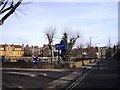
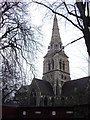
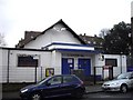
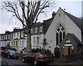
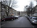
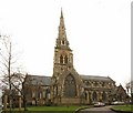
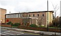
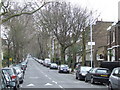
100 photos from this area
Area Information
Key information about the SE5 8TR including its size, population, and administrative classification.
- Area Type
- Postcode
- Area Size
- 8869 m²
- Population
- 2043
- Population Density
- 8679 people/km²
House Prices in SE5 8TR
94
Properties
£445,667
Average Sold Price
£87,000
Lowest Price
£750,000
Highest Price
Showing 94 properties
| Address | Type | Beds | Baths | Last Sale Price | Last Sale Date | |
|---|---|---|---|---|---|---|
| Flat 4, 55 Camberwell Church Street, London, SE5 8TR | Flat | 1 | 1 | £750,000 | May 2015 | |
| 47A Camberwell Church Street, London, SE5 8TR | Flat | - | - | £500,000 | Apr 2007 | |
| 43A Camberwell Church Street, London, SE5 8TR | Flat | - | - | £87,000 | Mar 2001 | |
| Flat 1, 37A Camberwell Church Street, London, SE5 8TR | Flat | 1 | 1 | - | - | |
| Flat Above, 73 Camberwell Church Street, London, SE5 8TR | Unknown | - | - | - | - | |
| First To Third Floor Flat, 55 Camberwell Church Street, London, SE5 8TR | Unknown | - | - | - | - | |
| Flat 10, 55 Camberwell Church Street, London, SE5 8TR | Flat | - | - | - | - | |
| Staff Accommodation, Funky Munky, 25 Camberwell Church Street, London, SE5 8TR | Flat | - | - | - | - | |
| Flat 9, 55 Camberwell Church Street, London, SE5 8TR | Semi-detached | 3 | 3 | - | - | |
| Flat 8, 55 Camberwell Church Street, London, SE5 8TR | Flat | - | - | - | - |
Page 1 of 10
Energy Efficiency in SE5 8TR
Amenities
Schools
| Rank | School | Type | Entry gender | Ages |
|---|
Explore more schools in this area
Go to Schools tabDemographics
Household Size
Family (3-5 people)
most common
Accommodation Type
Flats
most common
Tenure
41
majority
Ethnic Group
White
most common
Religion
N/A
most common
Household Composition
N/A
most common
Age
47
median
Adults (30-64 years)
most common
Household Deprivation
N/A
with no deprivation
NS-SEC
51
in Lower managerial occupations
Explore more demographic insights in this area
Go to Demographics tabPlanning
Planning Constraints
- Flood RiskPremium
- Ramsar Wetland SitesPremium
- Area of Outstanding Natural BeautyPremium
- Protected Nature ReservePremium
- Protected WoodlandPremium