Area Overview for SE5 8SN
Photos of SE5 8SN


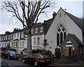
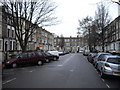


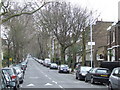
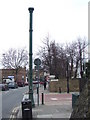


100 photos from this area
Area Information
Key information about the SE5 8SN including its size, population, and administrative classification.
- Area Type
- Postcode
- Area Size
- 1.2 hectares
- Population
- 2043
- Population Density
- 8679 people/km²
House Prices in SE5 8SN
37
Properties
£497,372
Average Sold Price
£208,000
Lowest Price
£848,860
Highest Price
Showing 37 properties
| Address | Type | Beds | Baths | Last Sale Price | Last Sale Date | |
|---|---|---|---|---|---|---|
| 83C Grove Lane, London, SE5 8SN | house | - | - | £420,000 | Oct 2018 | |
| 85 Grove Lane, London, SE5 8SN | house | 4 | - | £848,860 | Sep 2011 | |
| Second Floor Flat, 91 Grove Lane, London, SE5 8SN | Unknown | - | - | £208,000 | Aug 2007 | |
| 89 Grove Lane, London, SE5 8SN | house | - | - | £590,000 | Oct 2006 | |
| 87 Grove Lane, London, SE5 8SN | Terraced | - | - | £420,000 | Jul 2000 | |
| 91D Grove Lane, London, SE5 8SN | Terraced | 5 | 4 | - | - | |
| 93 Grove Lane, London, SE5 8SN | Land | - | - | - | - | |
| Unit 2B, 93 Grove Lane, London, SE5 8SN | Retirement | - | - | - | - | |
| Apartment 1, 91C Grove Lane, London, SE5 8SN | Flat | - | - | - | - | |
| Apartment 2, 91C Grove Lane, London, SE5 8SN | Flat | - | - | - | - |
Page 1 of 4
Energy Efficiency in SE5 8SN
Amenities
Schools
| Rank | School | Type | Entry gender | Ages |
|---|
Explore more schools in this area
Go to Schools tabDemographics
Household Size
Family (3-5 people)
most common
Accommodation Type
Flats
most common
Tenure
41
majority
Ethnic Group
White
most common
Religion
N/A
most common
Household Composition
N/A
most common
Age
47
median
Adults (30-64 years)
most common
Household Deprivation
N/A
with no deprivation
NS-SEC
51
in Lower managerial occupations
Explore more demographic insights in this area
Go to Demographics tabPlanning
Planning Constraints
- Flood RiskPremium
- Ramsar Wetland SitesPremium
- Area of Outstanding Natural BeautyPremium
- Protected Nature ReservePremium
- Protected WoodlandPremium