Area Overview for SE5 8JF
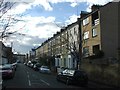
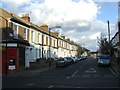
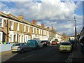
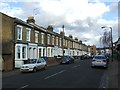
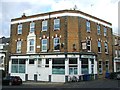
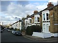
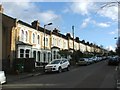
Photos of SE5 8JF

Area Information
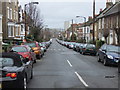
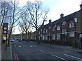
SE5 8JF occupies a very specific residential cluster in South London, covering an area of just 7,416 square metres. This compact footprint means the postcode represents a distinct, small-scale environment rather than a sprawling district. With a recorded population of 1,850 residents, the area maintains a tight-knit character despite its urban location. You will find yourself in a setting defined by density and proximity, where neighbours are likely to know one another given the limited physical space. Living in SE5 8JF involves navigating a space where every square metre counts, creating an intimate living situation. The area sits within England, offering residents a slice of South London life that is contained and focused. This postcode serves as a small residential hub where daily life revolves around the immediate surroundings rather than distant suburbs. The sheer concentration of people within such a small boundary creates a unique atmosphere for those choosing homes in this specific zone.
- Area Type
- Postcode
- Area Size
- 7416 m²
- Population
- 1850
- Population Density
- 18994 people/km²
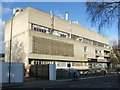
The housing market in SE5 8JF is dominated by rented accommodation, with only 30% of residents owning their homes. Flats represent the primary accommodation type within this small cluster, reflecting the area's high density and the nature of the 7,416 square metre site. Most people living in SE5 8JF do not own their property, which points to a market heavily skewed towards tenancies. If you are looking to buy homes in this postcode, you are targeting a specific minority within the total population of 1,850. The stock is not primarily composed of owner-occupied family houses or large detached homes. Instead, you will find predominantly flat living arrangements. This structure means that any buyer interested in this area faces a competitive market where existing owners are less common. The concentration of flats suggests that the property Mix is uniform and specialised for urban living rather than suburban sprawl.
House Prices in SE5 8JF
Showing 19 properties
| Address | Type | Beds | Baths | Last Sale Price | Last Sale Date | |
|---|---|---|---|---|---|---|
| 25 Graces Mews, London, SE5 8JF | house | 3 | 1 | £750,000 | Oct 2023 | |
| 27 Graces Mews, London, SE5 8JF | house | - | - | £800,000 | Mar 2021 | |
| 30 Graces Mews, London, SE5 8JF | Flat | - | - | £1,900,000 | Apr 2013 | |
| 6 Graces Mews, London, SE5 8JF | house | - | - | £500,000 | Oct 2009 | |
| 23 Graces Mews, London, SE5 8JF | house | - | - | £295,000 | May 2009 | |
| 24 Graces Mews, London, SE5 8JF | Terraced | - | - | £249,990 | Jun 2005 | |
| 1 Graces Mews, London, SE5 8JF | Terraced | 3 | 1 | £354,500 | Jan 2001 | |
| 73H Camberwell Grove, London, SE5 8JF | Detached | - | - | - | - | |
| 5 Graces Mews, London, SE5 8JF | Terraced | - | - | - | - | |
| 2A Graces Mews, London, SE5 8JF | house | - | - | - | - |
Energy Efficiency in SE5 8JF
Daily life in SE5 8JF offers convenient access to essential services and leisure facilities within a short distance. Residents have immediate access to five railway stations, with Denmark Hill Station and Peckham Rye Station being notable local hubs. Shopping options are robust, featuring five nearby retailers including Morrisons Camberwell, Sainsburys Camberwell, and Lidl Denmark. Transport connections extend to five metro stops such as Kennington Station and Loughborough Junction Station, facilitating easy travel across South London. Beyond land transport, the area is close to five ferry locations, including Vauxhall St George Wharf Pier and Millbank Pier. Commuters can also rely on three bus and coach stations, notably the Green Line Coach Station and London Victoria Coach Station Arrivals. This density of amenities means you do not need to travel far for groceries, work commutes, or leisure activities. The cluster provides a self-contained lifestyle where work, transport, and shops are all integrated into your immediate vicinity.
Amenities
Schools
| Rank | School | Type | Entry gender | Ages |
|---|
Explore more schools in this area
Go to Schools tabDemographics
The community in SE5 8JF presents a clear demographic picture centred on mature adults. Data indicates that the most common age range for residents falls between 30 and 64 years old, with a specific median age of 47. This suggests the neighbourhood is populated by established adults rather than young families or students. You will encounter a population where long-term residents dominate the streets. Home ownership accounts for only 30 per cent of households, indicating a significant portion of the community rents their accommodation. The majority of the housing stock consists of flats, aligning with the urban density of the cluster. Ethnically, the predominant group is identified as black_total, reflecting the diverse cultural makeup of this South London locality. Understanding these figures helps you gauge the social fabric of the area. The high proportion of renters and the specific age profile suggest a community of professionals or students who may not yet have purchased property.
Household Size
Accommodation Type
Tenure
Ethnic Group
Religion
Household Composition
Age
Household Deprivation
NS-SEC
Explore more demographic insights in this area
Go to Demographics tabPlanning
Planning Constraints
- Flood RiskPremium
- Ramsar Wetland SitesPremium
- Area of Outstanding Natural BeautyPremium
- Protected Nature ReservePremium
- Protected WoodlandPremium