Area Overview for SE5 8AN
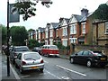
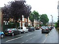
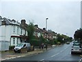
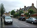
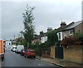
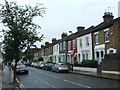
Photos of SE5 8AN


Area Information
SE5 8AN represents a specific postcode area covering a small residential cluster within South London. You are looking at a defined space of just 7559 square metres, yet it accommodates a population of 1345 people. This results in a population density of 177944 people per square kilometre. Living in SE5 8AN means residing in a tightly packed urban environment where every building is likely within shouting distance of its neighbour. The area functions as a distinct hub rather than a sprawling neighbourhood. Daily life here is characterised by immediate access to the wider transport network and local services. While the physical footprint is small, the connection to the rest of the city is extensive. You will find yourself surrounded by other residents rather than open green space. This high density creates a community-focused atmosphere where local amenities are central to your routine. The location serves as a practical base for those who need to navigate the transport links of south London efficiently. Your home will be part of a significant concentration of households in a limited geographical zone.
- Area Type
- Postcode
- Area Size
- 7559 m²
- Population
- 1345
- Population Density
- 12523 people/km²
The property market in SE5 8AN is heavily skewed towards rented accommodation. Only 29% of residents own their homes, meaning the majority live in tenancies. The primary accommodation type is flats, which aligns with the high population density of 177944 people per square kilometre. This spread of postcodes covers a small residential cluster, limiting the variety of property types. You will encounter a market dominated by leasehold units rather than freehold houses. This structure impacts who can buy and the costs associated with purchasing. Buyers looking at this small area and its immediate surroundings should focus on flat markets. The low ownership percentage suggests strong investor interest or a rental-heavy demand dynamic. If you are considering purchasing a home, you are entering a competitive sector with limited options for new build or traditional suburban housing. The area is built for density. Expect to navigate a landscape where flats are the standard solution for housing 1345 people in just 7559 square metres.
House Prices in SE5 8AN
Showing 3 properties
| Address | Type | Beds | Baths | Last Sale Price | Last Sale Date | |
|---|---|---|---|---|---|---|
| Kings College Hall, 10 Champion Hill, London, SE5 8AN | residential_school | - | - | - | - | |
| Maple, 10-16 Champion Hill, London, SE5 8AN | commercial | - | - | - | - | |
| Rowan, 10-16 Champion Hill, London, SE5 8AN | commercial | - | - | - | - |
Energy Efficiency in SE5 8AN
Your daily life in SE5 8AN benefits from immediate access to major retail, dining, and leisure venues. There are five notable retail options including Sainsburys Dulwich, Tesco Denmark, and M&S Kings nearby. Convenience shopping is just a short walk away. For transport needs, five rail hubs including Denmark Hill Station and Loughborough Junction Station are located in close proximity. Five metro stations like Stockwell Station and Kennington Station connect you to the Underground network. Travel options extend to five ferry terminals including Vauxhall St George Wharf Pier and Millbank Pier. You can also access busy bus hubs such as the Victoria Coach Station. This concentration of amenities ensures you can run errands or start your workday without excessive travel time. The area functions as a practical центр for shopping and transit. Dining and grocery choices are abundant within the local radius. Living in SE5 8AN grants you the convenience of world-class retailers and transport links right on your doorstep. You do not need to travel far to find essential services or entertainment.
Amenities
Schools
| Rank | School | Type | Entry gender | Ages |
|---|
Explore more schools in this area
Go to Schools tabDemographics
The community in SE5 8AN is defined by a mature median age of 47 years. The most common age range for residents falls between 30 and 64 years. Living in SE5 8AN involves interacting with a largely adult population. You are dealing with a group that has largely moved past early career stages. Home ownership stands at 29%, indicating a majority of residents are tenants or renting through other means. The predominant form of accommodation consists of flats. This suggests a built environment designed for vertical living rather than detached housing. The area reflects significant ethnic diversity, with Black residents forming the predominant ethnic group. These factual markers shape the social fabric of the postcode. A lower home ownership rate often correlates with higher rental turnover and fewer long-term neighbours. You should expect a transient mix of households alongside families who have settled in the flats. The age profile implies a neighbourhood with fewer young children and more working professionals or retirees.
Household Size
Accommodation Type
Tenure
Ethnic Group
Religion
Household Composition
Age
Household Deprivation
NS-SEC
Explore more demographic insights in this area
Go to Demographics tabPlanning
Planning Constraints
- Flood RiskPremium
- Ramsar Wetland SitesPremium
- Area of Outstanding Natural BeautyPremium
- Protected Nature ReservePremium
- Protected WoodlandPremium