Area Overview for SE5 7LG
Photos of SE5 7LG
Area Information
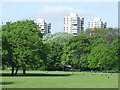
Living in SE5 7LG means residing within a very specific residential cluster that covers just over four and a half thousand square metres of land. With a population of 2,459 people, this postcode area packs a significant amount of activity into a compact space. The resulting population density of 545,746 people per square kilometre creates an intensely urban environment where neighbours are often just steps away. This high density defines the daily rhythm of the location, where urban conveniences are immediately accessible but crowd control becomes a reality. The area represents a concentrated slice of London life, typical of many Central ward postcodes where land use is maximised for housing. Prospective buyers should understand that life here is fast-paced and tightly knit. You will find yourself in an environment built for efficiency, where the proximity of services reduces travel time but noise levels remain naturally higher than in sprawling suburbs. This density offers convenience for those who prioritise location over quiet garden space. The area functions as a node within the wider SE5 postcode district, characterised by its deep integration into the city grid. Those considering homes in SE5 7LG must appreciate that they are choosing a high-intensity living setup. The small geographical footprint means that local news impacts the entire community quickly, and any development proposals will affect a tight-knit group of residents. It is an area defined by its position and its people rather than vast green spaces or isolated streets.
- Area Type
- Postcode
- Area Size
- 4506 m²
- Population
- 2459
- Population Density
- 8659 people/km²
The housing stock in SE5 7LG is almost exclusively comprised of flats, a fact derived directly from the accommodation type data. This configuration is typical of Central area postcodes where land value precludes the construction of single-family homes. With only 29% of residents owning their homes, the property market leans heavily towards the private rental sector. You will find that most transactions or tenancy agreements in this cluster involve rental properties rather than owner-occupied builds. Buyers looking at this small postal zone should expect a landscape of leasehold properties with shared areas managed by housing corporations. The low ownership rate means that few transactions involve freehold transfers, and thus, mortgage advice will focus primarily on leasehold valuations and service charges rather than ground rent or deed property types common in suburbs. Homes in SE5 7LG are designed for density, offering efficient use of space but lacking private ground access for most units. For investors or tenants, the data indicates a robust demand for rental accommodation. The concentration of flats in a 4,506 m² area suggests high turnover and consistent occupancy rates. Those purchasing here must conduct due diligence on lease terms carefully, as the rental market dominance often implies stricter management rules compared to owner-occupied estates. The area functions as a reliable rental hub, which maintains property values but limits the traditional owner-accumulation route to wealth building found in higher ownership neighbourhoods.
House Prices in SE5 7LG
Showing 9 properties
| Address | Type | Beds | Baths | Last Sale Price | Last Sale Date | |
|---|---|---|---|---|---|---|
| 6 Rust Square, London, SE5 7LG | Terraced | 4 | - | £690,000 | Aug 2014 | |
| 5 Rust Square, London, SE5 7LG | Terraced | - | - | £317,500 | Aug 2004 | |
| 8 Rust Square, London, SE5 7LG | Terraced | 5 | 3 | £545,000 | Mar 2004 | |
| 4 Rust Square, London, SE5 7LG | Terraced | - | - | £97,500 | Apr 1997 | |
| 3 Rust Square, London, SE5 7LG | Terraced | 4 | 1 | - | - | |
| 9 Rust Square, London, SE5 7LG | Terraced | - | - | - | - | |
| 7 Rust Square, London, SE5 7LG | Terraced | - | - | - | - | |
| 1 Rust Square, London, SE5 7LG | Terraced | - | - | - | - | |
| 2 Rust Square, London, SE5 7LG | Terraced | - | - | - | - |
Energy Efficiency in SE5 7LG
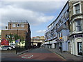
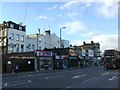
Residents of SE5 7LG enjoy immediate access to a wide array of retail and transport options. Within practical reach, you will find five major retail outlets, including Iceland Camberwell, Sainsburys Camberwell, and Budgens Camberwell. These supermarkets ensure that groceries and daily essentials are available a short walk from your doorstep. The presence of three bus stations, including the Green Line Coach Station and Victoria Coach Station Arrivals, expands your ability to travel further afield for leisure or business without relying on private car ownership. Transport connectivity is further enhanced by proximity to five metro stations, notably Kennington Station and Oval. Five rail stations, including Denmark Hill Station and Elephant and Castle Railway Station, provide direct access to the wider national network. Additionally, five ferry locations such as Vauxhall St George Wharf Pier, Lambeth Pier, and Millbank Pier allow for unique travel options across the Thames. This unparalleled access means you can reach London airports, business districts, and TV studios from this small residential cluster. The lifestyle here is defined by convenience. You can stock up on groceries at Sainsburys Camberwell, catch a train from Loughborough Junction Station for day trips, or take a boat trip from Lambeth Pier on a weekend. This mix of retail giants and diverse transport modes creates a self-sufficient living environment. For residents of SE5 7LG, the ability to access multiple modes of transport within the same neighbourhood simplifies travel planning and reduces dependence on any single provider.
Amenities
Schools
Families seeking education options near SE5 7LG will find St Peter's Church of England Primary School as a notable local institution. This primary school holds an Ofsted rating of good, providing reassurance for parents regarding educational standards. As a Church of England school, it offers a faith-based curriculum within the local catchment which may appeal to specific community groups. This is the only primary school listed in the immediate data for this postcode sector, meaning secondary education options likely lie within the wider SE5 or Southwark borough boundaries rather than the specific cluster of this post code. The presence of a state-rated primary school indicates that state-funded education is readily accessible to children living in the vicinity. You can expect the school to follow the national curriculum with appropriate inspections ensuring compliance with teaching standards. For those planning to move into homes in SE5 7LG with children, the good rating of St Peter's is a significant practical benefit. While secondary data is not included in the provided dataset, the quality of the primary education is a confirmed asset. Residents will need to consult the wider borough map for comprehensive secondary and tertiary education choices, but the primary stage is well-covered. The availability of this rated school supports the area's suitability for younger families despite the high-density rental market.
| Rank | School | Type | Entry gender | Ages |
|---|
Explore more schools in this area
Go to Schools tabDemographics
The community in SE5 7LG reflects a mature demographic profile, with a median age of 47 years. Most residents fall into the adult group aged between 30 and 64 years, suggesting the area attracts those establishing families or seeking long-term stability rather than students or young professionals. With 29% of households owning their homes, the majority of the population comprises renters. This high rental proportion points towards an area dominated by housing associations, leasehold flats, or short-term tenancies rather than owner-occupied detached houses. The predominant ethnic group is White, though you will find a diverse mix of cultures within the dense population due to the postal code's central location. The accommodation type data confirms that flats are the standard housing solution, reinforcing the vertical living nature of the postcode. You are unlikely to find large family homes here; instead, space is optimised through multi-storey block living. Deprivation levels in this immediate cluster are not provided in the current dataset, so direct comparisons to national averages are not possible from this specific source alone. However, the age profile and rental dominance often correlate with areas containing a mix of social housing and private rental schemes. The demographic stability indicated by the median age suggests a settled community where residents have likely established roots over many years. When considering homes in SE5 7LG, you are entering a neighbourhood where life stages are relatively consistent among neighbours.
Household Size
Accommodation Type
Tenure
Ethnic Group
Religion
Household Composition
Age
Household Deprivation
NS-SEC
Explore more demographic insights in this area
Go to Demographics tabPlanning
Planning Constraints
- Flood RiskPremium
- Ramsar Wetland SitesPremium
- Area of Outstanding Natural BeautyPremium
- Protected Nature ReservePremium
- Protected WoodlandPremium