Area Overview for SE5 7ED
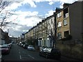
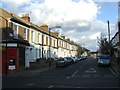
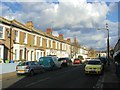
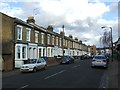
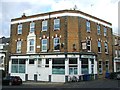
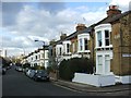
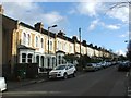
Photos of SE5 7ED

Area Information
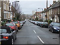
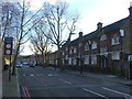
SE5 7ED is a compact residential postcode covering just 764 square metres. This very small footprint contains a population of 1,885 people, creating a tightly knit cluster within the wider London borough. Living in this specific area means navigating a dense environment where every square inch counts. The resident population centres largely on adults between the ages of 30 and 64 years. You will find a community that prioritises convenience, with widespread access to rail, metro, and bus networks immediately on your doorstep. Daily life here revolves around proximity. Residents benefit from being minutes away from major tube stations like Kennington and Stockwell, alongside railway hubs such as Denmark Hill and Peckham Rye. Local shopping needs are met by supermarkets including Sainsburys Camberwell, Tesco Southampton, and Morrisons Camberwell. This concentration of services within walking distance defines the rhythm of living in SE5 7ED. The area functions as a satellite hub, feeding into the broader transport arteries that connect South London to the capital's financial and cultural centres. Understanding the scale of this postcode is essential for anyone planning to move their home here.
- Area Type
- Postcode
- Area Size
- 764 m²
- Population
- 1885
- Population Density
- 16915 people/km²
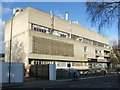
Focusing on the housing stock, you will encounter a concentration of flats within SE5 7ED. This accommodation type aligns with the area's high density and compact 764 square metre footprint. Only 35% of residents own their homes, meaning roughly two in every five occupants rent their property. This disparity between ownership and rental households signals a market heavily weighted towards tenants and investor portfolios. When considering homes in SE5 7ED, you should anticipate purchasing or renting within a flatted building rather than a traditional house. The small physical size of the postcode area restricts the variety of property types available. The dominance of flats suggests that space is at a premium, with architectural designs prioritising vertical expansion over horizontal sprawling. For buyers seeking a footprint of traditional suburban semi-detached housing, this specific postcode will not meet those expectations. The 35% ownership rate also implies that buyers entering the market must be prepared for higher competition or potentially tighter margins compared to owner-occupied districts.
House Prices in SE5 7ED
Showing 10 properties
| Address | Type | Beds | Baths | Last Sale Price | Last Sale Date | |
|---|---|---|---|---|---|---|
| Flat 2, Safara House, Dalwood Street, London, SE5 7ED | Flat | - | - | - | - | |
| Flat 6, Safara House, Dalwood Street, London, SE5 7ED | Flat | - | - | - | - | |
| Flat 8, Safara House, Dalwood Street, London, SE5 7ED | Flat | - | - | - | - | |
| Flat 7, Safara House, Dalwood Street, London, SE5 7ED | Flat | - | - | - | - | |
| Flat 1, Safara House, Dalwood Street, London, SE5 7ED | Flat | - | - | - | - | |
| Flat 9, Safara House, Dalwood Street, London, SE5 7ED | Flat | - | - | - | - | |
| Flat 3, Safara House, Dalwood Street, London, SE5 7ED | Flat | - | - | - | - | |
| Flat 4, Safara House, Dalwood Street, London, SE5 7ED | Flat | - | - | - | - | |
| Flat 5, Safara House, Dalwood Street, London, SE5 7ED | Flat | - | - | - | - | |
| Safara House, Dalwood Street, London, SE5 7ED | Retirement | - | - | - | - |
Energy Efficiency in SE5 7ED
Daily conveniences are maximised in SE5 7ED through proximity to major retail and leisure hubs. Residents have immediate access to five key retail locations, specifically Sainsburys Camberwell, Tesco Southampton, and Morrisons Camberwell. These supermarkets form the backbone of weekly grocery shopping without the need for long commutes. Transport-enabled leisure is a core feature of living here. Five nearby rail and metro stations, such as Loughborough Junction Station and Stockwell Station, connect you to cinemas, theatres, and dining districts across South London. Water-based recreation is accessible via five ferry piers, including Lambeth Pier and Wapping Pier. For those preferring overland travel, three major coach stations, like the Victoria Coach Station, offer routes beyond the local borough. This mix of urban retail, advanced transit, and water access creates a lifestyle where work, leisure, and shopping coexist within a very short travel radius.
Amenities
Schools
| Rank | School | Type | Entry gender | Ages |
|---|
Explore more schools in this area
Go to Schools tabDemographics
The community in SE5 7ED is defined by a median age of 47 years. This figure sits squarely within the most common age range of adults between 30 and 64 years. You are looking at a neighbourhood populated predominantly by White ethnic groups, according to local census data. Home ownership stands at 35%, indicating that a significant portion of residents rent their properties. This statistic often correlates with the accommodation type found in the area, where flats predominate over detached or semi-detached houses. The high density of residents, calculated at 2,465,786 people per square kilometre, highlights the intense urban character of this location. Such density typically supports a vibrant street culture, though it also implies little open space directly within the immediate postal boundary. The demographic profile suggests a working-age population likely employed in service sectors or professional roles accessible via the local transport links. Families with younger children may find the flat-based housing stock less typical of other suburbs, whereas couples or professionals will find the demographic alignment strong. The low home ownership rate suggests a dynamic market where tenancy changes occur regularly, keeping the household composition fluid.
Household Size
Accommodation Type
Tenure
Ethnic Group
Religion
Household Composition
Age
Household Deprivation
NS-SEC
Explore more demographic insights in this area
Go to Demographics tabPlanning
Planning Constraints
- Flood RiskPremium
- Ramsar Wetland SitesPremium
- Area of Outstanding Natural BeautyPremium
- Protected Nature ReservePremium
- Protected WoodlandPremium