Area Overview for SE5 0ND
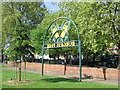
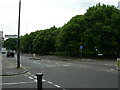
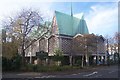
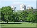
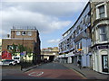
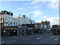
Photos of SE5 0ND


Area Information
Living in SE5 0ND offers householders a defined residential cluster characterised by distinct boundaries and a focused community layout. This specific postcode area houses a population of 1,634 residents, creating a tight-knit environment where neighbours are likely to know one another. The area sits firmly within Greater London, providing direct access to the broader city while maintaining a specific local identity. Daily life here centres on a residential rhythm supported by nearby transport links and essential services. You will find yourself surrounded by a mix of housing types rather than sprawling estates, which contributes to a quieter atmosphere compared to the wider borough of Southwark or Lambeth. The small scale of this postcode means that what you can reach on foot is concentrated, reducing the need for extensive travel for daily errands. Residents value the immediate accessibility of local shops and stations without the noise and congestion typical of high-density urban cores. The distinct character of SE5 0ND is defined by its specific address clusters, offering a sense of place that appeals to those seeking a clearly bounded home rather than an open-ended neighbourhood. You will experience a community where the local environment is well-understood by both current residents and those considering moving in. This clarity of location helps buyers understand exactly what they are acquiring in terms of property value and lifestyle convenience. The area stands as a practical choice for individuals who prioritise known parameters over expansive undefined territories.
- Area Type
- Postcode
- Area Size
- Not available
- Population
- 1634
- Population Density
- 13766 people/km²
The property market in SE5 0ND is defined by a significant disparity between ownership and tenancy, with recorded home ownership at just 29%. This statistic confirms that SE5 0ND operates primarily as a rental market rather than an owner-occupied estate. Flats constitute the main accommodation type within this postcode, reflecting a housing stock designed for higher density living rather than detached family homes. Buyers looking at properties in SE5 0ND should expect to navigate a landscape where purchase rates are lower than the national average or surrounding districts. The prevalence of flats suggests that you will encounter multi-unit buildings constructed for efficiency and location rather than privacy and space. This market structure often attracts investors, young professionals, and senior citizens who prefer low-maintenance living arrangements. When searching for homes in SE5 0ND, you must understand that finding an outright purchase opportunity may be more challenging than in areas with higher ownership percentages. The rental dominance indicates a strong demand for accommodation, which can influence property values and lease conditions. Potential residents buy into a system where long-term commitment to a specific property is less common than in neighbourhoods where families have bought to stay. This dynamic creates a fluid market where turnover is regular, and stability often depends on the tenant rather than the owner. Your strategy for buying or renting here must account for the fact that the majority of stock remains outside the traditional purchase chain.
House Prices in SE5 0ND
No properties found in this postcode.
Energy Efficiency in SE5 0ND
Living in SE5 0ND places you within practical reach of a diverse array of amenities, supported by five nearby retail venues. You can shop at Iceland Camberwell, Sainsburys Camberwell, and Tesco Camberwell for groceries and daily essentials. This concentration of supermarket branches in Camberwell ensures that food shopping is a brisk walk or short bus ride away. Transport connectivity is extensive, with five nearby metro stations including Kennington Station, Oval, and Stockwell Station. Five railway stations such as Elephant and Castle Railway Station, Denmark Hill Station, and Loughborough Junction Station offer regular connections across London. Additionally, five ferry locations like Vauxhall St George Wharf Pier, Lambeth Pier, and Millbank Pier provide river crossing options. Three major bus stations, including the Green Line Coach Station and Victoria Coach Station, are also accessible. This density of transport nodes means you rarely need a car for daily commuting. The availability of multiple station types ensures flexibility in your travel choices, whether you prefer the Tube, the train, or the river bus. Shopping, dining, and leisure are integrated into your daily routine through these nearby facilities. The proximity of both high street retail and transport hubs creates a vibrant utility where work and origin points are minutes away. You enjoy the convenience of city-scale access without the distance or cost of central London living. Every limb of your daily journey is supported by infrastructure that is immediately reachable from your doorstep.
Amenities
Schools
Families seeking education options for SE5 0ND residents are situated near John Ruskin Primary School and Language Classes. This institution is rated outstanding by Ofsted, marking it as a top-tier facility for primary education. As the only school listed in your immediate vicinity, this venue serves as the central point for local schooling needs. You should note that the data provided specifies only primary education, meaning there are no secondary schools or further education colleges listed within the immediate catchment area of this postcode. This single data point indicates that older children in SE5 0ND will likely need to travel to schools in adjacent boroughs or nearby towns for their secondary education. The outstanding rating of John Ruskin Primary School offers reassurance for parents with young children who are purchasing or renting flats in the area. The presence of language classes within the primary school suggests a curriculum designed to broaden horizons and support linguistic development from an early age. However, the absence of listed secondary options means you must research schools beyond the immediate NE1 postcode boundary for older pupils. Parents considering SE5 0ND as a family base should factor in commotion time to boarding schools or large secondary academies outside the zone. The clear quality provided by this one primary facility stands out against the lack of comprehensive secondary data, guiding your decision on where your youngest members will spend their educational formative years.
| Rank | School | Type | Entry gender | Ages |
|---|
Explore more schools in this area
Go to Schools tabDemographics
The community in SE5 0ND is dominated by adults, with the most common age range falling between 30 and 64 years. This demographic profile suggests a neighbourhood stabilised by working-age professionals and long-term residents rather than a transient student population or empty nesters. The median age stands at 47 years, reinforcing the presence of established households who have settled in the area over time. You will find that home ownership accounts for only 29% of the population, indicating that the majority of residents live in rental accommodation. This high proportion of renters often correlates with a younger demographic moving into flats or a workforce unable to purchase local property immediately. Flats remain the predominant accommodation type within SE5 0ND, aligning with the density required to house 1,634 people in such a confined postcode. While White residents form the predominant ethnic group, the concentration of flats and rental units suggests a diverse flow of tenants entering the market regularly. The age structure implies a lack of very young children in the immediate vicinity, as the primary occupants are well past childhood. This demographic reality shapes the local culture, favouring adult-oriented services and quiet residential streets over playgrounds or infant-focused amenities. Understanding these figures helps you gauge the typical household composition you are likely to encounter on your doorstep.
Household Size
Accommodation Type
Tenure
Ethnic Group
Religion
Household Composition
Age
Household Deprivation
NS-SEC
Explore more demographic insights in this area
Go to Demographics tabPlanning
Planning Constraints
- Flood RiskPremium
- Ramsar Wetland SitesPremium
- Area of Outstanding Natural BeautyPremium
- Protected Nature ReservePremium
- Protected WoodlandPremium