Area Overview for SE5 0JD
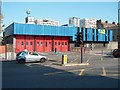
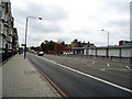
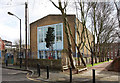
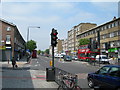
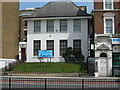
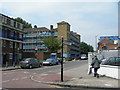
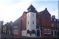
Photos of SE5 0JD


Area Information
SE5 0JD is a highly compact residential postcode covering just 6.7 hectares. You are looking at a small cluster where 2,133 people call the area home. This specific location sits within the South East London landscape, offering a dense, neighbourhood-focused living experience. The land footprint is tiny, suggesting a close-knit environment where residents are within immediate reach of their neighbours. Daily life here revolves around this tight community structure rather than wide-open spaces. You find a high concentration of people in a very limited geographic zone. This density forms the backbone of the local identity in SE5 0JD.
- Area Type
- Postcode
- Area Size
- 6.7 hectares
- Population
- 2133
- Population Density
- 5781 people/km²
Buying in SE5 0JD means entering a market defined by a specific lack of owner-occupiers. Only 29% of homes in this postcode are owned outright, suggesting a heavy reliance on the rental sector. Flats dominate the accommodation landscape, fitting the 6.7-hectare footprint of the area. This structure creates a unique dynamic where landlords and investors play a significant role in the local economy. You face a scenario where traditional family homes with gardens are scarce, if they exist at all. The housing stock is tailored for those seeking urban convenience over suburban space. Prospective buyers must understand that this is primarily a rental market with a smaller private market share. The prevalence of flats aligns with the high population density of 31,609 people per square kilometre.
House Prices in SE5 0JD
Showing 1 properties
| Address | Type | Beds | Baths | Last Sale Price | Last Sale Date | |
|---|---|---|---|---|---|---|
| Cobourg Primary School, Cobourg Road, London, SE5 0JD | commercial | - | - | - | - |
Energy Efficiency in SE5 0JD
Living in SE5 0JD places you at the heart of London's transport network. You are close to Tesco Southwark, Asda Old, and Lidl Walworth for your daily shopping needs. Rail access is excellent with South Bermondsey Station, Elephant & Castle Railway Station, and Peckham Rye Station nearby. The地铁 system offers further connectivity through Bermondsey Station, Kennington Station, and Borough Station. You also have ferry options via Wapping Pier, Tower Bridge Quay, and London Bridge City Pier. Bus links connect you to the Green Line Coach Station and Victoria Coach Station. London City Airport lies within practical reach for short flights. This density of amenities means you rarely need a car for errands or commuting.
Amenities
Schools
Families considering living in SE5 0JD should note the proximity of Cobourg Primary School. This is the only school listed for catchment access within a practical distance for residents. As a primary institution, it serves as the main educational option for younger children. The absence of secondary schools in the immediate data suggests a need to look beyond this specific postcode for older students. You rely on Cobourg Primary for early years education while older family members may commute to other London zones. The single-school listing indicates a focused but limited educational catchment within this small residential cluster. Parents must factor in travel time to other institutions if Cobourg does not meet specific curriculum needs.
| Rank | School | Type | Entry gender | Ages |
|---|
Explore more schools in this area
Go to Schools tabDemographics
The community in SE5 0JD is dominated by adults aged between 30 and 64 years old. The median age for residents is 47, indicating a mature population rather than a young family hub. Home ownership stands at 29%, meaning the majority of households are likely tenants or privately renting their accommodation. Flats represent the primary form of housing in this area, reflecting the high density of the 6.7-hectare site. White demographics form the predominant ethnic group within this specific cluster. The mix of adult residents and rental accommodation builds a distinct social fabric. You deal with a population profile that favours established adults over children, shaping the local social interactions and community needs.
Household Size
Accommodation Type
Tenure
Ethnic Group
Religion
Household Composition
Age
Household Deprivation
NS-SEC
Explore more demographic insights in this area
Go to Demographics tabPlanning
Planning Constraints
- Flood RiskPremium
- Ramsar Wetland SitesPremium
- Area of Outstanding Natural BeautyPremium
- Protected Nature ReservePremium
- Protected WoodlandPremium