Area Overview for SE4 2SH
Photos of SE4 2SH
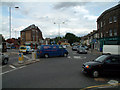
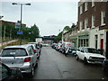
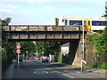
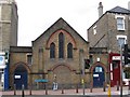
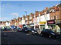
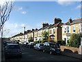
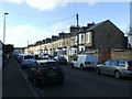
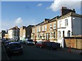
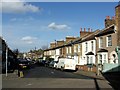
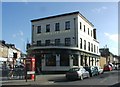
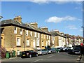
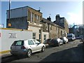
100 photos from this area
Area Information
Key information about the SE4 2SH including its size, population, and administrative classification.
- Area Type
- Postcode
- Area Size
- 7414 m²
- Population
- 1994
- Population Density
- 13419 people/km²
House Prices in SE4 2SH
49
Properties
£671,923
Average Sold Price
£53,000
Lowest Price
£1,150,000
Highest Price
Showing 49 properties
| Address | Type | Beds | Baths | Last Sale Price | Last Sale Date | |
|---|---|---|---|---|---|---|
| 142 Foxberry Road, London, SE4 2SH | Terraced | 3 | 1 | £722,500 | Apr 2025 | |
| 138 Foxberry Road, London, SE4 2SH | Terraced | 3 | 2 | £832,500 | Aug 2024 | |
| 130 Foxberry Road, London, SE4 2SH | Terraced | 4 | 1 | £760,000 | Jan 2024 | |
| 110 Foxberry Road, London, SE4 2SH | house | - | - | £685,000 | Oct 2022 | |
| 144 Foxberry Road, London, SE4 2SH | Terraced | 3 | 1 | £852,000 | Dec 2021 | |
| 84 Foxberry Road, London, SE4 2SH | Semi-detached | 5 | 2 | £1,150,000 | Aug 2021 | |
| 92 Foxberry Road, London, SE4 2SH | house | - | - | £800,000 | Jun 2021 | |
| 114 Foxberry Road, London, SE4 2SH | Terraced | 3 | 1 | £600,000 | Jan 2021 | |
| 128 Foxberry Road, London, SE4 2SH | Terraced | 4 | 1 | £650,000 | Jul 2019 | |
| 94 Foxberry Road, London, SE4 2SH | Terraced | 4 | 1 | £745,000 | Jun 2019 |
Page 1 of 5
Energy Efficiency in SE4 2SH
Amenities
Schools
| Rank | School | Type | Entry gender | Ages |
|---|
Explore more schools in this area
Go to Schools tabDemographics
Household Size
Family (3-5 people)
most common
Accommodation Type
Flats
most common
Tenure
50
majority
Ethnic Group
White
most common
Religion
N/A
most common
Household Composition
N/A
most common
Age
47
median
Adults (30-64 years)
most common
Household Deprivation
N/A
with no deprivation
NS-SEC
52
in Lower managerial occupations
Explore more demographic insights in this area
Go to Demographics tabPlanning
Planning Constraints
- Flood RiskPremium
- Ramsar Wetland SitesPremium
- Area of Outstanding Natural BeautyPremium
- Protected Nature ReservePremium
- Protected WoodlandPremium