Area Overview for SE4 2JT
Photos of SE4 2JT
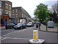
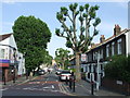
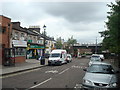
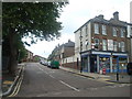

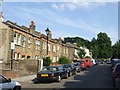
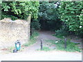
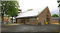
100 photos from this area
Area Information
Key information about the SE4 2JT including its size, population, and administrative classification.
- Area Type
- Postcode
- Area Size
- 9143 m²
- Population
- 1696
- Population Density
- 10367 people/km²
House Prices in SE4 2JT
38
Properties
£338,045
Average Sold Price
£59,995
Lowest Price
£880,000
Highest Price
Showing 38 properties
| Address | Type | Beds | Baths | Last Sale Price | Last Sale Date | |
|---|---|---|---|---|---|---|
| 53 Avignon Road, London, SE4 2JT | Terraced | 5 | 1 | £880,000 | Mar 2018 | |
| 50 Avignon Road, London, SE4 2JT | Terraced | 4 | - | £802,500 | Jan 2017 | |
| 55 Avignon Road, London, SE4 2JT | house | - | - | £845,000 | Sep 2015 | |
| 62 Avignon Road, London, SE4 2JT | Terraced | - | - | £405,000 | Oct 2011 | |
| 58 Avignon Road, London, SE4 2JT | Flat | - | 1 | £345,000 | Oct 2008 | |
| 54 Avignon Road, London, SE4 2JT | Terraced | - | - | £430,000 | May 2008 | |
| 42 Avignon Road, London, SE4 2JT | house | 5 | - | £360,000 | Feb 2007 | |
| 38 Avignon Road, London, SE4 2JT | Terraced | 5 | 2 | £275,000 | Nov 2006 | |
| 48 Avignon Road, London, SE4 2JT | Terraced | 4 | 2 | £347,000 | May 2006 | |
| 56B Avignon Road, London, SE4 2JT | Flat | - | - | £145,000 | Feb 2006 |
Page 1 of 4
Energy Efficiency in SE4 2JT
Amenities
Schools
| Rank | School | Type | Entry gender | Ages |
|---|
Explore more schools in this area
Go to Schools tabDemographics
Household Size
Family (3-5 people)
most common
Accommodation Type
Flats
most common
Tenure
48
majority
Ethnic Group
White
most common
Religion
N/A
most common
Household Composition
N/A
most common
Age
47
median
Adults (30-64 years)
most common
Household Deprivation
N/A
with no deprivation
NS-SEC
53
in Lower managerial occupations
Explore more demographic insights in this area
Go to Demographics tabPlanning
Planning Constraints
- Flood RiskPremium
- Ramsar Wetland SitesPremium
- Area of Outstanding Natural BeautyPremium
- Protected Nature ReservePremium
- Protected WoodlandPremium