Area Overview for SE4 1XZ
Photos of SE4 1XZ
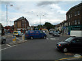
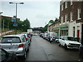
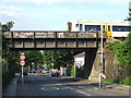
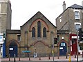
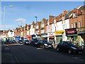
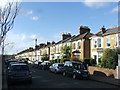
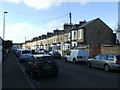
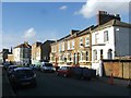
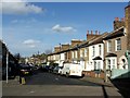
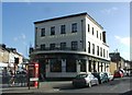
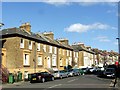
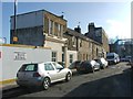
100 photos from this area
Area Information
Key information about the SE4 1XZ including its size, population, and administrative classification.
- Area Type
- Postcode
- Area Size
- 7892 m²
- Population
- 1674
- Population Density
- 11715 people/km²
House Prices in SE4 1XZ
63
Properties
£500,260
Average Sold Price
£3,625
Lowest Price
£1,650,000
Highest Price
Showing 63 properties
| Address | Type | Beds | Baths | Last Sale Price | Last Sale Date | |
|---|---|---|---|---|---|---|
| 137 Tressillian Road, London, SE4 1XZ | Flat | 2 | 1 | £600,000 | Mar 2025 | |
| 135 Tressillian Road, London, SE4 1XZ | Flat | 2 | 1 | £592,000 | May 2022 | |
| 105 Tressillian Road, London, SE4 1XZ | Terraced | 4 | 2 | £1,650,000 | Jan 2022 | |
| 123 Tressillian Road, London, SE4 1XZ | house | 4 | 2 | £1,080,000 | Oct 2020 | |
| 113B Tressillian Road, London, SE4 1XZ | Flat | - | - | £320,000 | Sep 2015 | |
| 139 Tressillian Road, London, SE4 1XZ | Detached | 2 | 2 | £420,000 | Aug 2012 | |
| 83 Tressillian Road, London, SE4 1XZ | Terraced | 2 | 2 | £590,000 | Mar 2012 | |
| 95A Tressillian Road, London, SE4 1XZ | Flat | 1 | 1 | £137,500 | Aug 2010 | |
| 119 Tressillian Road, London, SE4 1XZ | Terraced | - | - | £353,000 | Mar 2004 | |
| 99A Tressillian Road, London, SE4 1XZ | Flat | - | - | £164,995 | Jul 2002 |
Page 1 of 7
Energy Efficiency in SE4 1XZ
Amenities
Schools
| Rank | School | Type | Entry gender | Ages |
|---|
Explore more schools in this area
Go to Schools tabDemographics
Household Size
Two person
most common
Accommodation Type
Flats
most common
Tenure
42
majority
Ethnic Group
White
most common
Religion
N/A
most common
Household Composition
N/A
most common
Age
47
median
Adults (30-64 years)
most common
Household Deprivation
N/A
with no deprivation
NS-SEC
52
in Lower managerial occupations
Explore more demographic insights in this area
Go to Demographics tabPlanning
Planning Constraints
- Flood RiskPremium
- Ramsar Wetland SitesPremium
- Area of Outstanding Natural BeautyPremium
- Protected Nature ReservePremium
- Protected WoodlandPremium