Area Overview for SE4 1JA
Photos of SE4 1JA
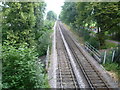
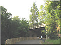

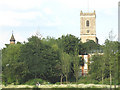
100 photos from this area
Area Information
Key information about the SE4 1JA including its size, population, and administrative classification.
- Area Type
- Postcode
- Area Size
- 7656 m²
- Population
- 1907
- Population Density
- 4125 people/km²
House Prices in SE4 1JA
32
Properties
£425,735
Average Sold Price
£79,000
Lowest Price
£740,000
Highest Price
Showing 32 properties
| Address | Type | Beds | Baths | Last Sale Price | Last Sale Date | |
|---|---|---|---|---|---|---|
| 47 Gordonbrock Road, London, SE4 1JA | Detached | 3 | 1 | £740,000 | Aug 2023 | |
| 61 Gordonbrock Road, London, SE4 1JA | house | - | - | £400,000 | Oct 2019 | |
| 37 Gordonbrock Road, London, SE4 1JA | house | - | - | £641,000 | Jul 2019 | |
| 55 Gordonbrock Road, London, SE4 1JA | Terraced | 3 | 1 | £635,000 | Sep 2016 | |
| 33 Gordonbrock Road, London, SE4 1JA | Terraced | 4 | 2 | £685,000 | Jul 2016 | |
| 35 Gordonbrock Road, London, SE4 1JA | house | - | - | £602,500 | Jul 2015 | |
| 41 Gordonbrock Road, London, SE4 1JA | house | - | - | £650,000 | Jul 2015 | |
| 29 Gordonbrock Road, London, SE4 1JA | house | - | - | £718,000 | Jun 2015 | |
| 15 Gordonbrock Road, London, SE4 1JA | Terraced | - | - | £320,000 | Jun 2012 | |
| 43 Gordonbrock Road, London, SE4 1JA | house | - | - | £400,000 | Feb 2011 |
Page 1 of 4
Energy Efficiency in SE4 1JA
Amenities
Schools
| Rank | School | Type | Entry gender | Ages |
|---|
Explore more schools in this area
Go to Schools tabDemographics
Household Size
Family (3-5 people)
most common
Accommodation Type
Houses
most common
Tenure
61
majority
Ethnic Group
White
most common
Religion
N/A
most common
Household Composition
N/A
most common
Age
47
median
Adults (30-64 years)
most common
Household Deprivation
N/A
with no deprivation
NS-SEC
49
in Lower managerial occupations
Explore more demographic insights in this area
Go to Demographics tabPlanning
Planning Constraints
- Flood RiskPremium
- Ramsar Wetland SitesPremium
- Area of Outstanding Natural BeautyPremium
- Protected Nature ReservePremium
- Protected WoodlandPremium