Area Overview for SE3 9PW
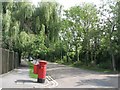
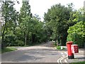
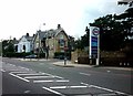
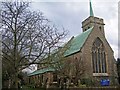
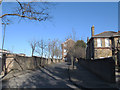
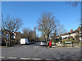
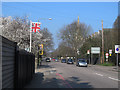
Photos of SE3 9PW
Area Information
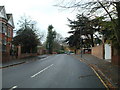
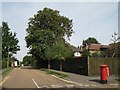
The postcode SE3 9PW covers a specific residential cluster of just 2.2 hectares in southeast London. This small footprint supports a population of 1,253 people, meaning the community is tightly knit and immediately recognisable. Living in SE3 9PW means existence within a high-density pocket where neighbours are close by and local streets are constantly in view. The area is defined by its proximity to the River Thames and the eastern suburbs of the capital. Residents benefit from a location that balances London connectivity with a distinct neighbourhood character. You will find yourself surrounded by a mix of private homes and flats suited to a very urban lifestyle. The area stands out for its extreme population density, which has reached 56,212 people per square kilometre. This figure indicates that the local infrastructure faces significant pressure, yet it also creates a vibrant, street-level scene. Daily life involves moving quickly between residential streets and major transport arterials. The postcode serves as a gateway to the wider Kidbrooke estate and the Cutty Sark area. You should expect a lived-in environment where local businesses sustain daily needs rather than large, distant commercial centres. The compact nature of SE3 9PW ensures that you rarely travel far for your morning routine.
- Area Type
- Postcode
- Area Size
- 2.2 hectares
- Population
- 1253
- Population Density
- 3464 people/km²
The property market in SE3 9PW is defined by the prevalence of flats and the split between ownership and renting. Only 45% of residents own their homes, which makes this a mixed market with a significant rental sector. This statistic means that if you are looking to buy, competition may be fierce as private sellers contest against landlords wishing to sell. The dominant accommodation type is flats, a hallmark of the Canning Town regeneration that transformed this part of the city. You should expect large multi-storey blocks to form the skyline rather than garden suburbs. Living in this estate offers the convenience of lift access and shared amenities, but it also means limited outdoor space for individual residents. The physical size of the area, at just 2.2 hectares, restricts the variety of property types available. Most homes are likely purpose-built apartment blocks dating from the early 1980s. Buyers looking for ground-floor units with external access will have better resale potential than those in high-floor flats without views. The high density drives up land values, pushing unit costs up even as the overall square footage per home remains small. Your options for upgrading or extending are non-existent due to strict planning constraints in such a built-up zone.
House Prices in SE3 9PW
Showing 25 properties
| Address | Type | Beds | Baths | Last Sale Price | Last Sale Date | |
|---|---|---|---|---|---|---|
| 161 Kidbrooke Park Road, Kidbrooke, SE3 9PW | Detached | 3 | 1 | £625,000 | Jul 2025 | |
| 159 Kidbrooke Park Road, Kidbrooke, SE3 9PW | Semi-detached | 3 | 2 | £610,000 | May 2024 | |
| 143 Kidbrooke Park Road, Kidbrooke, SE3 9PW | Semi-detached | 3 | 2 | £573,000 | Feb 2022 | |
| 179 Kidbrooke Park Road, Kidbrooke, SE3 9PW | house | - | - | £800,000 | Sep 2020 | |
| 171 Kidbrooke Park Road, Kidbrooke, SE3 9PW | Semi-detached | 4 | 2 | £912,000 | May 2019 | |
| 177 Kidbrooke Park Road, Kidbrooke, SE3 9PW | house | 4 | 2 | £590,000 | Oct 2013 | |
| 155 Kidbrooke Park Road, Kidbrooke, SE3 9PW | house | 3 | - | £320,000 | Jun 2013 | |
| 147 Kidbrooke Park Road, Kidbrooke, SE3 9PW | house | - | - | £435,000 | Mar 2013 | |
| 175 Kidbrooke Park Road, Kidbrooke, SE3 9PW | Detached | 3 | 2 | £385,000 | Aug 2007 | |
| 149 Kidbrooke Park Road, Kidbrooke, SE3 9PW | Semi-detached | - | - | £335,000 | Mar 2007 |
Energy Efficiency in SE3 9PW
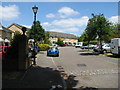
Living in SE3 9PW offers immediate access to a range of amenities that cater to daily needs and leisure. There are five retail outlets listed within practical reach, allowing you to stock up on essentials without long drives. Notable retailers include Aldi Kidbrooke, Morrisons Daily, and Tesco Kidbrooke, providing competition on pricing and variety. You have five railway stations and five metro stations nearby, reinforcing the area's status as a transport-rich hub. The five ferry stations listed, such as Greenwich Pier and Cutty Sark for Maritime Greenwich, offer scenic travel to Royal Victoria Dock and the Isle of Dogs. If you wish to fly, London City Airport sits just one facility away, positioned at the northern edge of the postcode boundaries. The density of transport options means you can choose between train, tube, DLR, or boat based on your schedule. Your weekly shopping trip can easily be completed at a Morrisons Daily or Aldi in minutes. The proximity to Greenwich Pier allows for weekend excursions to the Cutty Sark and the historic Royal Observatory. Amenities are dense, functional, and located close enough to disappear into your routine without adding significant time to your day.
Amenities
Schools
There are three primary schools listed as nearest to SE3 9PW, providing educational options within walking or short driving distance. Parents can choose between Wingfield Primary School or Thomas Tallis School for their children. You will find two entries for Wingfield Primary School in the records, one listed as Outstanding and the other merely as Primary, suggesting the school holds a top-tier Ofsted rating overall. Thomas Tallis School carries a 'good' Ofsted rating, indicating a solid standard of education without the top-tier accolades of its rival. All three options listed are primary institutions, meaning no secondary schools are explicitly named in the immediate vicinity. This reliance on primary education for families living in this cluster suggests that secondary schooling is located further away, likely in the broader Greenwich or Canary Wharf catchment zones. A family moving to SE3 9PW must plan carefully for secondary education logistics. The presence of two schools in the data raises the question of whether they are distinct campuses or data anomalies, but for a homebuyer, the key fact remains that at least one Outstanding-rated primary school is near you. You do not need to commute from home for elementary tuition.
| Rank | School | Type | Entry gender | Ages |
|---|
Explore more schools in this area
Go to Schools tabDemographics
The community within SE3 9PW is dominated by adults, with a median age of 47 years. The most common age range consists of residents aged between 30 and 64 years, suggesting a stable group of established homeowners and workers. This age profile indicates a shift away from student housing or young professional enclaves towards a more settled demographic. You will find that 45% of residents own their homes outright or via a mortgage, while the other half likely rent. The prevailing accommodation type in this cluster is flats, reflecting the area's history as a site for high-rise and mid-rise development after the old Bricklayers Arms power station stood there. The resident population is predominantly White, aligning with the wider southeast London demographic trends. Because the area relies heavily on flats, household sizes may be smaller on average compared to traditional suburban terraced streets. The high population density of over 56,000 per square kilometre creates a fast-paced social environment where privacy can be a premium commodity. Living here means engaging with a mature community that has adapted to intensification. The lack of single-family semis contributes to a different kind of street life, where balconies and ground-floor units replace traditional front gardens.
Household Size
Accommodation Type
Tenure
Ethnic Group
Religion
Household Composition
Age
Household Deprivation
NS-SEC
Explore more demographic insights in this area
Go to Demographics tabPlanning
Planning Constraints
- Flood RiskPremium
- Ramsar Wetland SitesPremium
- Area of Outstanding Natural BeautyPremium
- Protected Nature ReservePremium
- Protected WoodlandPremium