Area Overview for SE3 9LH
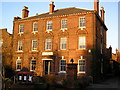
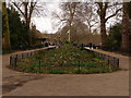
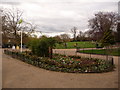
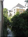
Photos of SE3 9LH
Area Information
SE3 9LH represents a specific residential cluster within the wider gravel pit landscape of south-east London. As one of the code's smallest clusters, the postcode covers a population of just over 1,500 people. You will find a settlement characterised by a mix of established homes and newer developments, situated along the corridor between Lewisham and the historic Greenwich peninsula. Daily life here revolves around proximity to major transport hubs, including Kidbrooke Station and Hither Green DLR, which connect you directly to central London. The area benefits from exceptional mobile coverage and access to London City Airport, making it a practical choice for those who rely on air travel for work or leisure. While the immediate surroundings feature significant open spaces like Dabs Common and the surrounding gravel pits, the estate itself is a compact, manageable neighbourhood. Residents have practical access to retail offerings such as Cook Blackheath and Morrisons Daily, without needing to travel far for essential shopping. This postcode serves as a quiet, functional base for homebuyers who value transport links and proximity to the capital's financial and cultural districts over a sprawling local high street.
- Area Type
- Postcode
- Area Size
- Not available
- Population
- 1502
- Population Density
- 4575 people/km²
The housing market in SE3 9LH is defined by a high proportion of flats and strong home ownership rates. With 60% of residents owning their homes, the estate functions primarily as an owner-occupied market rather than a short-term rental hotspot. This dynamic suggests that properties here tend to remain with the same families for extended periods, fostering neighbourhood consistency. The accommodation type is predominantly flats, often found in purpose-built blocks or converted industrial structures typical of the site's history as an opencast aggregate quarry. You are looking at a market where buyers seek secure tenures within a compact postcodes cluster. The prevalence of flats means that ground-level homes are less common than in other parts of Greenwich. Homeowners in this area likely value the balance between urban convenience and the nearby green spaces of Dabs Common and Cutty Sark. Property values in this specific postcode reflect its position within a growing housing cluster that has expanded significantly over the last decade. The mix of ownership types ensures a stable market for those looking to buy a flat in this strategic location.
House Prices in SE3 9LH
No properties found in this postcode.
Energy Efficiency in SE3 9LH
Living in SE3 9LH offers immediate access to a range of retail and leisure amenities within walking distance. You can visit Cook Blackheath, a well-known venue in the South East, which serves as a social hub for shopping and dining. For daily groceries, Morrisons Daily is a key contributor to your local convenience, ensuring fresh food is available without a drive. M&S Lee Lewisham BP adds further retail variety to your local high street experience. Beyond shopping, residents have five nearby railway stations and five metro stations, allowing you to reach major urban destinations quickly. The Cutty Sark DLR Station connects you directly to the historic ship at Greenwich while also providing access to the Bankside arts district. Five ferry piers, including Greenwich Pier and Royal Wharf Pier, place you on the doorstep of maritime heritage and river activities. London City Airport sits just beyond the horizon, adding an international travel dimension to your local lifestyle. You will find that daily errands can be completed locally, while weekend excursions into Greenwich or Canary Wharf are a short tube or foot ferry away. The blend of historic maritime landmarks and modern transport infrastructure creates a versatile setting for city living.
Amenities
Schools
Families living in SE3 9LH have access to First Steps Pre-Preparatory and Preparatory School, located just beyond the immediate estate boundaries. This independent school caters to early years education, offering an alternative to the state sector for young children. The school sits near the perimeter of your postcode, providing a convenient option for parents of toddlers and nursery-age children. Beyond this specific institution, the wider area offers more primary and secondary options, though these fall outside the immediate school catchment or data listed for this specific small cluster. The presence of an independent preparatory school indicates that residents value private education options alongside state schools. Most children in the area will likely attend schools in nearby Postcodes SE18, SE10, or SE6, but First Steps remains the key educational facility directly associated with this residential pocket. The single independent school listed provides a reputable educational starting point for the younger members of your household. You will find that the immediate vicinity focuses more on housing and transport links, with educational needs often being met by institutions in the surrounding townships.
| Rank | School | Type | Entry gender | Ages |
|---|
Explore more schools in this area
Go to Schools tabDemographics
The community within SE3 9LH reflects a mature settlement with a median age of 47 years. Adults between 30 and 64 years old form the most common age range, indicating a neighbourhood where families and established professionals have taken root. Home ownership stands at 60%, meaning the majority of residents have purchased their properties rather than renting. This significant owner occupancy rate points to a stable community with residents who have long-term ties to the area. The primary accommodation type consists of flats, which defines the physical character of the housing stock you will encounter here. While the predominant ethnic group is White, the area mirrors the diverse makeup of south-east London generally. Deprivation data is not available for this specific cluster, but the high rate of home ownership suggests a relatively secure economic base for those living here. The demographic profile paints a picture of a settled neighbourhood rather than a transient student hub or a high turnover rental district. You will find a population that has grown into the area rather than passing through it quickly.
Household Size
Accommodation Type
Tenure
Ethnic Group
Religion
Household Composition
Age
Household Deprivation
NS-SEC
Explore more demographic insights in this area
Go to Demographics tabPlanning
Planning Constraints
- Flood RiskPremium
- Ramsar Wetland SitesPremium
- Area of Outstanding Natural BeautyPremium
- Protected Nature ReservePremium
- Protected WoodlandPremium