Area Overview for SE3 8ZG
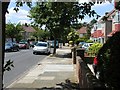
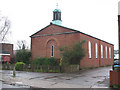
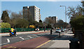
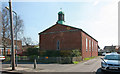
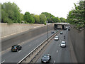
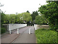
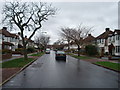
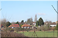
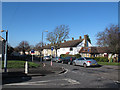
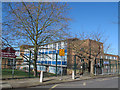
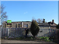
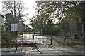
Photos of SE3 8ZG
Area Information
Living in SE3 8ZG means residing in a specific residential cluster within south-east London that forms part of the Kidbrooke Park estate. This postcode area covers a population of 1,852 people, creating a relatively contained environment compared to the wider borough. You will find yourself in a setting defined by modern planning, distinct from the older Victorian terracing found further inland. The area serves as a bridge between the urban centre and the parks to the west, offering residents a balance of daily convenience and relative seclusion. Daily life here revolves around proximity to Kidbrooke, where many services are integrated into the estate design. You are close to local stations like Kidbrooke and Charlton, which provide direct links across the river and into central London. The low population density allows for a slower pace than in inner-city districts, yet you remain within a five to ten-minute travel radius of major transport hubs including Waterloo and London Bridge. This sheltered locality functions as a residential pocket rather than a commercial hub, focusing on housing and immediate local needs. Families and professionals often choose this spot for its quiet streets and the sense of a planned community that separates residential zones from industrial activity.
- Area Type
- Postcode
- Area Size
- Not available
- Population
- 1852
- Population Density
- 6386 people/km²
You are looking at a property market defined entirely by houses within the SE3 8ZG cluster. Unlike many London areas where semi-detached, terraced, or outright flats dominate, this postcode consists of houses as the sole accommodation type. The 52% home ownership rate indicates that more than half of the residents have either bought their properties or hold them outright. This turnover profile differs significantly from the high-rental demand areas found in the immediate west, where investment income drives the market. The housing stock here does not include Victorian terraces or century-old flats, but rather likely constitutes a mix of family homes typical of the surrounding Kidbrooke development. Buyers targeting a rental yield strategy may find fewer applications here due to the lower density and lack of purpose-built blocks. Instead, the market consists largely of individuals and families seeking to settle down in this postcode. When searching for homes in SE3 8ZG, you will not encounter the mix of developing social housing or private rented stock common in neighbouring areas. The limited number of properties, capped by a population of 1,852, ensures a quieter local market compared to larger urban zones.
House Prices in SE3 8ZG
No properties found in this postcode.
Energy Efficiency in SE3 8ZG
Your daily lifestyle benefits from immediate access to a wide range of retail and leisure amenities within walking distance. You can visit five key retail points, including Co-op Kidbrooke, Morrisons Daily, and Co-op Shooters, which cover your food and household needs. Five rail stations serve the area, with Kidbrooke, Charlton, and Westcombe Park providing frequent services. The ferry network also supports five docking points, including Barrier Gardens Pier and Woolwich Ferry North Pier, giving you alternative commuting paths. Cultural options are within reach through five metro-style stations, such as Cutty Sark for Maritime Greenwich, Cutty Sark DLR Station, and Pontoon Dock Station DLR Station. You are also only a short journey from London City Airport for business or leisure travel. This density of transport links and shops means you rarely need a car for essentials. The presence of Morrisons Daily suggests a focus on quick grocery runs, while the variety of ferry piers indicates a strong connection to Greenwich and Woolwich. Living in SE3 8ZG means you can enjoy a suburban feel while accessing the bustling commercial and cultural scenes of the wider Thames neighbourhoods.
Amenities
Schools
The educational provision for families living in SE3 8ZG focuses heavily on primary education. Kidbrooke Park Primary School is the key institution listed in your vicinity, catering to younger children within the area. You rely on this single primary provider for early education before transitions occur to secondary schools elsewhere. The school carries a primary classification in the local dataset, though specific Ofsted ratings are not detailed in the current information. Because SE3 8ZG is a small residential cluster, most families situated here must travel to secondary schools beyond the immediate neighbourhood boundaries. The available data does not list any secondary schools, so you cannot assume comprehensive or selective options are located directly within the cluster. This means your choices for older children depend entirely on the catchment areas of the surrounding wider London boroughs. Current planning constraints, such as Ramsar sites or Areas of Outstanding Natural Beauty, do not include this postcode, meaning no protected green belts immediately restrict future school site developments. However, the absence of secondary names suggests that your children's commute to comprehensive school might be a regular part of daily life rather than a proximity advantage.
| Rank | School | Type | Entry gender | Ages |
|---|
Explore more schools in this area
Go to Schools tabDemographics
The community within SE3 8ZG reflects a mature demographic profile, with a median age of 47 years. Adults between 30 and 64 years old make up the most common age range, indicating a population that has typically completed their education and established careers. This age distribution suggests a neighbourhood populated by homeowners and long-term residents rather than recent graduates or transient workers. The area is predominantly White, which mirrors the traditional demographic shift seen in many established south-east London suburbs over the last decade. Home ownership stands at 52% in this postcode, placing it slightly above average for London but well below national figures. This statistic points to a significant number of mortgage holders and outright owners, suggesting residents are unlikely to move frequently. The accommodation type is exclusively houses, meaning flats or purposes blocks are not a feature of this specific cluster. This single dwelling type means you will not find terraced rows or shared ownership schemes in SE3 8ZG, offering a consistent pattern to the streetscapes. There is no formal deprivation data recorded for this specific location in the available assessments, so you cannot quantify economic disadvantage based on official indices. Instead, the high ownership rate and steady age profile imply a financially stable population accustomed to maintaining their own homes.
Household Size
Accommodation Type
Tenure
Ethnic Group
Religion
Household Composition
Age
Household Deprivation
NS-SEC
Explore more demographic insights in this area
Go to Demographics tabPlanning
Planning Constraints
- Flood RiskPremium
- Ramsar Wetland SitesPremium
- Area of Outstanding Natural BeautyPremium
- Protected Nature ReservePremium
- Protected WoodlandPremium