Area Overview for SE3 8UF
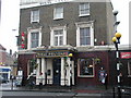
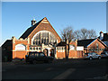
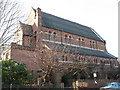
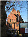
Photos of SE3 8UF
Area Information
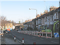
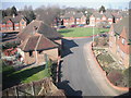
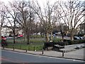
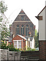
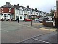
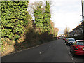
Living in SE3 8UF means residing within a specific residential cluster characterised by stability and established neighbourhood values. This postcode covers a small area of England with a resident population of 1,793 people. You will find a community defined by its long-standing character rather than rapid development. Daily life here is centred on proximity to local amenities and strong transport links to the wider city. The area offers a quiet environment where residents enjoy access to major retail parks and multiple transport hubs without being overwhelmed by urban density. Your routine involves easy access to essential services within practical reach. You might visit M&S Blackheath SF for shopping or catch a connecting rail service at Westcombe Park. The location balances independence with connectivity. Properties in this cluster provide a foothold into the Greater London market while maintaining a distinct local identity. The residential nature of SE3 8UF ensures that major commercial noise does not dominate your doorstep. Instead, you benefit from a layout that prioritises living comfort alongside convenient travel routes.
- Area Type
- Postcode
- Area Size
- Not available
- Population
- 1793
- Population Density
- 9666 people/km²
The housing market in SE3 8UF is primarily composed of owner-occupied houses. A reported 67% of residents own their homes, which significantly shapes the local property landscape. Houses are the main accommodation type throughout this postcode, distinguishing it from areas dominated by purpose-built flats or apartments. This dominance of detached or semi-detached homes typically offers more interior space and gardens compared to smaller urban units. For buyers searching for homes in SE3 8UF, the owner-occupation rate suggests that turnover may focus on families moving up the ladder or retirees downsizing. The small population of 1,793 indicates a limited inventory, meaning competition for suitable properties can be stiff. You cannot expect a wide variety of apartment blocks here. Instead, the market revolves around established houses that serve the local demographic. This structure makes SE3 8UF attractive to those seeking traditional living spaces. The prevalence of owner-occupiers also often means neighbours are invested in maintaining property values and standards within their cluster.
House Prices in SE3 8UF
No properties found in this postcode.
Energy Efficiency in SE3 8UF
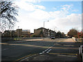
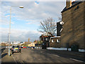
Your lifestyle in SE3 8UF centres on the convenience of nearby amenities within practical reach. You have access to five retail outlets including M&S Blackheath SF, Co-op Kidbrooke, and Morrisons Daily. These shops provide essential groceries and household goods without requiring a long journey into the city centre. Five rail stations allow you to reach these shopping hubs or travel further afield. When it comes to leisure, five ferry piers offer river access, while five stations provide District Line, DLR, or Main Line connections. Notable stops include Cutty Sark for Maritime Greenwich and Cutty Sark DLR Station, which lead to major attractions. You also have access to London City Airport for international travel. This concentration of transport and retail creates a efficient daily routine. You can run errands at Co-op Kidbrooke or Morrisons Daily on your way to work. The area supports a self-sufficient lifestyle where major conveniences are just a short walk or tube ride away.
Amenities
Schools
Families looking at schools near SE3 8UF have access to a limited but defined selection of educational institutions within the locality. Sherington Primary School serves the local primary education needs and holds a good Ofsted rating. This school is maintained by the local authority and provides state education for children in the area. RIMU Music Preparatory School and Nursery offers an independent alternative for younger children. This private institution operates alongside the state sector, giving parents a choice in early education pathways. The presence of both state and independent options means the catchment area supports diverse educational philosophies. However, the list of nearby schools is short, reflecting the small residential cluster nature of SE3 8UF. You should consider commute times to other broader catchment areas if these specific institutions do not meet your requirements. Both schools contribute to the community feel by engaging with the local family population.
| Rank | School | Type | Entry gender | Ages |
|---|
Explore more schools in this area
Go to Schools tabDemographics
The community in SE3 8UF reflects a mature demographic structure with a median age of 47 years. Most residents fall into the adult age range between 30 and 64 years. This age profile suggests an area populated by young families, empty-nesters, and established professionals rather than transient commuters. You will encounter a settled population where households have likely been established for some time. Home ownership stands at 67%, indicating a strong owner-occupied market rather than a rental-heavy zone. This high level of occupancy usually correlates with residents who plan to stay for the long term. Houses form the predominant accommodation type, meaning you are looking at traditional family dwellings rather than high-rise apartments. The area is predominantly white, consistent with its historic character. These figures point to a neighbourhood where families build roots and invest in local improvement, creating a stable social fabric for homebuyers to join.
Household Size
Accommodation Type
Tenure
Ethnic Group
Religion
Household Composition
Age
Household Deprivation
NS-SEC
Explore more demographic insights in this area
Go to Demographics tabPlanning
Planning Constraints
- Flood RiskPremium
- Ramsar Wetland SitesPremium
- Area of Outstanding Natural BeautyPremium
- Protected Nature ReservePremium
- Protected WoodlandPremium