Area Overview for SE3 8HA
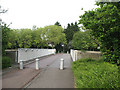
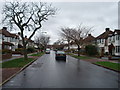
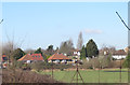
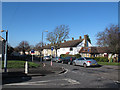
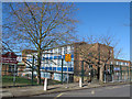
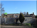
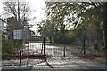
Photos of SE3 8HA

Area Information
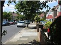
Living in SE3 8HA offers a quiet residential experience within postcode SE3, which spans a specific cluster of homes near London. This area contains a total population of 1,721 residents, creating a tight-knit community rather than a sprawling suburb. The small scale means neighbours are close and local streets are less congested than in wider parts of the borough. Daily life revolves around proximity to transport hubs and essential services, making it practical for those who work in the city. You live near major rail stations and river access points, yet the immediate locality retains a distinct, low-key character. The settlement is defined by its density and its status as a dedicated residential zone. This postcode attracts individuals seeking a calm environment without sacrificing access to the wider network. Homes here stand ready for those who value stability and a straightforward journey to work. The area functions as a functional part of the greater London infrastructure, prioritising convenience and ease of movement over urban density.
- Area Type
- Postcode
- Area Size
- Not available
- Population
- 1721
- Population Density
- 4131 people/km²
Homes in SE3 8HA are primarily houses, creating a distinct market from areas dominated by purpose-built blocks. The high rate of home ownership, standing at 60 per cent, indicates that the local estate is largely financed by residents rather than landlords. This suggests a stable housing stock where owners often maintain their properties for long periods. The majority of homes are likely detatched or semi-detached structures, typical of single-family dwellings in this postcode. You will find fewer rental apartments or executive flats compared to city-centre living. The market caters to those seeking privacy and conventional layouts rather than shared amenities. Buyers looking at this small area should expect competition from other property owners rather than institutional investors. The prevalence of owner-occupied homes often leads to better-kept streets and more stable neighbourhood values. Access to housing here requires a focus on traditional property types suited to family life or established professionals. The market reflects a preference for independence and personal investment in the home environment.
House Prices in SE3 8HA
No properties found in this postcode.
Energy Efficiency in SE3 8HA
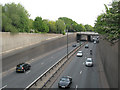
Residents of SE3 8HA enjoy convenient access to a variety of retail and leisure venues within practical reach. Five notable supermarkets operate nearby, including Co-op Shooters, Co-op Kidbrooke, and Morrisons Daily, ensuring you can shop for essentials without long travel times. You also have immediate access to five rail stations, with transport hubs at Kidbrooke, Eltham, and Charlton Station providing regular services. Five ferry terminals serve the local area, including Barrier Gardens Pier, Royal Wharf Pier, and Woolwich Ferry North Pier, offering river routes and connections. The public transport network extends further to include five metro stops such as Pontoon Dock Station and London City Airport, alongside Cutty Sark for Maritime Greenwich. One airport specifically serves the area directly. This density of amenities creates a lifestyle where daily errands and occasional trips do not require long commutes. The proximity of these specific venues supports a balanced mix of home life and city engagement.
Amenities
Schools
Families living in SE3 8HA have access to two named schools within the immediate vicinity of the area. Kidbrooke School serves as a primary institution for younger children in the local community. Corelli College operates as an academy, catering to older students within the secondary education phase. The presence of both a primary school and an academy provides a continuous local education pathway for residents. You do not need to travel far to enrol your children in established institutions. The mix of school types offers different educational philosophies, from the traditional grammar focus of Kidbrooke School to the collegiate structure of Corelli College. This educational infrastructure supports the demographic profile of the area, where many residents are adults with school-aged children. Parents in SE3 8HA can plan their schooling logistics around these two specific venues. The availability of these facilities is a key factor for families considering homes in this postcode. Both schools are situated to provide practical access for daily drop-off and collection routines.
| Rank | School | Type | Entry gender | Ages |
|---|
Explore more schools in this area
Go to Schools tabDemographics
The people living in SE3 8HA are predominantly adults aged between 30 and 64 years. The median age in this postcode is 47, indicating a community that has settled down rather than changed rapidly. Sixty per cent of households own their property, which signals a stable population with deep local roots. The remaining residents are likely tenants, though home ownership remains the dominant arrangement. Houses form the main type of accommodation, suggesting families and individuals looking for space rather than high-rise flats. The demographic profile shows a slight male dominance in the broader age brackets surrounding this median age. The predominant ethnic group identifies as White, reflecting a traditional community composition. This age profile often correlates with lower crime rates as young people move on or have fully integrated into family life. However, the area remains a standard residential zone where established residents coexist with those in the later stages of their working lives. There is a clear focus on long-term living arrangements rather than transient or short-term housing solutions.
Household Size
Accommodation Type
Tenure
Ethnic Group
Religion
Household Composition
Age
Household Deprivation
NS-SEC
Explore more demographic insights in this area
Go to Demographics tabPlanning
Planning Constraints
- Flood RiskPremium
- Ramsar Wetland SitesPremium
- Area of Outstanding Natural BeautyPremium
- Protected Nature ReservePremium
- Protected WoodlandPremium