Area Overview for SE3 8EP
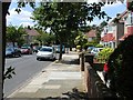
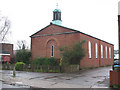
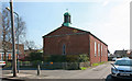
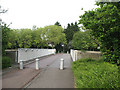
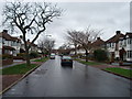
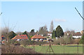
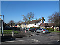
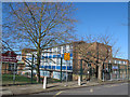
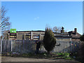
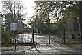
Photos of SE3 8EP


Area Information
Living in SE3 8EP means residing within a compact residential cluster defined by postcode SE3 8EP. This small area covers just 1.7 hectares and houses 1,576 residents. You are settling into one of the most densely populated places in England, with a population density of 90,880 people per square kilometre. Despite this high density, the location offers immediate access to extensive transport links, including close proximity to Kidbrooke, Eltham, and Charlton Station, plus several DLR stations and London City Airport. The community functions as a tight-knit neighbourhood where daily life centres on quick journeys to broader metropolitan opportunities. Your home in SE3 8EP sits at the heart of a network connecting you to Essex via the Dartford Crossing, Woolwich Ferry North Pier, and various river stations. With London City Airport only a stone's throw away, commuting by air is a realistic option for many residents. The area supports a mix of professional working homes and families who value speed of access over vast green spaces immediately outside their doors. You gain the convenience of urban living without needing to travel far for essential services, as five distinct rail, five metro stops, and multiple ferry points cluster within reach. This postcode serves as a strategic gateway to the wider East London and South Essex region.
- Area Type
- Postcode
- Area Size
- 1.7 hectares
- Population
- 1576
- Population Density
- 4741 people/km²
The property market in SE3 8EP is defined by a significant proportion of owner-occupiers, with 54% of homes owned by current residents. This high ownership rate points to an area where people have made a committed choice to settle permanently rather than renting short-term tenancies. The accommodation stock is predominantly houses, which contrasts with the tower blocks common in newer developments nearby. You are looking at a market where character homes and traditional layouts likely dominate the immediate streetscape of this 1.7-hectare cluster. For buyers assessing this postcode, the house-dominant profile offers a different living experience than inner-city flats. House ownership usually implies more privacy and potential for garden space despite the high density of 90,880 people per square kilometre. The market here appeals to those seeking the stability of ownership in a dense urban environment rather than the transient nature of rental sectors. When viewing properties in SE3 8EP, expect a stock that has served families for decades rather than speculative new builds filled with units available for immediate let. The prevalence of owner-occupied homes suggests a demand for established properties over purpose-built modern apartments.
House Prices in SE3 8EP
No properties found in this postcode.
Energy Efficiency in SE3 8EP
Life near SE3 8EP offers immediate access to a wide array of amenities within practical walking or short bus journeys. Retail options include five nearby stores, notably Co-op Shooters, Co-op Kidbrooke, and Aldi Kidbrooke, ensuring you can buy groceries and essentials without a major trip. Transport diversity is a key lifestyle feature, with five local railway stations near Kidbrooke, Eltham, and Charlton allowing rapid access to central London hubs. You also have access to five metro stations, including Pontoon Dock Station DLR Station, Which connects the region via the Docklands Light Railway system. For residents who travel further, the area sits close to major transport interchanges including London City Airport and Cutty Sark for Maritime Greenwich. This proximity turns daily commutes into short trips rather than long journeys. Water transport options add variety to your travel routine, with five ferry points available, including Woolwich Ferry North Pier, which crosses the Thames to Greenwich. These amenities create a lifestyle where you blend local convenience with regional accessibility. You can walk to Co-op shops for daily meals, hop on a train at Kidbrooke for a morning meeting, or take the ferry to enjoy a riverside evening stroll. The density of these facilities ensures that便利性 defines your everyday experience.
Amenities
Schools
Families looking at schools near SE3 8EP have access to specific educational institutions within practical reach. Leigh Academy Halley operates as an academy and holds a good Ofsted rating. This school offers a state-funded education with recognised standards, providing security for parents regarding school quality. Full Circle Education functions as an independent school, offering an alternative private education option for those who can afford the associated fees. The mix of academy and independent options gives you distinct choices depending on your educational values and budget. An academy like Leigh Academy Halley typically integrates into the standard state system with government oversight, while Full Circle Education provides the independence of private schooling. Neither school name appears repeatedly in generic lists, indicating a localized educational catchment or proximity for residents of SE3 8EP. You do not have to travel far to secure a place for your children, as both facilities are noted as nearest alternatives. The presence of these two specific names confirms that the immediate vicinity supports a functioning educational ecosystem without forcing long commutes to secondary centres.
| Rank | School | Type | Entry gender | Ages |
|---|
Explore more schools in this area
Go to Schools tabDemographics
The community in SE3 8EP reflects a mature yet active population, with a median age of 47 years. Most residents fall into the adults category, specifically those aged between 30 and 64 years. This age profile suggests a neighbourhood dominated by established families or professionals rather than young singles or retirees. You will find that 54% of households own their homes outright or via mortgage, indicating a stable, owner-occupied environment. The remaining 46% comprises tenants, renters, or other non-owner-occupier statuses typical of London postcodes. Accommodation in SE3 8EP primarily consists of houses, distinguishing it from the predominant apartment stock found in surrounding central zones. The demographic character is largely White, aligning with the broader South East London trend. Because the average age is 47, you should expect a quieter street scene during weekdays compared to areas packed with university students or young professionals. families with school-age children often form the core of neighbourly interactions here. The higher home ownership rate of 54% often correlates with more settled residents who have long-term investment in their properties. These socio-economic markers create a defined community culture where long-term stability meets the daily rhythm of working-age life.
Household Size
Accommodation Type
Tenure
Ethnic Group
Religion
Household Composition
Age
Household Deprivation
NS-SEC
Explore more demographic insights in this area
Go to Demographics tabPlanning
Planning Constraints
- Flood RiskPremium
- Ramsar Wetland SitesPremium
- Area of Outstanding Natural BeautyPremium
- Protected Nature ReservePremium
- Protected WoodlandPremium