Area Overview for SE28 8NQ
Photos of SE28 8NQ
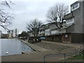
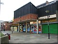

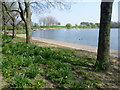
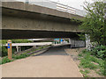
98 photos from this area
Area Information
Key information about the SE28 8NQ including its size, population, and administrative classification.
- Area Type
- Postcode
- Area Size
- 1.2 hectares
- Population
- 1738
- Population Density
- 4576 people/km²
House Prices in SE28 8NQ
30
Properties
£143,514
Average Sold Price
£39,995
Lowest Price
£357,809
Highest Price
Showing 30 properties
| Address | Type | Beds | Baths | Last Sale Price | Last Sale Date | |
|---|---|---|---|---|---|---|
| 51 Haldane Road, London, SE28 8NQ | Terraced | 1 | 1 | £255,000 | May 2023 | |
| 42 Haldane Road, London, SE28 8NQ | house | - | - | £357,809 | Sep 2022 | |
| 46 Haldane Road, London, SE28 8NQ | Terraced | 2 | 1 | £197,500 | Nov 2021 | |
| 33 Haldane Road, London, SE28 8NQ | Terraced | 3 | 1 | £334,000 | Sep 2021 | |
| 47 Haldane Road, London, SE28 8NQ | Terraced | 2 | - | £260,000 | Sep 2020 | |
| 54 Haldane Road, London, SE28 8NQ | Flat | 1 | 1 | £157,500 | Jul 2019 | |
| 48 Haldane Road, London, SE28 8NQ | Terraced | 2 | - | £163,000 | Oct 2013 | |
| 38 Haldane Road, London, SE28 8NQ | house | 3 | - | £185,000 | Oct 2010 | |
| 35 Haldane Road, London, SE28 8NQ | Terraced | - | - | £83,500 | Nov 2006 | |
| 59 Haldane Road, London, SE28 8NQ | house | - | - | £107,000 | Oct 2006 |
Page 1 of 3
Energy Efficiency in SE28 8NQ
Amenities
Schools
| Rank | School | Type | Entry gender | Ages |
|---|
Explore more schools in this area
Go to Schools tabDemographics
Household Size
Family (3-5 people)
most common
Accommodation Type
Houses
most common
Tenure
51
majority
Ethnic Group
black_total
most common
Religion
N/A
most common
Household Composition
N/A
most common
Age
47
median
Adults (30-64 years)
most common
Household Deprivation
N/A
with no deprivation
NS-SEC
26
in Lower managerial occupations
Explore more demographic insights in this area
Go to Demographics tabPlanning
Planning Constraints
- Flood RiskPremium
- Ramsar Wetland SitesPremium
- Area of Outstanding Natural BeautyPremium
- Protected Nature ReservePremium
- Protected WoodlandPremium