Area Overview for SE28 8HF
Photos of SE28 8HF
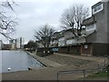
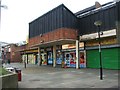

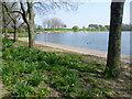
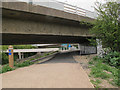
98 photos from this area
Area Information
Key information about the SE28 8HF including its size, population, and administrative classification.
- Area Type
- Postcode
- Area Size
- 7519 m²
- Population
- 1738
- Population Density
- 4576 people/km²
House Prices in SE28 8HF
36
Properties
£191,642
Average Sold Price
£31,000
Lowest Price
£425,000
Highest Price
Showing 36 properties
| Address | Type | Beds | Baths | Last Sale Price | Last Sale Date | |
|---|---|---|---|---|---|---|
| 7 Bledlow Close, London, SE28 8HF | house | - | - | £355,000 | Mar 2025 | |
| 52 Bledlow Close, London, SE28 8HF | Terraced | 3 | 1 | £425,000 | May 2024 | |
| 50 Bledlow Close, London, SE28 8HF | house | 3 | 1 | £380,000 | Mar 2023 | |
| 18 Bledlow Close, London, SE28 8HF | Flat | - | - | £143,750 | Dec 2022 | |
| 60 Bledlow Close, London, SE28 8HF | house | 3 | - | £355,000 | Sep 2022 | |
| 5 Bledlow Close, London, SE28 8HF | house | - | - | £320,000 | Dec 2020 | |
| 42 Bledlow Close, London, SE28 8HF | house | 3 | 1 | £300,000 | Feb 2020 | |
| 26 Bledlow Close, London, SE28 8HF | Flat | - | - | £140,000 | Sep 2018 | |
| 58 Bledlow Close, London, SE28 8HF | Terraced | 3 | 1 | £302,500 | May 2018 | |
| 6 Bledlow Close, London, SE28 8HF | house | - | - | £270,000 | Nov 2016 |
Page 1 of 4
Energy Efficiency in SE28 8HF
Amenities
Schools
| Rank | School | Type | Entry gender | Ages |
|---|
Explore more schools in this area
Go to Schools tabDemographics
Household Size
Family (3-5 people)
most common
Accommodation Type
Houses
most common
Tenure
51
majority
Ethnic Group
black_total
most common
Religion
N/A
most common
Household Composition
N/A
most common
Age
47
median
Adults (30-64 years)
most common
Household Deprivation
N/A
with no deprivation
NS-SEC
26
in Lower managerial occupations
Explore more demographic insights in this area
Go to Demographics tabPlanning
Planning Constraints
- Flood RiskPremium
- Ramsar Wetland SitesPremium
- Area of Outstanding Natural BeautyPremium
- Protected Nature ReservePremium
- Protected WoodlandPremium