Area Overview for SE28 8AT
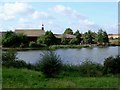
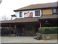
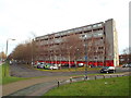
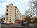
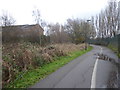
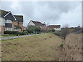
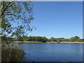
Photos of SE28 8AT


Area Information
Living in SE28 8AT means settling into a compact residential cluster covering just 3.3 hectares. The postcode serves approximately 1,783 residents within this small footprint. You will be part of a community where space is at a premium, with a population density reaching 53,665 people per square kilometre. This high density defines the character of the neighbourhood, creating an environment where daily interaction is frequent. The area sits within the broader Thamesmead development, offering a specific slice of life that is both concentrated and close-knit. Daily life revolves around the immediate vicinity rather than long commutes to distant amenities. You are surrounded by neighbours rather than open countryside. The small scale of the estate means that local issues are felt immediately and resolved without delay. Prospective buyers should understand that this is a micro-community within a larger urban fabric. It is not a sprawling suburb but a defined residential pocket. The sheer number of people living nearby creates a dynamic atmosphere common in inner London developments. You gain the advantage of walking distances to facilities while accepting the noise and activity of urban density. This location offers a distinct lifestyle for those who prioritise convenience over space.
- Area Type
- Postcode
- Area Size
- 3.3 hectares
- Population
- 1783
- Population Density
- 3161 people/km²
The property market in SE28 8AT is characterised by a balanced mix of ownership and rental arrangements. Four out of every ten households own their homes outright or with a mortgage. The remaining fifty percent live in rented properties, creating a dynamic market where availability can shift quickly. Houses dominate the housing stock, meaning the area suits those seeking standalone or terraced domestic accommodation rather than apartments. You will not find high-rise blocks as the predominant home type here. The small land area of 3.3 hectares limits new development, keeping the existing housing stock intact. This scarcity often supports value for existing dwellings. Buyers looking for homes in SE28 8AT should prepare for competition due to the limited number of available properties. The area appeals to individuals or small families who prefer a house layout within a dense urban setting. Rental demand remains strong given the 47% home ownership rate. Whether you intend to buy or rent, the specific nature of the homes here offers a distinct alternative to the tower blocks found elsewhere in SE1 or SE18. The market reflects a choice between space and location.
House Prices in SE28 8AT
No properties found in this postcode.
Energy Efficiency in SE28 8AT
Residents of SE28 8AT enjoy convenient access to a variety of retail and leisure options within practical reach. You can visit Aldi Thamesmead, Iceland Thamesmead, and Morrisons Thamesmead for daily groceries and household needs. These three supermarkets form the core of your retail experience, ensuring basics are never far away. Transport connections are extensive with five rail stations nearby including Abbey Wood, Barking Riverside, and Plumstead. Five metro stations serve the area including Gallions Reach, Cyprus, and King George V. A fifth pier each facilitates ferry travel via Woolwich Arsenal Pier, Woolwich Ferry North Pier, and Barrier Gardens Pier. London City Airport sits one station away, offering quick flight access for business or leisure. You hold five rail lines, five metro lines, multiple ferries, and an airport in your immediate network. This density of transport options gives you flexibility in how you travel each day. You can shop locally or commute globally depending on your schedule. The interplay of retail and travel defines the convenience of living here.
Amenities
Schools
Families living in SE28 8AT have access to a range of educational institutions nearby. Woolwich Polytechnic School for Boys operates as a primary school for younger children. Waterfield School also functions as a primary option for families with younger children. For older students, Woolwich Polytechnic School provides comprehensive education as an academy with a good Ofsted rating. Woolwich Polytechnic School for Girls rounds out the local provision as another academy with a good Ofsted rating. You have two primary choices and two comprehensive academies within your reach. This variety ensures that older siblings can attend the same thoroughbred academies while younger ones access primary schooling. The presence of two academies with good ratings indicates quality educational standards in the vicinity. Parents value the consistent performance of the academy sector in this zone. The mix of primary and secondary options means you can identify suitable schools for children at different stages. Transport links facilitate easy access between your home and these educational establishments.
| Rank | School | Type | Entry gender | Ages |
|---|
Explore more schools in this area
Go to Schools tabDemographics
The community in SE28 8AT reflects a mature demographic profile with a median age of 47 years. Most residents fall into the adult age range between 30 and 64 years, suggesting a population of working families or established households. Home ownership stands at 47%, indicating a market split between owners and renters. This figure implies that roughly half the residents have bought their homes while the other half live in rented accommodation. Houses constitute the primary accommodation type within this postcode sector. You will find traditional domestic housing rather than high-rise flats or purpose-built social housing blocks. The area holds a higher proportion of black residents compared to the wider national average. This diversity shapes the cultural landscape of the neighbourhood. Older residents coexist with younger adults in a relatively stable age distribution. The high population density reinforces the sense of a lived-in, populated area. You are joining an established community rather than a ghost development. The mix of tenants and owners creates a varied social fabric. This demographic profile suggests stability, with long-term residents forming the backbone of the local population.
Household Size
Accommodation Type
Tenure
Ethnic Group
Religion
Household Composition
Age
Household Deprivation
NS-SEC
Explore more demographic insights in this area
Go to Demographics tabPlanning
Planning Constraints
- Flood RiskPremium
- Ramsar Wetland SitesPremium
- Area of Outstanding Natural BeautyPremium
- Protected Nature ReservePremium
- Protected WoodlandPremium