Area Overview for SE28 0GS
Photos of SE28 0GS

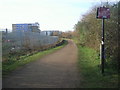

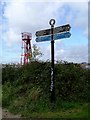
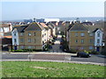
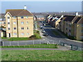
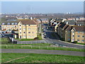
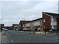
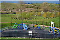
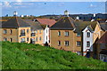
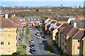
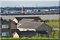
79 photos from this area
Area Information
Key information about the SE28 0GS including its size, population, and administrative classification.
- Area Type
- Postcode
- Area Size
- 43.0 hectares
- Population
- 1941
- Population Density
- 1941 people/km²
House Prices in SE28 0GS
94
Properties
£219,580
Average Sold Price
£117,500
Lowest Price
£445,000
Highest Price
Showing 94 properties
| Address | Type | Beds | Baths | Last Sale Price | Last Sale Date | |
|---|---|---|---|---|---|---|
| 82 Waterside Close, Thamesmead, SE28 0GS | Terraced | 2 | 2 | £330,000 | Jun 2025 | |
| 52 Waterside Close, Thamesmead, SE28 0GS | Terraced | 3 | 2 | £337,500 | Nov 2024 | |
| 44 Waterside Close, Thamesmead, SE28 0GS | Terraced | 4 | 3 | £415,000 | May 2024 | |
| 134 Waterside Close, Thamesmead, SE28 0GS | Terraced | 4 | 3 | £445,000 | Jan 2024 | |
| 10 Waterside Close, Thamesmead, SE28 0GS | Flat | - | - | £190,000 | Aug 2023 | |
| 116 Waterside Close, Thamesmead, SE28 0GS | Flat | - | - | £230,000 | Mar 2023 | |
| 56 Waterside Close, Thamesmead, SE28 0GS | Terraced | 3 | 2 | £435,000 | Feb 2023 | |
| 6 Waterside Close, Thamesmead, SE28 0GS | Flat | 1 | 1 | £209,000 | Sep 2022 | |
| 28 Waterside Close, Thamesmead, SE28 0GS | Flat | - | - | £240,000 | Dec 2020 | |
| 136 Waterside Close, Thamesmead, SE28 0GS | Terraced | 2 | 1 | £300,000 | Nov 2018 |
Page 1 of 10
Energy Efficiency in SE28 0GS
Amenities
Schools
| Rank | School | Type | Entry gender | Ages |
|---|
Explore more schools in this area
Go to Schools tabDemographics
Household Size
Family (3-5 people)
most common
Accommodation Type
Houses
most common
Tenure
36
majority
Ethnic Group
black_total
most common
Religion
N/A
most common
Household Composition
N/A
most common
Age
47
median
Adults (30-64 years)
most common
Household Deprivation
N/A
with no deprivation
NS-SEC
26
in Lower managerial occupations
Explore more demographic insights in this area
Go to Demographics tabPlanning
Planning Constraints
- Flood RiskPremium
- Ramsar Wetland SitesPremium
- Area of Outstanding Natural BeautyPremium
- Protected Nature ReservePremium
- Protected WoodlandPremium